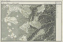
Craiva (Arad)
|
Craiva Krajowa Bélkiráymező |
||||
|
||||
| Basic data | ||||
|---|---|---|---|---|
| State : |
|
|||
| Historical region : | Screeching area | |||
| Circle : | Arad | |||
| Coordinates : | 46 ° 35 ' N , 21 ° 59' E | |||
| Time zone : | EET ( UTC +2) | |||
| Area : | 114.90 km² | |||
| Residents : | 2,880 (2011) | |||
| Population density : | 25 inhabitants per km² | |||
| Postal code : | 317095 | |||
| Telephone code : | (+40) 02 57 | |||
| License plate : | AR | |||
| Structure and administration (as of 2016) | ||||
| Community type : | local community | |||
| Structure : | Craiva, Chișlaca , Ciuntești , Coroi , Mărăuș , Rogoz de Beliu , Stoinești , Susag , Șiad and Tălmaci | |||
| Mayor : | Bercea Ioan ( PNL ) | |||
| Postal address : | Str. Principală No. 108 loc. Craiva, jud. Arad, RO-317095 |
|||
| Website : | ||||
Craiva (German: Krajowa , Hungarian: Bélkiráymező ) is a municipality in the Arad district , in the Kreischgebiet , in western Romania . The Craiva municipality also includes the villages of Chișlaca , Ciuntești , Coroi , Mărăuș , Rogoz de Beliu , Stoinești , Susag , Șiad and Tălmaci .
Geographical location
Craiva is located in the north of the Arad district, 81 km from the district capital Arad and 31 km from the nearest town Ineu .
Neighboring places
| Coroi | Ucuriș | Mărăuș |
| Șomoșcheș |

|
Secaci |
| Cermei | Chișlaca | Embassy |
history
The first written mention of the village comes from 1344.
Over the centuries, various place names made their appearance: 1344 Keralmezei , 1349 Kyralmezey , 1429 Kyralmezeye , 1598 Krayova , 1600 Kralioua , 1773 Krajova , 1773-1808, 1780-1781 Krajova , 1785 Krajova , 1786 Craiova , 1789 Krajova , 1796-1799 Krajova 1808 Krajova , 1839, 1851 Krajova , 1858 Krajova , 1863 Krajova , 1877 Krajova , 1882 Krajova , Craiova , 1893 Krajova , 1909 Craiva , Krajova , 1913 Bélkirálymező , 1921 Craiova , Bélkirálymező , 1932 Craiova , 1956 Craiova , 1960 Craiva .
After the Peace of Karlowitz (1699), Arad and the Maroscher Land came under Austrian rule , while the Banat south of the Marosch remained under Turkish rule until the Peace of Passarowitz (1718) . On the Josephine land survey is Krajowa entered.
As a result of the Austro-Hungarian Compromise (1867), the Arad region, like the whole of Banat and Transylvania, was annexed to the Kingdom of Hungary within the Austro-Hungarian dual monarchy . As a result of the law on the Magyarization of place names , which was applied at the beginning of the 20th century, the official place name from 1913 was Bélkiráymező .
The Treaty of Trianon on June 4, 1920 resulted in the regulation of the borders , whereby Craiva fell to the Kingdom of Romania .
Population development
| census | Ethnicity | |||||||
|---|---|---|---|---|---|---|---|---|
| year | Residents | Romanians | Hungary | German | Other | |||
| 1880 | 4043 | 3987 | 42 | 2 | 12 | |||
| 1910 | 5046 | 4817 | 118 | - | 111 | |||
| 1930 | 5668 | 5560 | 23 | 5 | 80 | |||
| 1977 | 4761 | 4680 | 30th | 2 | 49 | |||
| 1992 | 3492 | 3252 | 3 | - | 237 | |||
| 2002 | 3118 | 2789 | 4th | - | 325 | |||
Web links
- ghidulprimariilor.ro , Craiva Town Hall
- virtualarad.net , Craiva on VirtualArad
Individual evidence
- ↑ citypopulation.de , census October 20, 2011
- ↑ Mayoral elections 2016 in Romania ( MS Excel ; 256 kB)
- ↑ arcanum.hu , Szabó M. Attila : Historical and administrative place names book of Transylvania, Banat and Partium
- ^ Gerhard Seewann : History of Germans in Hungary , Volume 2, 1860 to 2006, Herder Institute, Marburg 2012
- ↑ kia.hu , E. Varga: Statistics of the population by ethnic group in the Arad district according to censuses from 1880 - 2002


