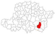
Vărădia de Mureș
|
Vărădia de Mureș, Totvărădia, Vărădia Slovacă Waradia, Slovak Waradia Tótvárad |
||||
|
||||
| Basic data | ||||
|---|---|---|---|---|
| State : |
|
|||
| Historical region : | Screeching area | |||
| Circle : | Arad | |||
| Coordinates : | 46 ° 0 ' N , 22 ° 9' E | |||
| Time zone : | EET ( UTC +2) | |||
| Area : | 118.58 km² | |||
| Residents : | 1,755 (2011) | |||
| Population density : | 15 inhabitants per km² | |||
| Postal code : | 317380 | |||
| Telephone code : | (+40) 02 57 | |||
| License plate : | AR | |||
| Structure and administration (as of 2016) | ||||
| Community type : | local community | |||
| Structure : | Vărădia de Mureș, Baia , Julița , Lupești , Nicolae Bălcescu , Stejar | |||
| Mayor : | Miculiţ Crina Melania ( PSD ) | |||
| Postal address : | Str. Principală No. 126 loc. Vărădia de Mureș, jud. Arad, RO-317380 |
|||
| Website : | ||||
Vărădia de Mureș (popularly: Totvărădia and Vărădia Slovacă , German: Waradia , Slovak Waradia , Hungarian: Tótvárad ) is a municipality in the Arad district , in the Kreischgebiet , in western Romania . The villages of Baia , Julița , Lupeşti , Nicolae Bălcescu and Stejar also belong to the municipality of Vărădia de Mureș .
Geographical location
Vărădia de Mureș is located in the Maroschtal , in the contact zone of the Transylvanian Ore Mountains with the Zărand Mountains , 81 km from the district capital Arad .
Neighboring places
| Nicolae Bălcescu | Julița | Lupești |
| Bulci |

|
Sâvârşin |
| Ostrov | Birchiș | Căpâlnaș |
history
Waradia was first mentioned in a document in 1369.
In the course of the centuries different spellings of the place name appeared: 1369 Waradia , Varadi , 1427 Waradya , 1479 Castellum Varadya , Varadia , 1660 Váradja , 1808 Várad , Tót-Várad , Tótváradja , 1913 Tótvárad , 1909 Totvărădia , 1919 Vărădia .
In 1369 there was an old earth fortress "Varadi", the medieval fortress Castellum Varadya appears in 1479 in the contemporary documents.
Until the Turkish rule after the First Austrian Turkish War (1552), the history of the village is closely linked to the history of the fortress. At the end of the 15th century, the village was elevated to a market. According to the description of the historian Evliya Çelebi, there are 150 houses in the fortress and in the “Palanka” (suburb).
After the Peace of Karlowitz (1699), Arad and the Maroscher Land came under Austrian rule , while the Banat south of the Marosch remained under Turkish rule until the Peace of Passarowitz (1718) . On the Josephine land survey is Totvaradje entered. During the Habsburg era , the village belonged to the Tisza-Marosch military border . The fortress was completely destroyed during the Kuruz war and abandoned in 1709.
As a result of the Austro-Hungarian Compromise (1867), the Arad region, like the whole of Banat and Transylvania, was annexed to the Kingdom of Hungary within the Austro-Hungarian dual monarchy . The official place name was Tótvárad .
The Treaty of Trianon on June 4, 1920 resulted in border regulation, whereby Totvărădia fell to the Kingdom of Romania .
Population development
| census | Ethnicity | |||||||
|---|---|---|---|---|---|---|---|---|
| year | Residents | Romanians | Hungary | German | Other | |||
| 1880 | 4378 | 4300 | 22nd | 34 | 22nd | |||
| 1910 | 4948 | 4787 | 150 | 7th | 4th | |||
| 1930 | 4213 | 4107 | 33 | 3 | 70 | |||
| 1977 | 2829 | 2781 | 35 | 6th | 7th | |||
| 1992 | 2279 | 2261 | 11 | 3 | 4th | |||
| 2002 | 2112 | 2084 | 10 | - | 18th | |||
Web links
- ghidulprimariilor.ro , Vărădia de Mureș on the Arad County Council website
- virtualarad.net , Vărădia de Mureș on the VirtualArad website
Individual evidence
- ↑ citypopulation.de , census October 20, 2011
- ↑ Mayoral elections 2016 in Romania ( MS Excel ; 256 kB)
- ↑ fatornyosfalunk.com , András János: History of the Transylvanian towns
- ↑ varadia-de-mures.ro , Vărădia de Mureș
- ↑ kia.hu , E. Varga: Statistics of the population by ethnic group in the Arad district according to censuses from 1880 - 2002


