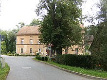
Collis
|
Collis
City of Gera
Coordinates: 50 ° 51 ′ 26 ″ N , 12 ° 7 ′ 2 ″ E
|
|
|---|---|
| Height : | 214 m above sea level NN |
| Residents : | 91 (Jan 1, 2009) |
| Incorporation : | July 1, 1950 |
| Incorporated into: | Thränitz |
| Postal code : | 07554 |
| Area code : | 0365 |
|
In the town
|
|
Together with Thränitz and Am Stern, Collis forms the 3.51 hectare district of Thränitz in the city of Gera in Thuringia with a total of 391 inhabitants (as of December 31, 2011).
Geographical location
Collis is located southeast of the Gera core city between the districts of Zschippern in the north, Thränitz in the northeast, Kaimberg in the south-southeast and Pforten in the west. It is located in the Gessental , through which the Gessenbach , a tributary of the White Elster , flows.
geology
The so-called Collis Alps , a remarkable Kulm schist formation , are located on site ; it extends in a north-south direction from Thränitz via Collis to Kaimberg .
history
Until the founding of the state of Thuringia, Collis belonged to the Principality of Reuss younger line . Archaeological finds suggest that the area was settled as early as the Ice Age. In 1827 a barrow from the Bronze Age was discovered in the area, and in 1914 a Slavic grave with 14 bones. Iron slag found in the site during excavations suggests that an early metal melt was located here. The first permanent settlement is likely to have arisen around 1200, on June 2, 1293 a Friedericus de Culs is mentioned as a witness in a document from Heinrich the Younger of Weida. This family was probably the owner of a knight residence in Collis, after which the place was named. For 1388 and 1413 Collis is certified as belonging to the knight seat Thränitz. In 1490 it was sold to the von Uttenhofen family by Hans von der Phorten (Pforten) . Later he came to Kaimberg, in 1681 back to the Knights at Pforten. At this time, the Collis farmers were on the job of the feudal lords of Kaimberg.
In 1827 the place had 17 houses and 90 inhabitants. The parish and school location for Collis was Thränitz, in 1971 Pforten became the school location responsible.
The route of the Gera-Gößnitzer Bahn , which opened in 1865, is also supposed to lead via Colliser Grund, so that in 1864 there is a lawsuit over the expropriation of land in the Collis district.
In 1912 a water pipeline was built and electrification began in 1919.
On July 1, 1950, Collis was incorporated into the community of Thränitz and reclassified together with her on July 1, 1994 to Gera.
A cattle fattening facility built in GDR times is still operated today by the Kauern agricultural cooperative from neighboring Kauern ( Greiz district ).
Attractions
- Collis Alps
- Megalithic grave in the Collis Alps.
- Two four-sided courtyards that are under monument protection.
- Collis Mill, old water mill; rebuilt after a fire in 1867.
politics
Collis and Thränitz with Am Stern have been incorporated into the city of Gera since July 1, 1994. Since then, the three places have formed the Thränitz district of the city of Gera with its own local constitution and local council (until II / 2009 local council) . The district mayor has been Dieter Karius (non-party) since 1994.
Development of the population
| year | 1867 | 1874 | 1939 | 2009 |
| Residents | 82 | 90 | 92 | 91 |
traffic
- Collis is accessed via the south-east tangent Gera.
- There is a public transport connection with the GVB line 12.
- The closest train station is Gera-Gessental on the outskirts of the village.
leisure
In the Gessental and Lammsbachtal there are beautifully landscaped hiking trails, u. a. to the Collis Alps , which offer a wonderful view. There is also a shelter hut here. Thanks to the appropriate infrastructure, the place is an ideal starting point or stage for riding hikes in the surrounding area or through Thuringia.
education
In neighboring Thränitz is the
- Kindergarten Rainbow of the People's Solidarity Gera.
The responsible primary school is
- State primary school Neulandschule in Pforten.
The closest regular school is the
- State regular school Ostschule , Gera-Ostviertel.
Individual evidence
- ↑ Gera city administration, FD 1200
- ↑ Federal Statistical Office (Ed.): Municipalities 1994 and their changes since 01.01.1948 in the new federal states. Metzler-Poeschel publishing house, Stuttgart 1995, ISBN 3-8246-0321-7 .
- ↑ Gera City Archives
- ^ German administrative archive
literature
- Klaus Brodale and Heidrun Friedemann: That was Gera in the 20th century. Gudensberg 2002.
- Johann Günther Friedrich Cannabich: Latest customer from Baden, Nassau, Hohenzollern, Lippe, Waldeck, Anhalt and the Reussian countries. Weimar 1827.
- Ferdinand Hahn: History of Gera and its immediate surroundings. Gera 1855.
- Ernst Paul Kretzschmer: Chronicle of Thränitz, Grobsdorf, Zschippern, Kaimberg. Gera 1935.
- Johann Christoph Klotz: Description of the rule and city of Gera. Schleiz 1816.
- August Ernst Köhler: Popular custom, superstition, sagas and other old traditions in the Vogtlande. Leipzig 1867.
- Mues, Siegfried: Gera. A historical walk. Geiger, Horb 1993, ISBN 3-89264-694-5 .
- Heinz Rosenkranz: place names of the Gera district. Greiz 1982.
- Thuringian Pestalozziverein (Ed.): Thuringia in words and pictures; Berlin 1900. Reprint. Weltbild, Augsburg 1997, ISBN 3-86047-919-9
- o. A .: Court and state calendar for the Principality of Reuss j. L. Gera 1864.
- Announcements of the history and antiquity research association. Altenburg; div.


