
Dahlmühle (Rodebach)
| Dahlmühle
|
||
|---|---|---|
 Dahlmühle in Gangelt |
||
| Location and history | ||
|
||
| Coordinates | 50 ° 59 '15 " N , 5 ° 59' 28" E | |
| Location | Germany | |
| Waters | Rodebach | |
| Built | around 1472 | |
| Shut down | 1935 End of the oil mill, grain mill a few years later | |
| technology | ||
| use | Oil and grain mill | |
| Grinder | 2 grinding courses 1 oil press | |
| drive | Watermill , Francis turbine from 1913 | |
| water wheel | undershot | |

The Dahl Mill is a former on Rodebach preferred water mill with an undershot waterwheel in Gangelt , a rural community in North Rhine-Westphalia Heinsberg district .
geography
The Dahlmühle is located on the right side of the stream, Zur Dahlmühle 11 in the municipality of Gangelt. The area on which the courtyard and mill building stands is approx. 61 m above sea level . Above is the Mohrenmühle , underneath the Brommler Mühle .
Waters
Up until the last century, the Rodebach supplied fourteen mills with water. The stream begins at a retention basin near Siepenbusch in the town of Übach-Palenberg at an altitude of 105 m above sea level. The Rodebach has a length of 28.9 km to its confluence with the Geleenbeek near Oud-Roosteren in the Netherlands . The mouth height is 29 m above sea level. The care and maintenance of the Rodebach and its tributaries is subject to the respective neighboring cities and communities. → See also Rodebach
history
The Dahlmühle was first mentioned in a document in 1472. It was a Jülich fiefdom owned by the Junkers of Drimborn. Around 1500 a wood mill “nuwer moelen” appears in the Millen account books, which is probably identical to the Dahlmühle. In the second half of the 18th century, the Dahlmüller was also active as a beer brewer . At the beginning of the 19th century the flour mill was expanded to include an oil press . In 1913 the output of the mill could be increased by installing a Francis turbine . The mill operated as an oil mill until 1935. The flour mill ran a few years longer.
Anchor nails hammered into the mill wall were used to maintain and determine the upper limits of the reservoirs of the drive waters. These measuring points were attached to all mills. For the Dahlmühle, the top water level was 56.44 m above sea level.
gallery

The Dahlmühle in Gangelt

Residential and farm buildings
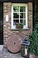
Decorative entrance area
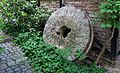
Millstone at the Dahlmühle
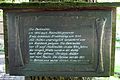
Information board of the Dahlmühle

Tranchot card 1804/05


literature
- Hans Vogt: Lower Rhine water mill guide 2nd edition. Niederrhein Association, Krefeld 1998, ISBN 3-00-002906-0 , pp. 243–245.
- Wilhelm Pieper: The last mill wheel on the Rodebach home calendar 1995 Heinsberg district p. 158–164
- State survey office of North Rhine-Westphalia topographic map 1:50 000 L 5102 Geilenkirchen and L 5000 Selfkant, ISBN 3-89439-417-X
Web links
At the worm :
Beeretz mill |
Bommers Mill |
Frelenberger Mill |
Horriger Mill |
Hünshovener oil mill |
Grinder and Oil Mill Trips |
Marienthaler Mill |
Müllendorfer mill |
Lohmühle |
Lohmühle |
Eichenthal Mill |
Mill Hommerschen |
Oil and paper mill Oberbruch |
Porselener Mill |
Randerather oil mill |
Rimburg mills |
Süggerather mill |
Interrupt mill |
Full mill interruption |
Zweibrügger Mühle
An der Junge Wurm:
Aldenhover Mühle |
Brünkers Mill |
Dahlmühle |
Horster mill |
Karker Mill |
Kemper Mill |
Lambertz Mill |
Liecker mill |
Powder mill ] |
Schafhausen grain mill |
Schafhausen oil mill |
Town mill |
Valley mill |
Wolfhager Mühle
Am Rodebach :
Brommler Mühle |
Dahlmühle |
Angel Mill |
Etzenrather mill |
Ingentaler Mill |
Isenbruch Mill |
Istrater mill |
Tüddern grain mill |
Millener mills |
Mohrenmühle |
Square mill |
Vollmühle Tüddern |
Wehrer Mühle
An der Schwalm :
Bischofsmühle |
Post mill |
Kornmühle Tüschenbroich |
Kringsmühle |
Lohmühle |
Neumühle |
Oil mill Tüschenbroich |
Rossmühle |
Wegberger Mühle
Am Mühlenbach :
Buschmühle |
Holtmühle |
Meismühle |
Molz mill |
Schrofmühle
Am Helpensteiner Bach:
Dalheimer Mühle |
Helpensteiner Mill |
Rödgener Mühle
Am Beeckbach :
Ophover Mühle
Am Kitschbach :
Kitscher Mühle
Am Knippertzbach :
Knippertzmühle
Am Uebach :
Übacher Mühle