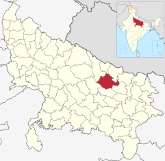
Gonda (district)
| Gonda district | |
|---|---|

|
|
| State | Uttar Pradesh |
| Administrative headquarters : | Gonda |
| Area : | 4003 km² |
| Residents : | 3,433,919 (2011) |
| Population density : | 858 inhabitants / km² |
| Website : | www.gonda.nic.in/ |
Gonda is a district in the northern Indian state of Uttar Pradesh .
The area is 4003 km². The administrative seat is the city of Gonda .
history
The area of what is now the Gonda district was part of the ancient kingdom of Kosala . The kingdom was later divided into two parts defined by the Ghaghara River. The northern part was then ruled from the capital Shravasti .
Some of the oldest evidence of Buddhism can be found in the district.
population
The population is 3,433,919 (2011). The population growth rate in the period from 2001 to 2011 was 24.17% and was therefore very high. Gonda has a gender ratio of 921 women per 1000 men. It has a literacy rate of 58.71% in 2011, an increase of 16 percentage points compared to 2001. However, literacy was well below the national average. Almost 80% of the population are Hindus and around 20% are Muslim .
Only 6.7% of the population live in cities. The largest agglomeration of the district was Gonda with 138,632 inhabitants.
Web links
Individual evidence
- ^ Gonda District in The Imperial Gazetteer of India , 1908, v. 12, p. 312.
- ↑ 2011 census (PDF; 398 kB)
- ^ Indian Districts by Population, Sex Ratio, Literacy 2011 Census. Retrieved April 16, 2019 .
