Hedges (Solingen)
|
Hedges
City of Solingen
Coordinates: 51 ° 10 ′ 56 " N , 7 ° 4 ′ 11" E
|
||
|---|---|---|
| Height : | about 205 m | |
|
Location of hedges in Solingen |
||
|
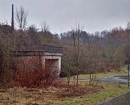
Hedges with the underpass under the Viehbachtalstraße
|
||
Hecken is a desert in the Solingen district of Mitte . The place was built over by the Viehbachtalstraße at the beginning of the 1980s .
geography
Hecken is located in the extreme north of Solingen-Mitte a little south of the Lochbach , which flows south of Wald through the valley of the same name and flows into the Itter at Ohligs . The place was at the point where the Viehbachtalstraße is connected to the Frankfurter Damm today. Untenscheidt bordered the place immediately to the south. To the south there is also the waste incineration plant and the bus depot of the Stadtwerke Solingen . To the east are Lehn , Dältgenstal and Eigen . In the north are the municipal clinic and hostel .
etymology
The place name Hecken occurs several times in the Bergisches Land (compare also Hecken (Bergisch Gladbach) ). The name may indicate a coppice or shrubbery , in the vicinity of which the original courtyard was built.
history
Hedges can be identified in the form of a Bergisch Hofschaft since 1500. In 1715 , Erich Philipp Ploennies recorded the farm in the map Topographia Ducatus Montani , Blatt Amt Solingen, with a farm and already named it as hedges . The farm belonged to the Scheid Honschaft within the Bergisches Amt Solingen. The topographical survey of the Rhineland from 1824 lists the place as zur Hecken and the Prussian first survey from 1844 as Zur Hecken . In the topographical map of the Düsseldorf administrative district from 1871, the place is shown as hedges .
After the Mairien and later mayor's offices were founded at the beginning of the 19th century, Hecken belonged to the forest mayor's office , where it was in corridor III. ( Scheid ). In 1815/16 45 people lived in what is known as the hamlet of Zur Hecken , in 1830 51 people . In 1832 the place was part of the second village honors within the forest mayor. The place, which was categorized as a court town according to the statistics and topography of the Düsseldorf administrative district , had a public building, 16 residential buildings and five agricultural buildings at that time. At that time there were 107 inhabitants in the place, 16 of them Catholic and 91 Protestant. The municipality and estate district statistics of the Rhine Province list the place in 1871 with 28 houses and 169 inhabitants. In the municipality lexicon for the Rhineland province of 1888, 29 houses with 176 inhabitants are given for hedges . In 1895 the district had 32 houses with 220 inhabitants, in 1905 29 houses and 190 inhabitants are given.
With the town union of Groß-Solingen in 1929, the Hecken estate became a district of Solingen. The construction work on Frankfurter Damm as a bypass road between Mitte and Wald past the Hofschaft began in 1934 as an emergency project to combat unemployment in Solingen, but was not completed for the time being. The road construction project was only taken up again in the post-war period, the Frankfurter Damm was completed in its current size and inaugurated on February 11, 1967.
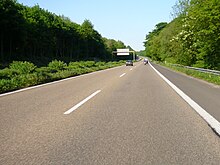
As one of the few actually realized sections of the planned Autobahn 54 , a four-lane motor road through the Viehbachtal was built at the end of the 1970s on the section from An der Gemarke to Mangenberg . This section of the Viehbachtalstraße, dedicated as L 141n, was opened to traffic on August 31, 1979. After numerous complaints from residents about too much noise, a number of measures for improved noise protection were introduced in the following year . The construction of the Viehbachtalstraße between Mangenberg and Frankfurter Damm continued until 1981. The last section of the road was supposed to run through hedges. The buildings of the court were therefore completely demolished, in their place a pedestrian underpass was built under Viehbachtalstraße, which re-connected the divided halves of Richard-Wagner-Straße. In addition to the Heckener Straße, which is also cut off, the Hecken bus stop of Stadtwerke Solingen (line 690) on Frankfurter Damm still indicates the former court.
swell
- ↑ a b City of Solingen: Street and place names in our city of Solingen , self-published, Solingen 1972
- ↑ a b Hans Brangs: Explanations and explanations for the corridor, place, yard and street names in the city of Solingen . Solingen 1936
- ^ Topographic map of the Düsseldorf administrative district . Designed and executed according to the cadastral recordings and the same underlying and other trigonometric work by the Royal Government Secretary W. Werner. Edited by the royal government secretary FW Grube. 4th rev. Edition / published by A. Bagel in Wesel, 1859 / Ddf., Dec. 17, 1870. J. Emmerich, Landbaumeister. - Corrected after the ministerial amendments. Ddf. d. Sept. 1, 1871. Bruns.
- ↑ a b c Johann Georg von Viebahn : Statistics and Topography of the Düsseldorf Government District , 1836
- ↑ Friedrich von Restorff : Topographical-statistical description of the Royal Prussian Rhine Province , Nicolai, Berlin and Stettin 1830
- ↑ Royal Statistical Bureau Prussia (ed.): The communities and manor districts of the Prussian state and their population . The Rhine Province, No. XI . Berlin 1874.
- ↑ Königliches Statistisches Bureau (Prussia) (Ed.): Community encyclopedia for the Rhineland Province, based on the materials of the census of December 1, 1885 and other official sources, (Community encyclopedia for the Kingdom of Prussia, Volume XII), Berlin 1888.
- ↑ Königliches Statistisches Bureau (Prussia) (Ed.): Community encyclopedia for the Rhineland Province, based on the materials of the census of December 1, 1895 and other official sources, (Community encyclopedia for the Kingdom of Prussia, Volume XII), Berlin 1897.
- ↑ Royal Statistical Bureau (Prussia) (Ed.): Community encyclopedia for the Rhineland Province, based on the materials of the census of December 1, 1905 and other official sources, (Community encyclopedia for the Kingdom of Prussia, Volume XII), Berlin 1909
- ^ Solinger Tageblatt from the series search for traces / street names
- ↑ Ralf Rogge, Armin Schulte, Kerstin Warncke: Solingen - Big City Years 1929-2004 . Wartberg Verlag 2004. ISBN 3-8313-1459-4


