
compass


The compass (from Italian compasso "compass, magnetic needle", derived from compassare " pace ", plural: compasses ) is an instrument for determining a fixed direction , e.g. B. compass direction , navigation course , bearing direction . Originally, the compass supplemented other methods of navigation in shipping , for example using the sun, stars and landmarks , currents, waves and water depth. The oldest version of the compass is the rear sight, which allows you to find the North Star on a clear night.
The classic device is the mechanical magnetic compass , which uses the earth's magnetic field to determine the magnetic north direction and thus all other cardinal directions. Other designs are electronic (magnetic) compasses based on Hall sensors or other sensors. With a fluxgate magnetometer , the magnitude and direction of the earth's magnetic field can be determined with an accuracy of 1 / 100,000 of its absolute value.
Gyroscopic compasses , whose mode of operation is based on the rotation of the earth, work without using the earth's magnetic field . The direction measurement takes place in relation to the geographic north-south direction instead of the direction of the field lines of the earth's magnetic field. There are also gyroscopic instruments without a directional reference ( free gyroscopes such as the course gyroscope ), which, however, have to be readjusted periodically. Solar compasses also work without a magnetic field .
A compass with a bearing device is also called a bussole . Mostly this term is used in surveying technology for precision bearing compasses, but especially in Austria and Italy the simple hiking or marching compass is also called that.
History of the magnetic compass
Wet compass

The knowledge that splinters of magnetic iron stone rotate in a north-south direction has been known in Europe since ancient Greece and in China since the Warring States period , between 475 BC. BC and 221 BC Known.
The serious studies of the origin of the compass by J. Klaproth and L. de Saussure lead to the conclusion that the Chinese navigators were already familiar with the wet compass at the turn of the millennium. The Chinese had been using a floating, wet compass needle called the Südweiser since the 11th century AD . In fact, the south direction is marked as the main direction on the Chinese compass . In the course of time, special compass shapes with a division into 24, 32, 48 or 64 lines or cardinal points developed from this (see branches of the earth ). At the end of the 11th century, Shen Kuo (1031-1095 AD) recommended in his main work a compass with division into 24 directions; shortly after his death such compasses were actually in use.
The sailors of the eastern Mediterranean learned about the wet compass and optimized it by the time of the Crusades at the latest . However, since it gave its owner great advantages over the competition on the one hand and, on the other hand, practically worked with forbidden magical powers, this knowledge was kept as secret as possible. In Europe in 1187 , the English scholar Alexander Neckam described the wet compass as a magnetized floating needle that was in use among seafarers. The floating magnetic needle was also mentioned in a church-critical writing by the French monk Hugues de Bercy around 1190 (perhaps even before 1187).
The compass was probably not invented on the Arabian Peninsula , as the Arab seafarers had a good knowledge of astronomy around the turn of the millennium and, thanks to the steady winds, were able to navigate their region of the world well. The wet compass can be found in the Arab world about a hundred years after Alexander Neckam was mentioned.
In 1932 Edmund Oskar von Lippmann published a study in which he tried to prove the alleged superiority of the " Nordic race " by trying to make arguments for a hypothetical , independent invention of the compass in Europe, without going into any other earlier research. This false theory is still partly held today.


Dry compass
The first written mention of a magnetic needle playing dry on a pen can be found in the Epistola de magnete of 1269, written by Petrus Peregrinus de Maricourt , with which the dry compass , which is still used today, was invented. A seafarer named Flavio Gioia , whose existence is not certain, is honored with a memorial at the port of Amalfi as the alleged “inventor of the compass”. The legend of Flavio Gioia is probably based on a translation error.
The dry compass was more accurate than the floating needle, allowing more precise navigation. In the late 13th century, Mediterranean seafarers were the first to combine the magnetic needle with the compass rose .
On German, i.e. for the Middle Ages: Hanseatic seagoing vessels, the compass was only used in the 15th century, English and southern European seafarers were clearly ahead of them.
Improvements
For the multiple meanings or uses of "wind roses" see wind rose (disambiguation) .
Around the year 1400, European seafarers built the dry compass needle and wind rose into a solid housing in order to permanently station it on their ships. Leonardo da Vinci was the first to propose to place the compass box in a cardanic suspension in order to further increase the accuracy. His idea was realized from 1534 and became established throughout Europe during the 16th century, giving European sailing ships the most advanced and precise compass technology of their time. After China, the dry compass was about the year 1600 over Japan , which it from Spaniards and Portuguese had taken
Discovery of magnetic declination
At the beginning of the 15th century it was noticed in Europe that the compass needle does not point exactly to the geographic North Pole, but - locally different - mostly deviates either to the west or to the east. This deviation is known as a misalignment or declination . It is not certain who first recognized this. However, it is certain that Georg von Peuerbach was the first to write about the magnetic declination. The oldest surviving compass showing the declination comes from Peuerbach. Later, an Englishman - James Cook - took precise measurements of the declination in the areas he traveled and thus provided the basis for a map that showed the declination around the globe. By 1542 it was already known that there was also a line without declination - the agone. Another Englishman - Henry Gellibrand - discovered that the declination changed over time.
Discovery of the inclination
An English compass maker - Robert Norman - noticed that an initially balanced magnetic needle tilted after it was magnetized. He thought about a remedy and weighed down the high end with a weight. He recognized the inclination as the cause and published a treatise about it (Newe Attractive, Magnetic Inclination).
Structure and functionality of mechanical magnetic compasses
The classic magnetic compass consists of a rotatable pointer made of ferromagnetic material and a housing in which this pointer is mounted with as little friction as possible . As a carrier of the magnetic needle z. B. abrasion-resistant gemstones such as ruby or sapphire are used. An angle scale is usually attached to the housing. The pointer itself can be in the traditional shape of a needle. In marine compasses, however, this angle scale is located as a complete disc on the needle and there is only a reading line (control line) on the housing.
If the pointer is freely movable in all directions, it aligns itself in the direction of the earth's magnetic field . Its field lines run roughly in a geographical north-south direction. Since the deviation is mostly known very precisely and is partly recorded in topographic maps , conclusions can be drawn relatively precisely about the true north from the direction of the pointer.
Nowadays, compass capsules are usually filled with a liquid to dampen the movement of the needle. As a result, it vibrates less in the event of shocks, which makes reading easier without making it difficult to settle in quickly. The liquid often consists of a light oil or a solvent that does not rust the needle and does not freeze even at low temperatures.
Structure and functionality of electronic magnetic compasses
The earth's magnetic field is also used in the electronic magnetic compass. A wide variety of technologies are used for the sensor. In addition to the actual magnetic field detector, components are often used to determine the orientation of the detector to the earth's surface. (But cardanic suspensions are also used instead of the position detector). A downstream electronics allows the consideration, i. H. Compensation of disturbing magnetic fields in the environment (deviation, deflection). This is particularly important when used on vehicles. In addition, the electronics can also take into account the declination (magnetic declination).
The general disadvantage of electronic magnetic compasses is their dependence on a power supply, which excludes their sole use for some (safety-relevant) applications. In such cases, a power-independent classic magnetic compass is often part of the equipment.
Because the required components are very small and cheap, they are often installed as additional equipment in smartphones, handheld GPS devices, etc. There are also electronic magnetic compasses as standalone devices.
use
Declination (magnetic declination)
Since the line connecting the magnetic poles is inclined by about 11.5 ° with respect to the earth's axis , the magnetic poles are currently about 2000 km away from the geographic poles. The magnetic poles change their position in the course of time, because the earth's magnetism is based on changing currents in the metallic earth core . In some places, the course of the magnetic field lines is also influenced by special local geological conditions (e.g. ferrous rock). There are also other influencing factors that are insignificant for navigational purposes. The first two factors mentioned have the effect that the deviation of the compass needle from true north is different in every place on earth. This phenomenon is called declination .
When gyrocompass no declination (declination) has to be considered because it independent of the earth's magnetic field works
Deviation
As Deviation deflections are referred to the compass needle, which are caused by magnetic fields in the vicinity of the compass. Such fields are generated by magnetic or magnetizable objects and devices as well as by flowing alternating or direct current. This creates a particular problem with vehicles.
Usually, to compensate for the deviations, either magnetic needles are inserted into the compass housing or in its vicinity at designated locations or movably mounted magnets in the compass housing are adjusted accordingly using adjusting screws. In order to achieve this compensation, the vehicle (ship) is successively placed in the different directions and tries to correct the compass display with the compensation devices. The compensation is repeated in one and the same direction after stays in the shipyard, with a full steel load or after long lay periods.
Any residual errors remaining after compensation, which should be less than 5 °, are entered in a deviation table , from which the corresponding correction is read for each map course (for ships e.g. from 10 to 10 degrees) and thus the course taken from the map in a compass course can be converted.
In general aviation , the deviation must be checked after certain changes to the aircraft or at specified time intervals and the compass must be compensated again if necessary. Corresponding specifications can be found in the flight and operating manuals.
In the case of electronic compasses, however, neither a compensation by magnets nor the creation of a deviation table are necessary because the error compensation is done electronically. Instead, the vehicle must be turned slowly one or more times while the "calibration routine" is running.
Inclination
The angle between the tangents to the magnetic field lines and the horizontal tangential plane to the earth's surface is called the inclination . In Central Europe the inclination is about 66.5 °. The earth's magnetic field can be broken down into a vertical and a horizontal component. The vertical component of the earth's magnetic field is around twice as large as the horizontal component in Central Europe.
To determine the north direction, only the horizontal component is important. The inclination , on the other hand, plays a role in the construction of a mechanical compass. So with simple compasses z. B. simply weighted down the southern half of the needle with a so-called rider so that the northern end does not lean down. Such a compass can not be used in the southern hemisphere , as the needle will then tilt and, in the worst case, touch the bottom of the compass housing. There are two solutions to this problem:
- For cheaper compass models, many manufacturers have started dividing the world into up to five zones and offering a separate model variant for each zone. (The variants differ in their centers of gravity of the needles, so that they are balanced in the respective zone).
- In the case of higher-quality models, special needle mountings and mechanisms are used that make the same compass usable worldwide.
Confusion about north or south pole
Again and again the question leads to confusion as to whether the north or south magnetic pole is in the north of the earth . A look at history helps to understand the facts. When the magnetic property of the magnetite needle was discovered, the end of the needle pointing north was naturally called the north pole of the needle. It wasn't until much later that the reason for the effect was recognized and that opposing poles always attract each other in magnets . The name of the polarity was already defined. The magnetic pole of the northern hemisphere therefore has a magnetic polarity that is opposite to the north pole of the compass needle. If you stick to the terminology that the north-pointing tip of the compass needle is the magnetic north pole - which still exists today - the magnetic pole in the geographic north of the earth is inevitably a magnetic south pole.
This physically correct statement is of little importance in everyday life. In common parlance, the direction to the magnetic pole of the northern hemisphere is called "magnetic north" or the magnetic pole itself is also called "magnetic north pole".
To avoid this linguistic ambivalence, the terms “ arctic magnetic pole ” and “Antarctic magnetic pole” have recently been used.
Under water
Under water, the compass, combined with time and speed measurement , is often the only way to determine direction. Above a certain depth, submarines and divers can neither observe the sun nor the stars and also cannot use a navigation system for navigation. The light of the sun or stars as well as the radio frequency signals of the navigation satellites are strongly absorbed by the water . The earth's magnetic field, however, also penetrates the water. On submarines, however, the surrounding steel casing makes the magnetic compass unusable, so that here, as on other larger ships, a gyro compass is mostly used.
Graduation of the compass rose
Basically, compass roses are divided into sectors of the same size . For degrees this is 360, for gons ( grads) 400 and for lines or mils 6400 subranges, with mils usually only showing the hundreds ( march number ). An older classification was made in nautical lines . However, this division is rarely used in navigation today.


Ship compass
In the case of a mechanical ship's compass, instead of the pointer (the so-called needle), a circular disc with a graduation (rose) is attached. The disk floats in a liquid that dampens its movements. The so-called kettle is gimbaled so that the rose always lies horizontally despite the ship's movements ( pitching and rolling (longitudinal axis) ) caused by the sea . In newer models, instead of the cardanic suspension of the entire boiler, there is an inner cardanic (so-called spherical compass ). Since the compass rose rotates as a whole, the direction can be read from a marking (control line) firmly attached to the housing. In contrast, on compasses used on land, the compass rose is attached to the case and only the compass needle appears to rotate. (In reality, however, the compass housing rotates in both cases and the pointer (or rose) remains aligned with the magnetic field lines).
The compass rotation error (aviation)
In aviation, the mechanical magnetic compass shows incorrect values when accelerating due to its inertia . This effect is called acceleration error. When turning flight kicking rotation error on. On the other hand, there are no such display errors when climbing or descending , contrary to the often opposite view.
The acceleration error arises from the fact that the center of gravity of the rotatable part is lower than its suspension point, even with the compasses customary in aviation. When accelerating across the magnetization (east-west direction), the compass magnet tilts in such a way that the vertical component of the earth's magnetic field can pull its north pole down, which falsifies the display.
The rotation error is based on the inclination of the compass in curves and occurs in a north-south direction. Here, too, the compass magnet is adjusted by the vertical component of the earth's magnetic field. A curve is therefore to be completed earlier on a northerly course and later on a southerly course than the compass indicates. This applies to the northern hemisphere, the effect is the opposite in the southern hemisphere. Today, in powered flight, curves are generally flown according to the course gyro without turning error, so that the compass turning error is hardly of practical importance here.
There are acceleration-free and rotational error-free compasses, for example models from the Swiss company Bohli-Magnete or the German company Schanz Feinwerktechnik. Bohli and Schanz compasses have been specially developed for gliders and there in particular for use in cloud flying . These compasses have the disadvantage that they have to be adjusted by hand to the bank of the aircraft. As cloud flying is now banned in glider flying competitions, they are rarely found in gliders today either. This variant of the compass is hardly known outside of the gliding scene.
Despite the existence of satellite-based positioning systems such as GPS, Galilei or GLONASS (collective term GNSS ), the magnetic compass is still widely used. The above-mentioned satellite-based electronic navigation systems have now almost completely replaced navigation using maps and compasses. Due to its independence from an energy supply, however, the magnetic compass is still often used today, mostly as an emergency device. In addition, a compass forces constant confrontation with the real situation, while a navigation device can easily tempt you to blindly rely on satellite technology . A satellite-supported device cannot determine a direction when stationary, it only shows the direction of movement when it is in motion.
For land navigation with a map and compass , a plate compass , also called a map compass , is usually used today, the housing of which is located in a transparent acrylic sheet, or a map protractor with a map pointer . This plate makes map work easier and makes it easy to align the north-south lines of the compass with the grid of a topographic map . A Einnorden the map is not necessary.
Use in mining
The compass was also used in mining by mine separators as a surveying instrument. In the northern Italian mountain town of Massa , compasses for determining the direction of advance and avoiding breakthroughs between mining operations are documented as early as the 13th and 14th centuries, and it was a matter of course in Tyrolean mining in the second half of the 15th century. The mountain booklet by the German mining scientist Ulrich Rülein von Calw (1505) can be regarded as a first theoretical treatise on the underground use of the compass.
Wrist compasses as military equipment

The Adrianow compass ( Russian Компас Адрианова ) is a military compass that was already used by the tsarist army. A first version was developed by the military surveyor Vladimir Adrianov in 1907. Corresponding wrist compasses were worn by the Red Army and the Soviet Army. In the iconographic image of the Berlin Reichstag, May 2, 1945 , the flag-raising soldier noticed that he appeared to be wearing two wristwatches, one of which was retouched before publication. The widespread interpretation as a looter is obvious from a distance, but is not mandatory due to the possible confusion with the wrist compass.
photos
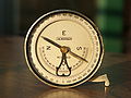
Bussole of the Swiss Army with 6400¯ division (see Mil )
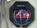
Ball compass of a sailing yacht
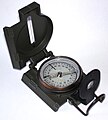
US Army compass with two scales (mils and degrees)

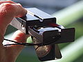
Sighting an object with a compass

Aiming at the march target with rear sight and front sight and reading the march number over the mirror

Matthäus Seutter: Tabula Anemographica seu Pyxis Nautica, vulgo Compass, Augsburg 1734/1749

Compass with prism (scales)

Compass with prism (bearing 220 ° through the optics)

Compass with 400 gon graduation and conversion ruler (D = degree = degree, G = gon, ″ = line) with length in millimeters
Land surveyor compass with inclinometer

Geological compass according to Prof. Clar with bubble level and flap with inclinometer function, also stratum compass

Typical map compass with "global needle" ( inclination compensated )

Bundeswehr Conat compass


Other forms
- Bézard compass
- Hanging compass
- Bussolentheodolite - combination of compass and theodolite
- Pin compass
- Sitometer
- Earth inductor compass
See also
- Flight navigation
- Map protractor with map pointer
literature
- Wolfgang Linke: Orientation with map, compass, GPS. 16th edition. Delius Klasing, Bielefeld 2014, ISBN 978-3-7688-3314-1 .
- Albert Schück: The compass. Self-published, Hamburg 1911–1918.
- OKW : regulation H.Dv. 362: Instructions for using the marching compass. (M.Ko.). 1940.
- Heinz Balmer : Contributions to the history of the knowledge of terrestrial magnetism. Sauerländer, Aarau 1956 ( publications of the Swiss Society for the History of Medicine and Natural Sciences 20).
- Art Roeland Theo Jonkers: North By Northwest. Seafaring, Science and the Earth's Magnetic Field (1600-1800). Cuvillier, Göttingen 2000, ISBN 90-90-13825-0 (Amsterdam, Vrije Univ., Acad. Proefschrift, 2000).
- Karl-Heinz Ludwig, Volker Schmidtchen : Metals and Power. 1000 to 1600. Propylaea Ullstein, Berlin a. a. 1992, ISBN 3-549-05227-8 ( Wolfgang König (Ed.): Propylaea History of Technology. Volume 2).
- Uta Lindgren : European technology in the Middle Ages 800–1400. Tradition and innovation. A manual. 3. Edition. Gebr. Mann, Berlin 1998, ISBN 3-7861-1748-9 .
- Christian Rohr : Compass, paper and gunpowder. ( Memento from October 23, 2006 in the Internet Archive ) Salzburg 2003.
- Amir D. Aczel: The Compass. An invention changes the world. Rowohlt, Reinbek 2005, ISBN 3-498-00056-X .
- Allan Gurney: The Compass. His story in stories. Delius Klasing, Bielefeld 2004, ISBN 978-3-7688-2622-8 .
- Joachim Schult: Sailors Lexicon. With 5700 keywords and 2000 illustrations. Delius Klasing, Bielefeld 2008, ISBN 978-3-7688-1041-8
Web links
- Kite Farm's virtual compass museum. ( Memento from October 1, 2008 in the Internet Archive )
- Compassipedia - the virtual compass museum. Trilingual DE / FR / EN.
- How does my compass perform in Australia?
- The clock as a compass - an error consideration.
supporting documents
- ^ Friedrich Kluge: Etymological dictionary of the German language. 24th edition, edited by Elmar Seebold. Walter de Gruyter, Berlin 2002. ISBN 3-11-017472-3 . P. 515.
- ↑ compass. Section: Grammar. In: Duden . Bibliographical Institute , accessed May 14, 2014 .
- ↑ Bussŏle . In: Meyers Großes Konversations-Lexikon . 6th edition. Volume 3, Bibliographisches Institut, Leipzig / Vienna 1905, pp. 656–657 .
- ^ A b c d e Karl-Heinz Ludwig, Volker Schmidtchen: Metals and power. 1000 to 1600. Propylaen Ullstein, Berlin / Frankfurt / Main 1992.
- ^ Julius Klaproth: Lettre à M. le Baron A. von Humboldt sur l'invention de la Boussole. German version: Arnim Wittstein, 1885.
- ↑ L. de Saussure: L'origine de la rose des vents et l'origine de la boussole. Geneva 1923.
- ^ Joseph Needham: Science and civilization in China . Vol.4, Pt.3: Civil engineering and nautics . Cambridge Univ. Press, Cambridge 1971, ISBN 0-521-07060-0 , pp. 560 ff. (English).
- ↑ La Bible de Guyot; Source: Compassipedia / Kompassmuseum, history / specialist literature.
- ^ Karl Heinrich Wiederkehr, Gudrun Wolfschmidt: Stars show the way. History of navigation. Books on Demand , Norderstedt 2009, p. 55 f.
- ↑ Barbara M. Kreutz: Mediterranean Contributions to the Medieval Mariner's Compass. In: Technology and Culture , 14, 1973.
- ↑ Edmund O. von Lippmann: History of the compass needle up to the invention of the compass (around 1300). Julius Springer Publishing House, Berlin 1932.
- ^ Christian Rohr: Compass, Paper and Gunpowder. Salzburg 2003.
- ↑ Uta Lindgren: European technology in the Middle Ages 800–1400. Tradition and innovation. Berlin: Gebr. Mann, 1998.
- ^ Uwe Schnall: Navigation according to sight and sand , in: Gabriele Hoffmann and Uwe Schnall: Die Kogge , Bremerhaven 2003, pp. 38–40.
- ↑ Function index compasses. Section needle with gem bearing. Company Suunto; accessed 2014.
- ↑ magnetic field
- ↑ Walter Würtl ( mountain climbing ): 292 ° WNW: The compass - an indispensable obsolete model? (PDF) p. 3 f. Retrieved July 24, 2009 (PDF, 652 KiB ).
- ^ Magnetic declination. FAQ. ( Memento from February 5, 2009 in the Internet Archive )
- ^ Recta : Declination and inclination. Description of Recta's own "Global System". Retrieved July 24, 2009.
- ↑ Dr. Wolfgang Linke: Will GPS replace the map, compass and altimeter? . In: Orientation with map, compass, GPS . Retrieved August 26, 2009.
- ^ Karl-Heinz Ludwig, Volker Schmidtchen: Propylaea history of technology. Metals and Power 1000–1600. Berlin 1997, ISBN 3-549-05633-8 , pp. 62-64.
- ^ A b Karl-Heinz Ludwig, Volker Schmidtchen: Propylaea history of technology. Metals and Power 1000–1600. Berlin 1997, ISBN 3-549-05633-8 , p. 64.
- ↑ AM Popov: Начальная военная подготовка (учебник) . DOSAAF, Moscow 1978, OCLC 316895320 , p. 219 (Russian, Basic Military Training - A Manual).