List of cultural monuments in Radeberg
The list of cultural monuments in Radeberg includes the cultural monuments of the Saxon city of Radeberg that were recorded by the State Office for Monument Preservation of Saxony until July 2017 (excluding archaeological cultural monuments). The notes are to be observed.
This list is a partial list of the list of cultural monuments in the Bautzen district .
division
Because of the large number of cultural monuments in Radeberg, the cultural monuments in the districts are listed in partial lists.
| Cultural monuments in Radeberg- ... |
|---|
| Großerkmannsdorf |
| Liegau-Augustusbad |
| Ullersdorf |
List of cultural monuments in Radeberg
| image | designation | location | Dating | description | ID |
|---|---|---|---|---|---|
 |
Radeberg old town monument protection area (proposal) | (Map) | Radeberg old town monument protection area |
09301954 |
|
 |
Water tower | (Railway system) (map) |
Late 19th century | Located at the railway system, of significance in terms of railway history and technology. The striking, around 16 meter high water tower made of red clinker brickwork with a cantilevered, light tower head was built in 1895 at Radeberg station to supply the steam locomotives on the Görlitz - Dresden-Neustadt railway line. The conical tower shaft is accessed by a protruding entrance house and accentuated by narrow belt cornices above the base and at the transition to the tower head. The steel water tank (type Intze I) is enclosed by a filigree iron framework that protrudes far over a hollow and is plastered. It bears the lettering "Radeberg". Narrow rectangular windows, each arranged in pairs, ensure the light of the container floor, the upper end of which is designed with a slate-covered conical roof. The original ventilation hood on the roof has not been preserved, there are remains of the water level indicator on the side of the track. The water tower is in its original, unrenovated condition, but it is no longer used for water storage. As a testimony to the development of the water supply in the railway sector at the end of the 19th century, it is of technical and railway historical value. |
09285333 |
 More pictures |
Radeberg railway station ; Entrance building and another station building | At station 2, 3 (map) |
1876 | Significant in railway history. Reception building (number 2, parcel number 1527/19): symmetrical, wide-spread building with three pavilion-like wings, red clinker brick. Another station building (number 3, parcel number 2193) made of yellow and red bricks. |
09285450 |
| townhouse | Am Steinhübel 1, 2, 3, 4 (map) |
Around 1910 | Located within the Ernst-Braune-Siedlung , historically significant, four entrances, sandstone plinth, ground floor shutters, ribbon-like entrance framing (fired bricks) |
09285503 |
|
| Residential building | At the three houses 9 (map) |
1st half of the 19th century | Half-timbered structure, of importance in terms of building history |
09285277 |
|
 More pictures |
Evangelical City Church of the Holy Name of God and monument to Mayor Seydel | At the church (map) |
Consecrated in 1730, remodeled 1887–1889; baroque (grave monument of the mayor Christoph Seydel) | Structurally and locally of importance. The church, originally built at the end of the 15th century, burned down in 1714. In 1730 the new building was consecrated. In 1887–1889 the church was rebuilt and the tower was built. 1887 start of the tower renovation, reconstructed church consecrated in 1889, a previous building already existed there in 1498, this is indicated by the implementation of a late Gothic door in the later church renovation. The Leipzig Weidenbach and Kaeppler are named as architects. The church is a plastered building with sandstone elements. The tower is completely clad with sandstone and covered with a copper dome. On the north-east wall of the church there is a monument to the mayor Christoph Seydel (died 1747). Sandstone, baroque forms. 1997 new bronze bell, no house number according to ALK data, Flst. 39. |
09285033 |
 |
Diaconate; Residential house in open development | At the church 2 (map) |
Around 1800 | Structurally and historically important, original front door |
09285035 |
 |
City school | At the church 3 (map) |
Around 1820 | Secondary school, of importance in terms of local history and the appearance of the streets. Large structure, hipped roof. Original portal, unfortunately new windows. |
09285034 |
 |
Residential house in open development | At the church 6 (map) |
1st half of the 19th century | Architecturally important |
09285030 |
 |
Rectory with outbuildings | At the church 7 (map) |
Around 1800 | Structurally and locally of importance. Broad house with hipped roof. Original beautiful portal and front door. Back building with a broken roof, according to ALK data house no. 7th |
09285031 |
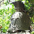 |
Memorial to those who fell in the Battle of Bautzen | at An der Kirche 7 (old churchyard, in front of the rectory) (map) |
1839 | Significant in local history. Three-tier plinth with pedestal and cover plate with helmet, according to ALK data at number 7. See also Memorial Major FG Probsthain .
Memorial (tomb with crypt) for Major Friedrich Gottlieb Probsthain (1778–1839), Commander of the Royal. Saxon. Brigade of the Riding Artillery Radeberg, Knight of the Royal French Legion of Honor . Inaugurated for his burial on November 9, 1839 in the Radeberg churchyard (in front of the superintendent ) |
09285032 |
 |
Apartment building in closed development with courtyard passage | August-Bebel-Strasse 2 (map) |
Before 1900 | Architecturally important, three-story, clinker brick facade, exits on the first and second floors |
09285235 |
 |
Apartment building with shop in closed development and courtyard passage | August-Bebel-Strasse 4 (map) |
Before 1900 | Architecturally important. First and second floor clinker brick. Gable above the central axis. |
09285234 |
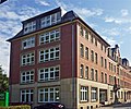 |
Apartment building in closed development with a rear building | August-Bebel-Strasse 6 (map) |
Before 1900 | Architecturally important. First and second floor clinker brick, neo-renaissance gable. |
09285233 |
 |
Villa with enclosure and two courtyard entrance pillars | Badstrasse 1 (map) |
Around 1870 | Evidence of the city expansion at the end of the 19th century, of architectural significance. Sandstone walls, classical decorative shapes, central projections, window canopies on the side and middle of the ground floor, first floor triple windows. |
09285531 |
 More pictures |
Villa with enclosure and two courtyard entrance pillars | Badstrasse 8 (map) |
Around 1870/1880 | Testimony to the expansion of the city at the end of the 19th century, historically significant, central protrusion with loggias, central gable, ox eyes on the side, lead glazing in the loggia, elegant design |
09285529 |
 More pictures |
Residential house with enclosure | Badstrasse 9 (map) |
Around 1900 | Evidence of the city expansion at the end of the 19th century, of architectural significance, sandstone walls, roof extensions |
09285315 |
 More pictures |
Residential house with enclosure and outbuildings | Badstrasse 10 (map) |
Around 1900 | Evidence of the city expansion at the end of the 19th century, of architectural significance, central projectile with triangular gable, ornamental frieze over the first floor, balcony, sandstone walls |
09285318 |
 More pictures |
Semi-detached house with enclosure | Badstrasse 11, 13 (map) |
After 1900 | Elaborately designed, evidence of the city expansion at the end of the 19th century, of architectural significance. Colored glass in verandas, gables boarded with wood, painted in color (Heimatstil). |
09285314 |
 More pictures |
Residential house with enclosure | Badstrasse 12 (map) |
Around 1900 | Villa-like, evidence of the city expansion at the end of the 19th century, historically significant, entrance pillars, clinker brick ornamentation |
09285317 |
 More pictures |
Residential building | Badstrasse 14 (map) |
Marked 1904 | Villa-like, evidence of the city expansion at the end of the 19th century, of architectural significance |
09285316 |
 More pictures |
Residential building | Badstrasse 15 (map) |
Around 1900 | Villa-like, evidence of the city expansion at the end of the 19th century, historically significant, side extension, leaded glass windows |
09285313 |
| Residential building | Badstrasse 25 (map) |
Around 1880 | Evidence of the city expansion at the end of the 19th century, of architectural significance |
09300429 |
|
| Residential building | Badstrasse 29 (map) |
Around 1880 | Evidence of the city expansion at the end of the 19th century, of architectural significance, two-storey plastered building with belt and profiled eaves cornice, facade accented in the center by a three-axis risalit, window coverings, loft extensions, plaster carvings below, gable with turrets, sandstone walls |
09285311 |
|
| Double house of a cooperative | Badstrasse 45, 47 (map) |
1920s | Socially important, original condition with shutters, designed portals, ribbon windows over the stairwell |
09285307 |
|
| Double house of a cooperative | Badstrasse 49, 51 (map) |
1920s | Socially and historically significant, missing shutters, two entrances, designed portals, ribbon windows over the door |
09285306 |
|
 |
Residential complex Eschebach (totality) | Bahnhofstrasse 1, 2, 3, 4, 5, 6, 7, 8 (map) |
Around 1910 | Totality of a residential complex of the former Eschebach-Werke : eight residential houses in a row and front gardens delimited by hedges; Significant in terms of social history and the appearance of the street, two-story, central building with gate passage, sandstone walls |
09301650 |
 More pictures |
Eschebach factory ; Factory with various buildings: House 2 (main building along the street), House 28 (administration / offices?) And House 29 (formerly garages?) | Bahnhofstrasse 9, 10 (map) |
Around 1910 | Significant industrial history and a value that defines the street scene:
|
09285486 |
 |
Tenement house with shop | Bahnhofstrasse 20,21 (Dresdener Strasse 19) (map) |
Around 1910 | Significant in terms of building history and the appearance of the street, three bay windows, front building |
09285489 |
| Double house of a cooperative | Beethovenweg 1 (map) |
Around 1920 | From a socio-historical point of view, ribbon windows over incised portals, heavily profiled main cornice, missing shutters |
09285308 |
|
| Double house of a cooperative | Beethovenweg 2 (map) |
Around 1920 | From a socio-historical point of view, ribbon windows over incised portals, heavily profiled main cornice, missing shutters |
09285309 |
|
| Double house of a cooperative | Beethovenweg 3 (map) |
Around 1920 | From a socio-historical point of view, ribbon windows over incised portals, heavily profiled main cornice, missing shutters |
09285310 |
|
| Double house of a cooperative | Beethovenweg 10, 11 (map) |
Around 1920 | Significant in social history, two-storey plastered building with two entrances, relief fields with figurative representations above the entrances, hipped roof with roof pike, erroneously recorded under Beethovenstrasse until 2008 |
09301628 |
|
| Stadtgut; Residential house in open development and administrative building of the former slaughterhouse | Bruno-Thum-Weg 2 (Pulsnitzer Straße 47) (map) |
Marked 1897 | Of local and architectural significance, sandstone walls and lunettes, stable building with a terracotta head of a bull (demolition) |
09285524 |
|
 |
Single arch sandstone bridge | Dr.-Albert-Dietze-Strasse (map) |
Marked 1891 | Significant in traffic history |
09285319 |
 More pictures |
Monument commemorating the founding of the German Empire in 1871 and the campaigns of 1866 and 1870/1871 | Dr.-Rudolf-Friedrichs-Strasse (corner of Badstrasse) (map) |
1879 | Of local significance, sandstone with pedestal and helmet attachment |
09285305 |
| Residential house in open development with fencing | Dr.-Rudolf-Friedrichs-Strasse 7 (map) |
Before 1900 | Evidence of the expansion of the city around 1900, historically important, ornamental lattice lattice, clinker facing gable, central gable in a raised, raised center |
09285290 |
|
| Residential house in open development with fencing | Dr.-Rudolf-Friedrichs-Strasse 9 (map) |
Before 1900 | Evidence of the city expansion around 1900, of architectural significance, clinker brick, raised center, decorative framework |
09285298 |
|
| Residential house in open development with fencing | Dr.-Rudolf-Friedrichs-Strasse 12 (map) |
Around 1900 | Evidence of the expansion of the city around 1900, historically significant, curved gable, central window in the roof with volutes |
09285291 |
|
| Residential house in open development with fencing | Dr.-Rudolf-Friedrichs-Strasse 15 (map) |
Around 1900 | Evidence of the expansion of the city around 1900, historically significant, projected center with balcony and central gable |
09285292 |
|
| Residential house in open development with fencing | Dr.-Rudolf-Friedrichs-Strasse 17 (map) |
Around 1900 | Testimony to the expansion of the city around 1900, historically significant, central projection with broken gable |
09285294 |
|
| Residential house in open development with fencing | Dr.-Rudolf-Friedrichs-Strasse 19 (map) |
Around 1900 | Evidence of the expansion of the city around 1900, historically significant, clinker brick on the upper floor, protruding center, three-dimensional figurative decoration on the central projection |
09285295 |
|
| Residential house in open development with fencing | Dr.-Rudolf-Friedrichs-Strasse 25 (map) |
Around 1900 | Elaborately designed, evidence of the expansion of the city around 1900, historically significant, central projection with balconies, roof hood with lantern |
09285296 |
|
| Residential house with shop in corner location and enclosure | Dr.-Rudolf-Friedrichs-Strasse 27 (map) |
Around 1900 | Evidence of the city expansion around 1900, of importance in terms of building history and the appearance of the street, sloping corner with roof hood, side gable, richly designed window coverings, triangular gable with plastic-figurative decoration, with corner balconies |
09285299 |
|
| House in a corner | Dr.-Rudolf-Friedrichs-Strasse 29 (map) |
Around 1900 | Evidence of the city expansion around 1900, of architectural significance, side elevation with colored glazed loggia, plaster ornamentation |
09285300 |
|
| "Lindenhof" restaurant in a corner | Dr.-Rudolf-Friedrichs-Strasse 32 (map) |
1898 | Head building to the square, of importance in terms of building history, urban development and the street scene, sloping corner, clinker brick panels |
09285302 |
|
| Residential house in open development | Dr.-Rudolf-Friedrichs-Strasse 33 (map) |
Around 1900 | Evidence of the expansion of the city around 1900, historically significant, clinker brick on the upper floor, sandstone walls, stucco decorations |
09285303 |
|
| villa | Dr.-Rudolf-Friedrichs-Strasse 35 (map) |
Marked 1913 | Architecturally significant, winding building, plaster ornaments, relief with inscription "Ora et labora Anno Domini 1913" |
09285304 |
|
 |
Apartment building in closed development | Dr.-Wilhelm-Külz-Strasse 5 (map) |
1910s | Significant in terms of building history and urban development |
09285228 |
 |
Apartment building in closed development | Dr.-Wilhelm-Külz-Strasse 6 (map) |
1910s | Significant in terms of building history and urban development |
09285229 |
 |
Apartment building in closed development with gate passage | Dr.-Wilhelm-Külz-Strasse 7 (map) |
Around 1915 | Significant in terms of building history and urban development, three floors, seven axes, expanded attic, plastered facade with plastered structure, tiles, sandstone window frames, original: window, gate with skylight and handle, staircase, staircase window with colored structural glass, outside toilet doors, simple residential building in the closed street space with a typical small-town commercial situation in the rear, according to ALK data, workshop building and courtyard paving broken off |
09285915 |
 |
Apartment building in closed development | Dr.-Wilhelm-Külz-Strasse 8 (map) |
Before 1900 | Significant in terms of building history and urban development, plastering on the ground floor, clinker bricks on the first and second floors |
09285230 |
 |
Residential building in closed development | Dr.-Wilhelm-Külz-Strasse 10 (map) |
Around 1830 | Significant in terms of building history and urban development. Three central axes raised, with gable. Two roof extensions. Original front door. |
09285015 |
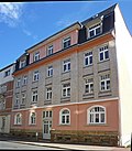 |
Apartment building in closed development | Dr.-Wilhelm-Külz-Strasse 12 (map) |
Around 1905 | Significant in terms of building history and urban development. White facing bricks on the upper floors. Blue glazed stones as decorative ribbons. Original windows, rear building broken off according to ALK data. |
09285014 |
 |
Railway bridge | Dresdener Strasse (map) |
Around 1900 | Steel girders with rivets, original railing, of importance in terms of traffic and technology |
09285444 |
 |
Radeberger export beer brewery ; Brewery building along the street consisting of administration, old machine house and old malt house with kiln (1911) as well as part of the facade of the building behind | Dresdener Strasse 2 (map) |
1911 (malting with kiln); marked 1906 (social and farm building) | In terms of building history and technology history, the facade of the building behind the main building is veneered, only a gable part is visible in front of it like a spolia |
09285510 |
 |
Tenement house with shop in a corner | Dresdener Strasse 3 (map) |
1890s | Significant in terms of building history and urban development, sloping corner with bay window and corner tower, clinker brick facade, elaborate sandstone decorations and cladding |
09285469 |
| Apartment building in closed development | Dresdener Strasse 5 (map) |
1890s | With clinker cladding façade, of architectural and urban significance, central projections, sandstone walls |
09285470 |
|
 |
villa | Dresdener Strasse 6 (map) |
Around 1870/1880 | Significant in terms of building history and urban development, clinker brick attic with ornamental framework, roof overhang, large balcony |
09285498 |
| Apartment building in closed development | Dresdener Strasse 7 (map) |
1890s | With clinker cladding façade, of architectural and urban significance, central projections, sandstone walls |
09285471 |
|
 |
villa | Dresdener Strasse 8 (map) |
1890s | Architecturally and urbanistically important, with clinker bricks and presented pilasters |
09285497 |
 |
Post office | Dresdener Strasse 9 (map) |
Marked 1894–1895 | Structurally and historically important, sloping corner, clinker brick facade, elaborate portal made of sandstone and stucco, gable, original staircase (inner railing) and shutters |
09285476 |
| Apartment building in half-open development | Dresdener Strasse 11 (map) |
1890s | Significant in terms of building history and urban development, clinker brick facade, sandstone walls |
09285472 |
|
| Apartment building with shop and courtyard passage in closed development | Dresdener Strasse 13 (map) |
1890s | Significant in terms of building history and urban development, clinker brick facade, sandstone walls |
09285473 |
|
| Apartment building with shop and courtyard passage in closed development | Dresdener Strasse 15 (map) |
Around 1900 | Architecturally and urbanistically important, three-storey plastered building, arched window and door frames on the ground floor, two round bay windows with inserted brick pillars on the first floor |
09285474 |
|
 |
Apartment house with shop in a corner and closed development | Dresdener Strasse 17 (map) |
1890s | Significant building history and urban development, sloping corner, large windows with inserted cast iron columns, upper floor clinker brick with sandstone elements, lavish, balconies facing Bahnhofstrasse |
09285475 |
| Tenement house with shop | Dresdener Strasse 19 (Bahnhofstrasse 20, 21) (map) |
Around 1910 | Significant in terms of building history and the appearance of the street, three bay windows, front building |
09285489 |
|
 More pictures |
Catholic parish church of St. Laurentius | Dresdener Strasse 31 (map) |
Construction began in 1881, consecration in 1883 | Significant from an architectural point of view, it was ceremoniously consecrated in neo-Gothic style after 14 months of construction on August 12, 1883, church hall on the first floor, ground floor with the pastor's living and working rooms |
09285509 |
| Residential building with rear cellar and quarry stone wall facing Dresdener Strasse | Dresdener Strasse 34c (map) |
17th century | Architecturally important. Residential building: Upper floor half-timbered, partly boarded up, partly plastered, hipped roof, protruding far. Basement: quarry stone and sandstone lintel. |
09285508 |
|
| chimney | Dresdener Strasse 40, 42 (map) |
2nd half of the 19th century | Of importance in industrial history. Large stately building with a half-hip roof, consisting of several building parts. Front part: triple window in the gable with three arches and central projection, when the property was inspected on February 2, 2011, a decision was made to delete the property by mutual agreement with Ms. Reimann (LRA Bautzen / UD) because structural interventions have already taken place and the building fabric is insufficient to justify the monument. Chimney with an octagonal floor plan and walling round in cross-section, brickwork (edges emphasized by brick association), tapering towards the top. Walling up probably to increase the chimney after 1900. |
09285056 |
|
 |
Residential house in open development with fencing | Dresdener Strasse 61 (map) |
Around 1900 | Significant in terms of building history and urban development, loggias, ornamental framework, roof overhang |
09285493 |
 |
Residential house in open development with entrance gate | Dresdener Strasse 63 (map) |
Marked 1897 | From a historical and urban point of view of importance, wooden balcony, loggia, high gable, designated therein, the entrance to the gate consists of two sandstone pillars |
09285494 |
| Residential house in open development | Dresdener Strasse 73 (map) |
Around 1910 | Architecturally and urbanistically important, shutters, some colored stained glass windows |
09285443 |
|
| Residential house in open development | Dresdener Strasse 75 (map) |
Around 1900 | Significant in terms of building history and urban development, sandstone walls, veranda built up |
09285442 |
|
| Residential house in open development | Dresdener Strasse 77 (map) |
1910/1920 | Structurally and in terms of urban planning, it is of importance, plaster structure, some with shutters |
09285441 |
|
| Residential building | Dresdener Strasse 90 (map) |
Marked 1898 | In the Heimat style, of architectural and urban significance, upper floor clinker brick, central projectile, roof house, original ridge tiles with ornament |
09285440 |
|
 |
Sandstone pillar with two figures and inscription plaque for home construction | Eigenheimweg (map) |
1920 | Artistically and historically important, by Kolbe (Dr.-Loschwitz), Ulbricht and Richter (Radeberg) |
09285452 |
 |
Residential building | Forststraße 1 (map) |
Around 1900 | Of architectural significance, elaborately designed, with two turrets, was mistakenly listed under number 1a until February 2008 |
09285445 |
| Residential house in open development and set back | Freudenberg 1 (map) |
Mid 19th century | Architecturally important. Broad, representative building, perhaps a former public building. Demolition permit December 16, 1997. Until 2003, the house was erroneously listed under “Am Freudenberg 2” in the list of monuments; according to the 2008 ALK data, the address is “Freudenberg”. |
09285140 |
|
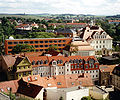 |
Humboldt Gymnasium (formerly Humboldt School) with stairs and gym | Freudenberg 9 (map) |
1912 | Structurally and locally of importance. School building with original equipment (doors, wall fountain, etc.). Gym with beautiful wooden ceiling. In the course of the expansion of the Humboldt School, the ruins of the riding arena were demolished (2000); according to the 2008 ALK data, the address is “Freudenberg”. |
09285172 |
 |
Radeberg Cemetery (aggregate) | Friedhofstrasse (map) |
1850-1945; after 1945 (soldier's grave and military cemetery) | Totality of the Radeberg cemetery with the following individual monuments: cemetery chapel, 6 tombs, 5 tombs, memorial for the victims of fascism, electroplating of an angel and cemetery enclosure with gate system (see obj. 09285548), cemetery design (garden monument) as well as two military cemeteries for Soviet and German fallen soldiers of the Second World War as a material totality; Architecturally, artistically and locally of importance. Soviet military cemetery as a rectangular complex with 59 individual graves, 21 German military graves in a row with gravestones. Cemetery design: old trees and avenues of trees within the complex. |
09301673 |
 |
Cemetery chapel (individual monument for ID No. 09301673) | Friedhofstrasse (map) |
Around 1900 | Individual monument belonging to the Cemetery Radeberg; Architecturally, artistically and locally of importance. Bright red clinker brick building, domed central building with two wings and apse-like extension. |
09285548 |
| 6 tombs (individual monument for ID no.09301673) | Friedhofstrasse (map) |
1830-1940 | Individual features of the entity Friedhof Radeberg; artistically and historically important:
|
09285548 |
|
| 5 grave sites (individual monument for ID no.09301673) | Friedhofstrasse (map) |
1894-1926 | Individual features of the entity Friedhof Radeberg; artistically and historically important:
|
09285548 |
|
| Memorial to the Victims of Fascism (individual monument for ID No. 09301673) | Friedhofstrasse (map) |
After 1945 | Individual monument belonging to the Cemetery Radeberg; Architecturally, artistically and locally of importance |
09285548 |
|
| Electroplating of an angel (individual monument for ID no.09301673) | Friedhofstrasse (map) |
Around 1900 | Individual features of the entity Friedhof Radeberg; Artistically and historically important, angel sculpture with wreath, electroplating, around 1900 |
09285548 |
|
| Cemetery enclosure with gate system (individual monument for ID No. 09301673) | Friedhofstrasse (map) |
Around 1900 | Individual monument belonging to the Cemetery Radeberg; Architecturally, artistically and locally of importance, enclosure wall with wrought iron cemetery portal |
09285548 |
|
 |
Heinrichsthal dairy (formerly) ; Dairy administration building and residential building | Großröhrsdorfer Strasse 15a (map) |
Founded in 1880 | Significant in terms of local history and building history |
09285523 |
| Tenement house with shop in a corner | Güterbahnhofstrasse 1 (map) |
Around 1900 | Significant in terms of architectural history and the appearance of the street, three-storey building with clinker cladding facade, corner accentuation through tower attachment |
09285463 |
|
| Apartment building in closed development | Güterbahnhofstrasse 2 (map) |
Around 1900 | Of architectural importance, clinker cladding facade |
09285464 |
|
| Apartment house in a corner | Güterbahnhofstrasse 3 (map) |
Around 1900 | Significant in terms of building history and urban development, corner emphasis by bay windows with tower top |
09285465 |
|
| Factory owner's villa of the former glass factory with clinker wall (facing the street, internal No. 2) | Güterbahnhofstrasse 16 (map) |
Around 1870 | Significant in terms of local history, elaborate stucco, wooden, figurative cornices, broken stone plinths |
09285449 |
|
 More pictures |
Hospital bridge over the Röder | Main street (map) |
19th century | Of technical significance, granite, cyclopean offset with original wrought iron grille, sandstone pedestals at the beginning and end of the bridge, grids in between |
09285485 |
 |
Residential building in closed development | Hauptstrasse 1 (map) |
Around 1870, core older | Architecturally important |
09285090 |
 |
Residential building in closed development | Hauptstrasse 2 (map) |
Around 1750 | Architecturally important, snail in the keystone. Building restored in 2001 and provided with an extension, including the seat of the city library. |
09285089 |
 |
Residential building in closed development | Hauptstrasse 3 (map) |
Around 1870 | Architecturally important |
09285091 |
 |
Mohren Pharmacy; Baroque house in closed development | Hauptstrasse 4 (map) |
Before 1760 | Baroque structure, of architectural significance. Original front door. Pharmacy with original equipment. |
09285024 |
 |
Residential house with shop in closed development and rear building | Hauptstrasse 6 (map) |
Around 1850 | Residential house with shop, of architectural significance. The right shop with the original front. Original front door. |
09285025 |
 |
House with shop in a corner | Hauptstrasse 7 (map) |
Around 1820 | Significant historically and shaping the street scene, crooked hips to the corner |
09285092 |
 |
Residential building with shop in closed development | Hauptstrasse 8 (map) |
Kern before 1760 | Architecturally important, three-storey plastered building with classical facade structure, plaster grooves on the ground floor, pilasters, belt cornices, saddle roof on the upper floors |
09285026 |
 |
Apartment house in a corner | Hauptstrasse 9 (map) |
Kern before 1830 | Architecturally important, right shop with original front |
09285079 |
 |
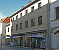
Former headquarters of the Radeberg garrison and rear building | Hauptstrasse 10 (map) |
1760 (headquarters); around 1860 (rear building) | Structurally and locally of importance. Baroque core, facade molded in the middle of the 19th century, marked 1760 on the portal of the courtyard passage on the left. Original front door. Rear building with commercial use. Plaster with clinker brick structure. |
09285027 |
 |
Fur house to the star (formerly); House in a corner | Hauptstrasse 12 (map) |
Before 1830 | Architecturally important. Upper floor half-timbered plastered, corner shop on the first floor with original shop window fittings, "Pelzhaus zum Stern". Wooden partitions with Art Deco design. At the Kirchgasse courtyard entrance. |
09285028 |
 |
Residential house in closed development with rear wing | Hauptstrasse 13 (map) |
Around 1880 | Architecturally important |
09285078 |
 |
Residential house in closed development with rear wing | Hauptstrasse 15 (map) |
Around 1925 | Architecturally important, bay window on the first floor |
09285077 |
 |
Residential building in closed development | Hauptstrasse 16 (map) |
Early 19th century | Significant in terms of building history and urban development |
09285187 |
 |
Residential building in closed development | Hauptstrasse 18 (map) |
Marked 1760 | Significant in terms of building history and urban development. Shop fronts at the end of the 19th century. Keystone with house brand and date. Wooden gate in rococo shapes, some with original windows. |
09285047 |
 |
Residential house with shop in half-open development | Hauptstrasse 20 (map) |
Around 1870 | Architecturally important. Original shop front. House with extensions stretched far down. |
09285048 |
 |
Apartment building with a corner store area with an extension to Berggasse and advertising display with a clock | Hauptstrasse 21 (map) |
1907-1908 | Significant in terms of building history and the appearance of the street. Clinker brick in the middle of the first floor, enamel slabs, blue glazed bricks. Shops with the original front. On the right-hand shop there is an advertising display with a clock from the time it was built, the last watchmaker Friebel gives up his business in early 2000 for reasons of age. |
09285074 |
 |
House in a corner with a courtyard wing | Hauptstrasse 23 (map) |
Before 1800 | Significant in terms of building history and urban development. Original courtyard gate. Shops with the original front. |
09285073 |
 |
Tenement house with a shopping area in a corner | Hauptstrasse 25 (map) |
Before 1900 | Significant in terms of building history and the appearance of the street. Clinker construction. Corner with two pillars on the ground floor. Corner bay window on the first and second floors. Corner tower with stucco. Beautiful stairwell windows. Stucco in the throat in the entrance area. |
09285072 |
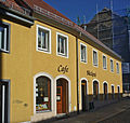 |
Residential building in closed development | Hauptstrasse 26 (map) |
Around 1820 | Significant in terms of building history and urban development, includes a slight bend in the street, residential building with café and bakery Päßler |
09285050 |
 |
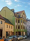
House in a corner | Hauptstrasse 27 (map) |
Around 1840 | Significant in terms of building history and urban development. A shop with the original front and a newer corner shop. |
09285071 |
 |
Residential building in closed development | Hauptstrasse 29 (map) |
Around 1840 | Significant in terms of building history and urban development. Shop with old window decoration and front. |
09285070 |
 |
Apartment building in closed development | Hauptstrasse 31 (map) |
Around 1908 | Architecturally important. Original house furnishings, with floor tiles. Bay windows on the first and second floors. |
09285069 |
 |
Apartment house in a corner | Hauptstrasse 34 (map) |
Around 1905 | Significant in terms of building history and the appearance of the street. Corner bay. Ground floor all newer shops. |
09285003 |
 |
Apartment building in semi-open development with original shop fittings | Hauptstrasse 36 (map) |
Around 1905 | Significant in terms of building history, urban development and the street scene. Three storeys, developed attic storey, dwarf house three axes, ground floor sandstone, plastered facade with plaster structure, sandstone window frames, sandstone eaves, four balconies with sandstone exit plates, original: windows, balcony grilles, coat of arms in the stairwell on the first floor, apartment doors, staircase, two lamps 1960s cinema access, shop fittings! The right shop with the original front and the same equipment: Art Nouveau wall tiles, the ceiling is held by steel bands with small rosettes. The almost destroyed cinema in the house dates from the 30s. The cinema extension is not a monument. |
09285004 |
 |
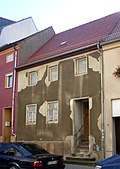
Residential building in closed development | Hauptstrasse 40 (map) |
Around 1800 | Significant in terms of building history and urban development. The shops with fronts around 1900. Raised three-axis central projection with a gable. |
09285006 |
 |
Residential building in closed development | Hauptstrasse 41 (map) |
Around 1840 | Significant in terms of building history and urban development |
09285065 |
 |
Residential building in closed development | Hauptstrasse 43 (map) |
Around 1840 | Significant in terms of building history and urban development, original front door |
09285064 |
 |
Residential building in closed development and rear building (former headquarters of the Radeberger Distillation & Liqueur Factory ) | Hauptstrasse 44 (map) |
Around 1870 | Architecturally important. Plastic sun on keystone. Four skylights, ridge tiles with ornament. |
09285007 |
 |
Apartment building in closed development | Hauptstrasse 45 (map) |
Around 1890 | Architecturally important, upper floors are clinker |
09285063 |
 |
Apartment building in closed development | Hauptstrasse 47 (map) |
Around 1880 | Architecturally important. Shops with beautiful original windows and lintels. Original front door. From the second floor upwards clinker brick. Left door new. |
09285062 |
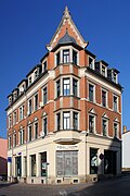 |
Corner apartment building with shop | Hauptstrasse 50 (map) |
Around 1890 | Significant in terms of building history and the appearance of the street. Clinker construction. Corner store with the original front. Corner bay. |
09285008 |
 |
House in closed development with shop | Hauptstrasse 51 (map) |
Around 1840 | Architecturally important. Two roof extensions. |
09285060 |
 |
Residential building in closed development | Hauptstrasse 52 (map) |
2nd half of the 19th century | Architecturally important |
09285244 |
 |
Residential building with two shops in closed development, plus two back buildings | Hauptstrasse 55 (map) |
Around 1820 | Significant in terms of building history and urban development. Roof landscape completely smooth. Original front door. |
09285058 |
 |
Apartment house in a corner | Hauptstrasse 57 (map) |
Before 1900 | Significant in terms of building history and the appearance of the street. Conceived as a corner building, corner bay window over two floors. Clinker brick on the first and second floors. |
09285226 |
 |
Apartment building in half-open development | Hauptstrasse 58 (map) |
Marked 1896 | Significant in terms of building history and urban development. Clinker facing facade, neo-renaissance gable, therein inscribed. |
09285241 |
 |
Apartment building in closed development | Hauptstrasse 60 (map) |
Late 19th century | Significant in terms of building history and urban development |
09285240 |
 |
Apartment building in open development with a two-winged extension, enclosure and two gate pillars (sandstone) | Hauptstrasse 61 (map) |
Late 19th century | Significant in terms of building history and urban development. Balconies over two upper floors, with a staggered triangular gable over the central axis. Right extension: loggias with lead glazing. Demolition in April 2015: two-winged extension (formerly a print shop). |
09285227 |
 |
Hotel Kaiserhof; Inn with annex | Hauptstrasse 62 (map) |
1895 | Inn with corner tower and ballroom, extension with original furnishings, of architectural and local significance. Three-storey solid plastered building, historic, with originally restored roof section (was changed in GDR times), pillared hall on the ground floor, ballrooms on the ground floor and the first floor. Known under the name "Rödereck" during the GDR era. |
09285239 |
 More pictures |
Royal Fireworks Laboratory Radeberg (formerly); Sachsenwerk (formerly); Robotron (formerly); Porter's house, gate entrance, administration building with turret (No. 104), main building without a flat extension (No. 108), large factory building (No. 210–213) and company vocational school | Heidestrasse 70 (map) |
1915-1918 | Structurally and locally of importance. Gate entrance: two pillars with beginning fencing. Large factory building: main building and three rear wings, labeled Zünder / Werkstatt. Established in 1915 as a purely military factory, "Fireworks Laboratory", then taken over by soldiers' councils, temporary civilian production, sold via Bankhaus Arnold to Sachsenwerke, from 1922 to Sachsenwerk Dresden as an external company in Radeberg, 1932 shutdown, 1935 partially opened as part of the Sachsenwerk, military production during World War II , after 1945 SAG operation, from 1946–1952 Rafena, 1968 according to the decision of the Center for Computer Technology, after Wende GmbH, dissolved by Treuhand, currently a business park. An object-historical treatise is currently being prepared. |
09285447 |
| Factory, consisting of an administration building and a factory building, a gatehouse and a factory owner's villa | Heinrich-Glasses-Strasse 10, 12 (map) |
Around 1910 | Structurally and locally of importance. Factory: house no. 12.Villa (number 10): elaborate design with all-round plaster profile over the second floor, projected central field on the street side with a large gable triangle, projected component on the side with an elaborately designed entrance area with open staircase and mansard gable, upper floor window with shutters, mostly original, double-sashed windows , Hip roof. Administrative building with reinforced concrete gable. Manufacturers' villa: plaster ornaments in arches over the windows and on the balcony wall, archer [Orion] in the gable. |
09285448 |
|
| Residential building of a residential complex with central gable and clock tower, passage to the courtyard and side wing structures | Hügelweg 29, 31 (Torweg 13, 14, 15, 16) (map) |
Around 1910 | A complex structure with six entrances - see also Torweg 13, 14, 15 and 16, of architectural and local significance, belongs to the WBG (Radeberg housing cooperative), originally built as a residential complex of the Feuerwerklaboratorium building cooperative, this building cooperative was founded in 1914/1916 |
09285455 |
|
 |
Two water feeder houses | Kamenzer Strasse (map) |
Marked 1910 | Socially important |
09285438 |
| House with half-timbered extension and wooden pump in the courtyard | Karlstrasse 1 (map) |
2nd half of the 19th century | From a socio-historical point of view, some windows were clogged, some were original |
09285262 |
|
| Residential house in open development | Karlstrasse 6 (map) |
Around 1900 | Architecturally important, emphasized the center of the facade, sandstone walls, profiled belt and main cornice |
09285261 |
|
| Residential house in open development | Karlstrasse 10 (map) |
Around 1900 | Architecturally of importance, roof houses, richly profiled cornices, sandstone walls |
09285260 |
|
| Residential house in semi-open development | Kirchstrasse 1 (map) |
Around 1870 | Architecturally important, three-story plastered construction, seven axes, belt and eaves cornices, triangular gable roofs in the middle on the first floor |
09285045 |
|
 More pictures |
Lion bridge ; Two-arch natural stone bridge | Kleinwolmsdorfer Strasse (map) |
1846 | With plastic lion heads in the gusset between the arches, of local and traffic development significance, sandstone corner cuboids on the central pillar and on the arch and on the border of both arches, subsequent widening (right and left cantilever for footpaths) |
09283251 |
| Residential building | Kleinwolmsdorfer Strasse 2 (map) |
Around 1900 | In the Heimatstil, of architectural significance, all windows on the first floor have window coverings |
09285437 |
|
| Apartment building in closed development | Langbeinstrasse 2 (map) |
1890s | Significant in terms of building history and urban development. Red clinker with yellow clinker decorations. Sandstone walls. Original front door and window. Stucco in the courtyard passage. Original courtyard door. |
09285198 |
|
| Apartment building in closed development | Langbeinstrasse 4 (map) |
1890s | Significant in terms of building history and urban development. Original front door and window. Stucco in the entrance area. Beautiful stairwell windows. |
09285199 |
|
| Apartment building in closed development | Langbeinstrasse 6 (map) |
1890s | Significant in terms of building history and urban development. First floor large bay window. Neo-Baroque ceiling painting in the entrance area. Stuck in the throat. Stencil painting on the walls, also in the stairwell. |
09285200 |
|
| Farm with residential house and stable house with large passage | Lotzdorfer Strasse 8 (map) |
18th century (stable house); 2nd half of the 19th century (residential building) | Significant in terms of building history and economic history. Upper floor half-timbered boarded up, old part, wooden entrance house, half-timbered house right gable slated. Barn deleted as a monument in September 2016 because of too high a degree of change. |
09285266 |
|
| Residential stable house in a four-sided courtyard | Lotzdorfer Strasse 9 (map) |
Marked 1847 | Architecturally important, upper floor half-timbered, marked in the lintel |
09285267 |
|
| Residential stable house | Lotzdorfer Strasse 10 (map) |
1st half of the 19th century | Architecturally important, upper floor half-timbered plastered |
09285273 |
|
| Quarry stone retaining wall by the road | Lotzdorfer Strasse 12 (map) |
1st half of the 19th century | Significant for the streetscape, 2004 deletion of the stable house (upper floor half-timbered) |
09285272 |
|
| Courtyard entrance | Lotzdorfer Strasse 16 (map) |
2nd half of the 19th century | Consisting of two sandstone pillars with striker plates, important to shape the street scene |
09285271 |
|
| Residential stable house (without rear extension), side building and barn with wooden beam ceiling | Lotzdorfer Strasse 24 (map) |
Marked 1846 | Structurally and socially important. Residential stable house marked 1846, side building upper floor plastered half-timbering, barn as a brick building with wooden beam ceiling |
09285286 |
|
| Residential stable house | Lotzdorfer Strasse 27 (map) |
Around 1850 | Architecturally important |
09285268 |
|
 More pictures |
Memorial to the soldiers from Lotzdorf who fell in World War I | Lotzdorfer Strasse 29 (map) |
After 1918 | Of local significance, wall with sandstone figures and inscription plaque |
09285269 |
| Stable house (half-timbered) and barn | Lotzdorfer Strasse 32 (map) |
1st half of the 19th century | Architecturally important, residential stable house illegible name, stone barn |
09285285 |
|
| Former inn | Lotzdorfer Strasse 34 (map) |
Marked 1846 | Significant local history, broad structure |
09285274 |
|
| Residential stable of a three-sided courtyard | Lotzdorfer Strasse 36 (map) |
Marked 1846 | Signed in the lintel, significant in terms of building history |
09285284 |
|
| Residential house in open development | Lotzdorfer Strasse 39 (map) |
1st half of the 19th century | Architecturally important |
09285276 |
|
| Residential stable house | Lotzdorfer Strasse 40 (map) |
Marked 1838 | Architecturally important |
09285283 |
|
 |
Residential stable house and memorial plaque for Wilhelm von Kügelgen | Lotzdorfer Strasse 48 (map) |
1st half of the 19th century | Architecturally important, upper floor half-timbered |
09285281 |
| Ludwig Richter School | Lotzdorfer Strasse 51 (map) |
Around 1880 | Significant local history, profiled sandstone walls |
09285282 |
|
| Residential stable house | Lotzdorfer Strasse 52 (map) |
1st half of the 19th century | Architecturally important, upper floor half-timbered plastered |
09285280 |
|
| Rural house | Lotzdorfer Strasse 58 (map) |
Early 19th century | From an architectural point of view, the upper floor and gable are slated |
09285278 |
|
| Rural house | Lotzdorfer Strasse 62 (map) |
Marked 1806 | Signed in the lintel, of architectural significance, upper floor timber-frame boarded up |
09285279 |
|
| Main building, barn (half-timbered) and farm building of the former lawn mill | Lotzdorfer Strasse 65 (map) |
1st half of the 19th century | Structurally and locally of importance |
09285431 |
|
 |
So-called town house; Ratskeller; Residential house with restaurant in closed development | Market 1 (map) |
Before 1800 | Structurally and historically of importance, with pilaster structure, according to ALK data 2008 address "Markt" |
09285101 |
 |
Gasthaus Stadt Dresden (formerly); Residential building in closed development | Market 2 (map) |
Before 1800 | Formerly an inn, of architectural and local importance, facade smoothed, according to ALK data 2008 address "Markt" |
09285102 |
 |
Residential building in closed development | Market 3 (map) |
Before 1800 | Significant in terms of building history and urban development, the facade has been smoothed. Shop with old front, according to ALK data 2008 address "Markt" |
09285103 |
 |
Residential building in closed development | Market 5 (map) |
After 1741 | From a building history point of view, according to ALK data 2008, address "Markt" |
09285088 |
 |
Residential building with shop in closed development | Market 6 (map) |
After 1741 (house); 19th century (shop fittings) | Architecturally important. Secret annexe with vault. 19th century shop fittings, according to ALK data 2008 address “Markt”. |
09285174 |
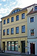 |
Residential building with shop in closed development | Market 9 (map) |
Before 1800 | Architecturally important, shop front from 1880, according to ALK data 2008 address "Markt" |
09285105 |
 |
Residential building with shop in closed development | Market 10 (map) |
Around 1750 | Architecturally important. Reload. Original front door, according to ALK data 2008 address “Markt”. |
09285106 |
 |
Sachsenhof (formerly); Residential building in closed development | Market 11 (map) |
Before 1800 | Architecturally of importance, founding premises of the KPD, original front door, according to ALK data 2008 address "Markt" |
09285107 |
 |
House with shop in the corner of Pirnaer Straße | Markt 12 (map) |
Before 1800 | From a building history point of view, according to ALK data 2008, address "Markt" |
09285096 |
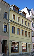 |
Residential building with shop in closed development and courtyard wing (half-timbered) | Market 15 (map) |
Core safe after 1741 | From a building history point of view, according to ALK data 2008, address "Markt" |
09285099 |
 |
Apartment building with shop in closed development with inner courtyard and adjacent parts of the building | Markt 16 (map) |
Around 1910 | From a building history point of view, according to ALK data 2008, address "Markt" |
09285100 |
 |
Golden Star; Residential house in closed development with left and right courtyard wings | Markt 18 (map) |
Marked 1742 | Structurally and locally of importance. Original front door, according to ALK data 2008 address "Markt", both courtyard wings broken off. |
09285087 |
 More pictures |
Town hall in closed development including hall extension | Markt 19 (map) |
1767–1769, redesigned in 1904 neo-baroque | Structurally and locally of importance. Back building to the town hall on Oberstrasse, with a small atrium in between. In the annex on the first floor there is a hall with colored lead glass windows with city motifs, around 1900. Construction after 1714 and 1741, very plain. Third floor added in 1822, with the designation in the weather vane. Gable roof with a high clock tower. Decoration of the front side at the beginning of the 20th century. City coat of arms in the keystone, according to ALK data 2008 address “Markt”. |
09285086 |
 More pictures |
Saxon postal mile columns (totality), postal mile column | Markt 19 (before) (map) |
Marked 1728, copy from 2012 based on the original | Copy of an original that was originally available at this location, but has been lost. Sandstone obelisk, marked 1728, with coat of arms, block of inscriptions and base. The column was restored several times before it was demolished in 1852. A copy was made (Hans Peter Hain, Meißen) and set up on the occasion of 600 years of Radeberg's town charter.
In 1722, the Electorate of Saxony began to erect the Saxon post-mile pillars. Elector Friedrich August I wanted to build a modern traffic and transport control system in the electorate in order to promote trade and economy. He entrusted Magister Adam Friedrich Zürner (1679–1742) with the implementation. The system of post mile pillars comprised distance pillars, quarter milestones, half and full mile pillars. The distance columns should be set up in the cities in front of the city gates, later only on the marketplaces. Quarter milestones, half and full mile pillars were set up along the Poststrasse. They received a consecutive numbering (row number), starting from the beginning of the measurement. The all-mile columns were set up outside the cities on the post roads at a distance of 1 mile (= 9.062 km). The distance pillars were marked with the monogram "AR" for "Augustus Rex", the Electoral Saxon and Polish-Lithuanian double coat of arms and the Polish royal crown. The full mile, half mile columns and quarter milestones were all similarly labeled, none of them had a coat of arms, but the monogram "AR". The distances were given in hours (1 hour = ½ post mile = 4.531 km). This mile system was the first European traffic management system. The pillar considered here is of great importance in the history of traffic as part of the nationally significant postal system. |
09304219 |
 |
Residential building in closed development | Mittelstrasse 2 (map) |
Around 1830 | Significant in terms of building history and urban development. Original windows on the first floor. Original front door. |
09285093 |
 |
House with shop (only part of the building on Pirnaer Straße) in a corner | Mittelstraße 3 (main address Pirnaer Straße 6) (map) |
Around 1830 (residential building); around 1900 (shop front) | Significant in terms of building history and urban development. Small inner courtyard and adjoining parts of the building have been preserved almost authentically. Corner house with crooked hip and ground floor shop (shop front around 1900), part of the building on Mittelstrasse (number 3) with ground floor shop, no monument, deleted after viewing the property in March 2011, not worth a monument. Eckhaus was listed under Mittelstrasse 3 in the list of monuments until April 2008. |
09285094 |
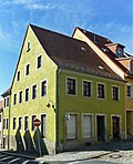 |
House in a corner | Mittelstrasse 4 (map) |
1st half of the 19th century | Significant in terms of building history and urban development |
09285335 |
| Residential building in closed development | Mittelstrasse 4 (near) (map) |
2nd half of the 18th century | In terms of building history, according to ALK data and the verbal testimony of a resident, this building belongs to Mittelstrasse 4, until April 2008 erroneously recorded under Pirnaer Str. 6 |
09285116 |
|
 |
Residential house in closed development, with right wing and transverse building | Mittelstrasse 6 (map) |
1st half of the 19th century | Significant in terms of building history and urban development. House freestanding to the left by demolishing the neighboring building. Original front door. |
09285120 |
 |
Apartment building in closed development, with right wing and courtyard building | Mittelstrasse 7 (map) |
1880-1890 | Significant in terms of building history and urban development. First and second floor clinker brick with sandstone structure elements, third floor newly added, building very narrow and high. Right wing and courtyard building painted as monuments because of insufficient historical value and not justifiable with regard to public interest in preservation. |
09285121 |
 |
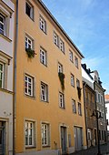
Residential building in closed development | Mittelstrasse 9 (map) |
Around 1850 | Significant in terms of building history and urban development. Original shop and front door. |
09285123 |
 |
Residential building in closed development | Mittelstrasse 10 (map) |
18th century | Architecturally important. Shop with original front with grille and stucco on the ceiling. Courtyard building with a crooked hip roof. Original front door on the front building. Front building long cellar corridors, 18th century, demolition permit for outbuildings and sheds granted in 2003. |
09285252 |
 |
Residential building in closed development | Mittelstrasse 11 (map) |
1st half of the 19th century, core older | Architecturally important |
09285253 |
 |
Mittelmühle (formerly); Residential mill building, barn, weir and villa of a former mill estate | Mühlstrasse 1 (map) |
Around 1850 | Significance in terms of local history and the local image. Residential mill building (flour mill) simple two-storey structure with authentic cubature and proportions, arched windows with tulip sprouts in the gable, back mill ditch, ruinous water wheel and ruinous ground floor walls of the former cutting mill, plant placed at the confluence of Schwarze Röder in Große Röder, there weir preserved, villa as a building with high Degree of originality preserved, outer skin simple compared to other buildings from the same period of origin, structure through raised plastered pilaster strips, rusticated plinth, differentiated window arrangement, original interior with wooden wall cladding, colored leaded glass windows, interior doors with polished glass fields and partially preserved box locks. In recent years it has been used as a physiotherapeutic practice, therefore several dry walls have been installed, but the original room structure has not been fundamentally changed. |
09285142 |
 |
Villa with villa garden with a fountain and 2 courtyard entrance pillars | Mühlstrasse 8 (map) |
Around 1900 | Architecturally important. Villa with nooks and crannies with various towers, upper floor half-timbered, fountain (sandstone) and two courtyard entrance pillars (sandstone) with vase attachments and fighter plates. |
09285332 |
 |
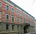
Apartment building in closed development | Mühlstrasse 19 (map) |
Around 1900 | Architecturally important, first and second floor clinker brick, original courtyard gate |
09285330 |
 |
Apartment building in closed development | Mühlstrasse 20 (map) |
Around 1900 | Structurally important, first and second floor clinker brick, ground floor sandstone, plastered, balcony with figurative. Jewelry on console, original courtyard gate |
09285329 |
 |
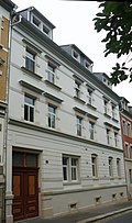
Apartment building in closed development | Mühlstrasse 21 (map) |
Around 1900 | Clinker brick, important in terms of building history |
09285022 |
 |
Apartment building with shop in closed development | Mühlstrasse 22 (map) |
Around 1910 | Architecturally important, first floor plaster scratches, protruding profiled main cornice, original front door |
09285328 |
 |
Apartment building in closed development | Mühlstrasse 23 (map) |
Around 1900 | Architecturally important, first and second floor clinker brick, sandstone walls |
09285327 |
 |
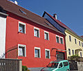
Apartment building in closed development | Mühlstrasse 24 (map) |
Around 1900 | From an architectural point of view, the first and second floors are clinker brick |
09285326 |
 |
Residential building in closed development | Niedergraben 6 (map) |
Around 1820 | Architecturally important, gate passage, petty-bourgeois defaced facade (smooth) |
09285208 |
 |
Residential building in closed development | Niedergraben 7 (map) |
Around 1820 | Architecturally important. Facade defaced in a petit bourgeois manner. |
09285207 |
 |
Residential building in closed development | Niedergraben 11 (map) |
Marked 1819 | Architecturally important. House small and simple. Name in the portal. |
09285019 |
 |
Residential building in closed development | Niedergraben 12 (map) |
Around 1820 | Architecturally important. House small and simple. |
09285020 |
 |
Residential building in closed development | Niedergraben 16 (map) |
Around 1820 | Architecturally important. House small and simple. Clinker brick dividing elements. Original front door. |
09285023 |
 |
Residential building in closed development | Niederstrasse 1 (map) |
Around 1830 | Architecturally important |
09285160 |
| Apartment building in closed development | Niederstrasse 3 (map) |
1890s | Architecturally important. First and second floor clinker brick with sandstone structure elements. Original windows and door. |
09285162 |
|
| Apartment building in closed development | Niederstrasse 4 (map) |
1890s | Significant in terms of building history and urban development, cf. Number 3 |
09285163 |
|
 |
Apartment house in a corner | Niederstrasse 7 (map) |
Around 1880 | Of importance in terms of urban planning and the appearance of the streets. Upper floor clinker with sandstone structure elements. Original windows and door. |
09285168 |
| Apartment building in a closed development with a shop in the corner of the main street | Obergraben 1 (map) |
Around 1907 |
|
||
| Apartment house in a corner | Obergraben 2 (map) |
Around 1907 | Significant in terms of building history and urban development. House blows the proportions of the lower, older street. Pulled up above the eaves corner and faced with slate. Original windows and front door, erroneously number 1 in the list of monuments until November 2008. |
09285051 |
|
 |
Residential building with shop in closed development | Obergraben 3 (map) |
Around 1890 | Significant in terms of building history and urban development. Clinker brick, partly glazed black and dark blue. With four putti heads. Original windows and door. Shop with original front. |
09285052 |
 |
Residential building in closed development | Obergraben 4 (map) |
Around 1820 | Significant in terms of building history and urban development. Original windows. |
09285053 |
 |
Residential building in closed development | Obergraben 5 (map) |
Around 1820 | Significant in terms of building history and urban development |
09285054 |
| Remnants of the city wall | Obergraben 5, 7, 9 (opposite) (map) |
18th century | Especially opposite Obergraben 5, 7, 9; of importance in terms of urban development and local history |
09285173 |
|
 |
Residential building | Obergraben 10 (map) |
Around 1820 | Significant in terms of building history and urban development |
09285039 |
 |
Wall along the upper ditch from house number 12 to the entrance to the church square | Obergraben 12 (from No. 12 to the Kirchplatz access road) (map) |
18th century | Significant for the streetscape |
09285044 |
 |
Residential building | Obergraben 14 (map) |
Around 1820 | Significant in terms of building history and urban development |
09285040 |
 |
Residential building | Obergraben 16 (map) |
Around 1820 | Significant in terms of building history and urban development |
09285037 |
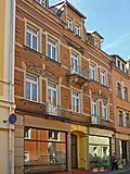 |
Apartment building in closed development | Oberstrasse 1 (map) |
Around 1900 | Significant in terms of building history and urban development. Clinker construction. Stucco in throat in the entrance area, ceiling painting painted over. On the first and second floor balconies, on the second floor balcony in the center of the facade with Art Nouveau grilles. |
09285085 |
 |
Apartment building in closed development | Oberstrasse 2 (map) |
Marked with 1901 | Significant in terms of building history and urban development. Clinker brick on the upper floors. Middle gable (Zwerchgiebel). Shops with the original front. |
09285084 |
 |
Rural residential building with courtyard passage and cellar with large barrel (field stone) in closed development, at right angles courtyard wing and barn (field stone) with extension (brick) | Oberstrasse 14 (map) |
1711 (according to information) | Architecturally important, residential building with baroque door, window shutters and fittings, barn covered with double beavers |
09285533 |
 |
House in a corner with a sloping corner | Oberstrasse 16a (map) |
Around 1890 | Historic plastered building with a sloping corner, of importance in terms of building history and urban planning. Two side gables, sandstone walls and gables, original front door. |
09285532 |
 |
Residential building with shop in closed development | Oberstrasse 21 (map) |
18th century | From an architectural point of view of importance, certainly later increased, basket arch portal |
09285540 |
| Rural house in closed development | Oberstrasse 22 (map) |
18th century | Architecturally important, the facade plastered over (including the bezels), profiled main cornice |
09285539 |
|
 |
Residential house in semi-open development | Oberstrasse 30 (map) |
Marked 1823 | Architecturally important. Previously used as a city prison. |
09285169 |
 |
Residential house in closed development with side wing | Oberstrasse 31 (map) |
Around 1850 | From an architectural point of view, the side wing extends far into the depth of the property |
09285170 |
| Residential house in open development with fencing | Otto-Bauer-Strasse 3 (map) |
1890s | Architecturally important. First floor clinker brick, with balcony, sandstone elements, side elevation, roof house. |
09285544 |
|
| Residential house with tower in open development with enclosure | Otto-Bauer-Strasse 5 (map) |
Around 1900 | Architecturally important, wooden loggias, sandstone elements |
09285547 |
|
| Residential house in open development, with enclosure | Otto-Bauer-Strasse 6 (map) |
Around 1890 | Architecturally important, clinker cladding arches over windows, central projections, stucco decorations, roof overhang |
09285543 |
|
| Residential house in open development with fencing and a sandstone pillar of the courtyard entrance | Otto-Bauer-Strasse 8 (map) |
Around 1900 | Architecturally important, with wooden loggias, side elevation |
09285545 |
|
 |
Tenement house with restaurant in closed development | Otto-Uhlig-Strasse 1 (map) |
1890s | Architecturally important. Upper floors of yellow clinker. Sandstone elements. Original front door and window. Stucco in the entrance area. |
09285209 |
 |
Apartment building in closed development | Otto-Uhlig-Strasse 3 (map) |
1890s | Structurally important, see number 11 |
09285554 |
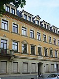 |
Apartment building with shop in closed development | Otto-Uhlig-Strasse 5 (map) |
1890s | Architecturally significant, see number 11, with balconies |
09285553 |
 |
Apartment building in closed development | Otto-Uhlig-Strasse 7 (map) |
1890s | Structurally important, see number 11 |
09285552 |
 |
Apartment building in closed development | Otto-Uhlig-Strasse 9 (map) |
1890s | Structurally important, see number 11 |
09285551 |
 |
Apartment building with shop in closed development | Otto-Uhlig-Strasse 11 (map) |
1890s | Architecturally important, sandstone walls, original doors, roof houses |
09285550 |
 |
Apartment building in half-open development | Otto-Uhlig-Strasse 13 (map) |
1890s | Architecturally important. Tenement: First and second floor clinker brick, sandstone walls with window coverings, side elevation with balconies and pilasters. Rear building (number 13) deleted, adjoining building in itself is not a monument, former sculpture / stonemasonry has already been converted on the front side (formerly large shop windows can only be recognized by the framing), segment-arched gable top is missing, at the back three axes on the long side are to be excluded anyway they are an afterthought. |
09285549 |
 |
Pestalozzi School (former boys' school) with two side wings | Pestalozzistraße 1 (map) |
1896 | Structurally and locally of importance. Yellow clinker building, central projection on the 2nd floor, windows with stucco ornamental bezels, strongly profiled cranked main cornice. |
09285320 |
 |
Apartment building in development closed to the left | Pestalozzistraße 2 (map) |
Around 1900 | Structurally important, first and second floor clinker brick, third floor subsequently added. First floor window coverings, figural and ornamental decorations, original front door |
09285321 |
 |
Apartment building in closed development | Pestalozzistraße 4 (map) |
Marked 1899 | Structurally important, first and second floor clinker brick, side elevation with balcony, ceiling picture in the entrance |
09285322 |
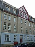 |
Apartment building in closed development | Pestalozzistraße 6 (map) |
Around 1900 | Architecturally important, first and second floors clinker-white facing bricks, gable with ornamental framework, blue ornamental tiles |
09285323 |
 |
Apartment building in closed development | Pestalozzistraße 8 (map) |
Around 1900 | Architecturally important, first and second floor clinker brick, white facing brick |
09285324 |
 |
Apartment building in closed development, rounded facade | Pestalozzistraße 10 (map) |
Around 1900 | Architecturally important, first and second floor clinker / white facing brick |
09285325 |
| Tenement house with shop in a corner | Pillnitzer Strasse 2 (map) |
Marked with 1901 | Architecturally important, corner bay with colored lead glass windows |
09285461 |
|
| Apartment building in closed development | Pillnitzer Strasse 4 (map) |
Around 1890 | Architecturally important |
09285460 |
|
| Apartment building in closed development | Pillnitzer Strasse 6 (map) |
Around 1890 | Architecturally important |
09285459 |
|
| Former hut building of the Wilhelm Hilsch and Bedrich glassworks | Pillnitzer Strasse 7 (behind) (map) |
Founded in 1880 | Significant in local history |
09285435 |
|
 |
Villa with enclosure | Pillnitzer Strasse 14 (map) |
Around 1870 | Architecturally important |
09285466 |
 More pictures |
Stork's Nest Villa ; Former manufacturer's villa of the glassworks (now a home for the deaf and blind) and side building (with apartments and coach houses) | Pillnitzer Strasse 71 (map) |
Around 1910 | Architectural and local historical significance. Villa: maternity home in GDR times. Side building: Rectangular building with rusticated basement, wooden planking on the upper floor on the front side (street-side gable wall and part of the street-side eaves wall and part of the eaves wall facing the courtyard), on the ground floor front part garages with originally preserved wooden gates. Both buildings have been preserved to a large extent authentically with design features typical of the time, created at the same time as a single property. |
09285467 |
 |
Residential building in closed development | Pirnaer Strasse 1 (map) |
Around 1740 | Architecturally significant, massive two-storey building with a gable roof, with largely unchanged cubature and proportions, disruption from the ground floor shop installation, original courtyard gate, original wooden stairs inside and wooden stairs to the attic, interesting roof structure from the time of construction, still impressively deep original cellar (three elongated barrel vaults) , according to ALK data, the side building in the courtyard demolished, the courtyard wing still in place is not relevant to the monument |
09285119 |
 |
Apartment building in closed development | Pirnaer Strasse 3 (map) |
1890s | Architecturally important. House freestanding to the right by demolishing the neighboring building. Clinker brick with sandstone elements on the first and second floors. Roof extensions with gables. Back building demolished in 1998. |
09285118 |
| House with shop (only part of the building on Pirnaer Straße) in a corner | Pirnaer Strasse 6 (Mittelstrasse 3) (map) |
Around 1830 (residential building); around 1900 (shop front) | Significant in terms of building history and urban development. Small inner courtyard and adjoining parts of the building have been preserved almost authentically. Corner house with crooked hip and ground floor shop (shop front around 1900), part of the building on Mittelstrasse (number 3) with ground floor shop, no monument, deleted after viewing the property in March 2011, not worth a monument. Eckhaus was listed under Mittelstrasse 3 in the list of monuments until April 2008. |
09285094 |
|
 |
Residential house in closed development with courtyard wing | Pirnaer Strasse 8 (map) |
Around 1800 | Architecturally important. House freestanding to the left by demolishing the neighboring building. |
09285113 |
| Barn in the yard (ruinous) | Pirnaer Strasse 15 (map) |
Early 19th century to 1840 | Architecturally important. Barn is currently being refurbished in accordance with listed building regulations. Removal of the residential building as a monument, public interest in preservation cannot be justified, demolition permit granted in 2004. |
09285112 |
|
 |
Residential house in closed development with side wings | Pirnaer Strasse 17 (map) |
Around 1850 | Architecturally important |
09285124 |
 |
Residential house with shop with rear annex and right wing | Pirnaer Strasse 21 (map) |
2nd quarter of the 19th century | Architecturally important, original front door, wooden beam ceiling, commercial use in the side wing |
09285109 |
 |
House in corner with courtyard building | Pirnaer Strasse 23 (map) |
Around 1850 | Architecturally important |
09285108 |
 |
Residential building | Pirnaer Strasse 24 (map) |
Around 1750 | From an architectural point of view, the gable is boarded up |
09285135 |
 |
House in a corner | Pirnaer Strasse 25 (map) |
Inscribed with 1802 | Architecturally important. Half-hip roof with roof extensions. Inscribed in the keystone, on it lamb with flag. |
09285129 |
| Residential building in closed development | Pirnaer Strasse 27 (map) |
Marked with 1901 | Former inn, of local history. Original courtyard gate. Building in the keystone marked 1901, courtyard wing painted as a monument in 2005. |
09285130 |
|
 |
Residential house in semi-open development | Pirnaer Strasse 29 (map) |
Before 1800 | Architecturally important |
09285131 |
 |
Residential house in semi-open development | Pirnaer Strasse 31 (map) |
Marked 1774 | Significant in terms of building history and urban development. Construction marked on the keystone. |
09285134 |
 |
Residential building in closed development | Pirnaer Strasse 35 (map) |
Around 1850 | Architecturally important. Original courtyard gate. |
09285137 |
 |
Residential building in closed development | Pirnaer Strasse 37 (map) |
2nd quarter of the 19th century | Architecturally important. Original front door. |
09285138 |
 More pictures |
Memorial to the fallen of World War I as a designed complex with metal name boards and a large stone sculpture | Pulsnitzer Strasse (in front of the churchyard) (map) |
1927 | Significant in local history |
09285916 |
 More pictures |
Memorial to the victims of fascism , with two soldiers' graves and a park | Pulsnitzer Strasse (corner of Otto-Uhlig-Strasse) (map) |
1945 | Burial place for forced laborers from 12 countries, including 30 Soviet citizens, of local historical importance. Previously erroneously recorded under Otto-Uhlig-Straße, main entrance to the memorial from Pulsnitzer Straße. |
09285141 |
 |
Villa with extension | Pulsnitzer Strasse 2a (map) |
1870/1880; Extension in the 1920s | Of architectural significance, today kindergarten |
09285231 |
 |
Apartment building in half-open development | Pulsnitzer Strasse 3 (map) |
1890s | Significant in terms of building history and the appearance of the street. House takes on kink in the street. At the kink, semicircular balconies with beautiful bars. Upper storeys clinker. Original windows, original courtyard passage. |
09285197 |
 |
Apartment building in closed development | Pulsnitzer Strasse 5 (map) |
1890s | Architecturally important. House with kink, takes up street. Kink is caught in the corner bay. Upper storeys clinker. Original windows. Courtyard passage. In the hallway stucco and a crest cartouche. |
09285196 |
 |
Apartment building in closed development | Pulsnitzer Strasse 7 (map) |
1890s | Architecturally important. Upper storeys clinker. Original windows and courtyard passage. Entrance area stucco in the throat. |
09285194 |
 |
Parish hall with hall | Pulsnitzer Strasse 8 (map) |
Marked 1926 | Architecturally and locally of importance, inscribed on the inscription panel, architect Ulbricht Richter |
09285036 |
 |
Apartment building in closed development | Pulsnitzer Strasse 9 (map) |
1890s | Architecturally important. Red clinker on the upper floors. Original windows, stucco in the entrance area. |
09285193 |
| Remnants of the city wall behind the specified properties | Pulsnitzer Strasse 10, 12, 14, 16, 18, 20 (map) |
Probably 15th century | From a local history point of view, remains of the city wall behind the stated properties |
09285255 |
|
 |
Residential building in closed development | Pulsnitzer Strasse 11 (map) |
1920s | Architecturally important. Original courtyard door, original windows. |
09285192 |
 |
Apartment building in closed development | Pulsnitzer Strasse 13 (map) |
1890s | Architecturally important. Red clinker brick on the upper floors. Smoothed ground floor. Sandstone elements. Original courtyard door and original windows. |
09285191 |
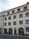 |
Four houses in a row and in closed development | Pulsnitzer Strasse 14, 16, 18, 20 (map) |
1920s | Significant in terms of building history and the appearance of the street. Residential complex very similar to numbers 10 and 12: facades and portals (drawn forward like a box) have the same design. Staircases to the front, vertical ribbon of windows, wheel windows above. Original windows, almost square. Above the main cornice there is a fully developed attic. |
09285081 |
 |
Apartment building in closed development | Pulsnitzer Strasse 15 (map) |
1890s | Architecturally important. Red clinker brick on the upper floors. Sandstone elements. Original courtyard door and original windows. |
09285190 |
 |
Apartment building in closed development | Pulsnitzer Strasse 17 (map) |
1890s | Architecturally important. Yellow clinker bricks on the upper floors. Sandstone elements. Original door and window. Stucco in the entrance area. |
09285189 |
 |
Residential and commercial building in a corner | Pulsnitzer Strasse 22, 22a (map) |
1920s | Significant in terms of building history and the appearance of the street. Shop (or restaurant) on the ground floor. Original skylight grilles. Original courtyard gate. |
09285083 |
| Apartment building in closed development | Pulsnitzer Strasse 26 (map) |
Before 1900 | Architecturally important. Clinker brick facade on the first and second floors. Stucco in the entrance area. |
09285251 |
|
 |
Apartment building in closed development | Pulsnitzer Strasse 28 (map) |
Before 1900 | Architecturally important. Original interior version. Stucco in the entrance area, original doors, etched windows. Clinker brick on the first and second floors. |
09285250 |
 |
Apartment building in closed development | Pulsnitzer Strasse 34 (map) |
1890s | Architecturally important. Yellow clinker brick building with brown clinker brick decorations, some original windows, sandstone walls. Stucco in the entrance area, beautiful grooved staircase window. |
09285175 |
 |
Apartment house in closed development in a corner | Pulsnitzer Strasse 36 (map) |
1890s | Architecturally important. Yellow clinker brick building with brown clinker brick decorations, some original windows with sandstone walls. Corner store with the original front. Stucco in the entrance area, beautiful grooved staircase window. |
09285176 |
 |
Residential building in closed development | Pulsnitzer Strasse 40 (map) |
1920s | Architecturally important. Art Deco elements on the house, triangular gable, two bay windows above the first to third floors. Original windows with bars. Original home furnishings. Front door with cut glasses. Back building with commercial use, formerly a cabinet maker. Removal of the rear building in 2016: The property inspection showed that no public interest in preservation can be justified because it has been largely gutted and there is no significant historical information available with regard to the external appearance. |
09285178 |
 |
Residential house in open development | Pulsnitzer Strasse 45 (map) |
Around 1860 | Architecturally important, sandstone walls, natural stone wall enclosure with wooden picket fence |
09285525 |
 More pictures |
Gym with living area and memorial stone for the fallen of the First World War | Pulsnitzer Strasse 46 (map) |
Around 1905 | Significant in social history, curved central gable |
09285526 |
| Stadtgut; Residential house in open development and administrative building of the former slaughterhouse | Pulsnitzer Strasse 47 (Bruno-Thum-Strasse 2) (map) |
Marked 1897 | Of local and architectural importance, administration building (Bruno-Thum-Straße 2): sandstone walls and lunettes. Stable building with a terracotta head of a bull (demolition). |
09285524 |
|
 |
City Hospital Radeberg Dr. Paul Kirchner; Asklepios - ASB Clinic Radeberg; Villa (marked in the portal) without extension | Pulsnitzer Strasse 60 (map) |
Marked with 1904/1905 | Architecturally important, elaborate portal, interior fittings (banisters, colored window glass, doors) |
09285528 |
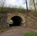 |
Tunnel under the railway embankment | Quantzweg (formerly Am Heiderand) (map) |
1845 | Of importance in terms of railway history and building history. Railway overpass from the construction time of the Görlitz-Dresden railway line from 1845 (construction of the section between Dresden and Radeberg from May 1844 to November 1845, completion of the entire line in 1847 - route abbreviation GD, route number 6212), overpass structure is at route kilometer 86.698, vault construction from rubble / Sandstone masonry with a protruding row of stones along the fighting line, length 11.6 m, height 10.7 m, portals with side wing walls (tunnel-like structure through the railway embankment, but to be classified as an overpass or bridge structure due to its length). |
09285446 |
 More pictures |
Kuranlage Augustusbad (totality); so-called Schwabesche Foundation | Radeberger Strasse 3 (map) |
1719 (construction); Beginning of the 19th century (Radeberger Haus); around 1880 (Luisenhof, main building); around 1880 (restoration building, gallery building); around 1880 (farm building); 2nd half of the 19th century (spa gardens); late 19th century, early 20th century (renovation of the spa gardens) | Consolidation of the Augustusbad spa complex with the so-called Schweizerhaus (later the Dr. Stünz maternity clinic), Kurpalais (so-called Palais-Hotel and Wirtschaftshaus), stable building, so-called coffee house, spa house (consisting of several building parts: bath house, mud bath house, manor house, garden house, Dresden house, spa house), so-called Hermitage and Swan Pond (individual monuments - Obj. 09275331, same address), the Kurpark (garden monument) as well as the so-called Radeberger Haus, the restoration and gallery building, the so-called Luisenhof and the farm building for the Kurpalais (material parts); Structural, local and socio-historical significance.
|
09275337 |
| So-called Schweizerhaus, later the Dr. Stünz (individual monument to ID no.09275337) | Radeberger Strasse 3 (map) |
1880s | Individual monument of the whole Kuranlage Augustusbad ; Architectural and local history as well as social history, building in the Swiss house style, formerly all plaster ashlar, broad structure, roof overhang, jamb floor, arched entrance |
09275331 |
|
| Kurpalais (so-called Palais-Hotel and Wirtschaftshaus) (individual monument to ID-Nr. 09275337) | Radeberger Strasse 3 (map) |
1808 | Individual monument of the whole Kuranlage Augustusbad ; Building and local history as well as social history significance. Kurhaus as a once representative building with an accentuated center, with an enclosed garden room, with an extension with a sun terrace, ruinous (1808, conversion and extension at the end of the 19th century) |
09275331 |
|
| Former stable building (individual monument for ID No. 09275337) | Radeberger Strasse 3 (map) |
Around 1880 | Individual monument of the whole Kuranlage Augustusbad ; Building and local history as well as social history importance, (right part) simple plastered construction, roof overhang, sandstone walls |
09275331 |
|
| So-called coffee house (individual monument to ID no.09275337) | Radeberger Strasse 3 (map) |
1783 | Individual monument of the whole Kuranlage Augustusbad ; Building and local history as well as social history importance, two upper floors half-timbered, plastered and hipped roof, classicist building (formerly known as the so-called manor house of Count Wallwitz) |
09275331 |
|
 |
Spa house, consisting of bath house, mud bath house, manor house, garden house, Dresden house and spa house (individual monument for ID no. 09275337) | Radeberger Strasse 3 (map) |
1808 (Kurhaus); 1851 (bath house); marked 1873 (Dresdner Haus) | Individual monument of the whole Kuranlage Augustusbad ; Building and local history as well as social history significance. Coherent structure, consisting of several individual parts of the building, lavishly decorated in part with blue wall tiles on the exterior, sandstone plinth, ornamental framework on the upper floor and the gables, sandstone columns set in windows, roof overhangs. Bathhouse built in 1851 by Dr. med. Klose, two building wings at an angle. |
09275331 |
| Hermitage and Swan Pond (individual monument for ID No. 09275337) | Radeberger Strasse 3 (map) |
Around 1870 | Individual features of the totality Kuranlage Augustusbad ; Building and local history as well as social history significance. Hermitage in the Swiss house style, ruinous. Swan pond with brick drain, underground collapsed canal, possibly related to swan pond. |
09275331 |
|
| Apartment building in closed development and corner location | Rathenaustraße 1 (map) |
1890s | Clinker brick facade, of architectural and urban significance, central projectile, sandstone walls |
09285477 |
|
| Apartment building in closed development | Rathenaustraße 3 (map) |
1890s | Clinker brick facade, of architectural and urban importance, central gable, inscribed 189? |
09285478 |
|
| Apartment building with courtyard entrance in closed development | Rathenaustraße 5 (map) |
1890s | Clinker brick facade, of architectural and urban importance, curved central gable, entrance area with stucco in the throat |
09285479 |
|
| Apartment building in closed development | Rathenaustraße 7 (map) |
1890s | Clinker brick facade, historically and urbanistically important, central gable |
09285480 |
|
| Former inn "Zum Pillnitzer Hof" | Rathenaustraße 11 (map) |
1890s | Clinker brick, of local historical importance, central gable and balconies on the central projection, sandstone walls and structural elements |
09285481 |
|
| Apartment building in closed development | Rathenaustraße 13 (map) |
1890s | Clinker brick facade, historically and urbanistically important, central gable |
09285482 |
|
| Apartment building in half-open development | Rathenaustraße 15 (map) |
1890s | Historic building with broken corner, clinker plaster facade, of architectural and urban significance, sandstone walls and structures |
09285483 |
|
| Apartment building in half-open development | Rathenaustraße 17 (map) |
1890s | Historic building with broken corner, clinker plaster facade, of architectural and urban significance, see number 15, ground floor and beveled corner plastered |
09285484 |
|
 |
Apartment building in closed development | Rathenaustraße 33 (map) |
Late 19th century | Architecturally important, clinker brick on the upper floor |
09285434 |
| kindergarten | Robert-Blum-Weg 1 (map) |
1950s | Structurally and socially important |
09285456 |
|
 |
Apartment building in closed development and corner location | Röderstrasse 1 (map) |
Opened in 1898 | Significant in terms of building history and the appearance of the street. Clinker brick building with corner tower and corner balconies on the first and second floors. Shops with the original front. Former restaurant "Zur Deutschen Eiche". |
09285057 |
 |
Apartment building in open development | Röderstrasse 5 (map) |
1880s | Significant in terms of building history and the appearance of the street. Building with a representative corner bay window at the staircase to Freudenberg. Bay window with lead glazing. Original front door. Stucco in the throat in the entrance area. Shops with the original front. |
09285146 |
 More pictures |
Stairway to Freudenberg | Röderstrasse 5 (next to) (Am Freudenberg) (map) |
1912 | Significant in terms of building history and the appearance of the street, stairs lead from Röderstraße to the school on Freudenberg |
09285147 |
 |
Apartment building in open development with courtyard passage | Röderstrasse 6 (map) |
Marked with 1907 | Architecturally important. Middle bay with Art Nouveau ornamentation. Lead-glazed windows. Original door. |
09285225 |
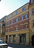 |
Apartment building in closed development with a right-angled side wing and courtyard passage (original design) | Röderstrasse 8 (map) |
Before 1900 | Architecturally important. First and second floor clinker brick. Third floor increased. Ceiling painting (stencil) in the gate passage, courtyard wing originally under protection, painted due to lack of monument properties. |
09285224 |
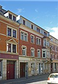 |
Apartment building in closed development | Röderstrasse 10 (map) |
Before 1900 | Architecturally important. First and second floor clinker brick, corner bay window. |
09285223 |
 |
Apartment house in closed development with two shops and a courtyard passage | Röderstrasse 12 (map) |
Before 1900 | Architecturally important. Clinker brick on the first and second floors. Originally preserved gate in passage. |
09285222 |
 |
Apartment building in closed development and gate passage | Röderstrasse 14 (map) |
Before 1900 | Architecturally important. Clinker brick on the first and second floors. Plaster grooves on the ground floor, middle bay above the first and second floors. |
09285221 |
 |
Residential house in open development | Röderstrasse 15 (map) |
1850-1860 | Architecturally important. Original courtyard gate. Representative window roofing on the first floor. Facade with central gable. Shops with original fronts. |
09285145 |
 |
Apartment building in closed development | Röderstrasse 16 (map) |
Before 1900 | Architecturally important, clinker brick on the first and second floors |
09285220 |
 |
Apartment building in closed development | Röderstrasse 18 (map) |
Before 1900 | Architecturally important. First and second floor clinker brick. |
09285219 |
 |
Apartment building in closed development, with extension | Röderstrasse 20 (map) |
Before 1900 | Architecturally important. Third floor subsequently increased. First and second floor clinker brick. Ground floor plaster grooves. |
09285218 |
 |
Apartment building in half-open development | Rumpeltstrasse 1 (map) |
Around 1910 | Architecturally important, entrance with console, plaster decoration and figures, round gable on the corner of Bahnhofstrasse |
09285487 |
| Semi-detached house with a neo-classical external appearance | Schillerstraße 2, 4 (map) |
Around 1910 | Architecturally significant, free-standing three-storey symmetrical building with a central projection, this with a triangular gable and a special design on the third floor through column positions (pilaster strips in the form of channeled columns with Ionic capitals), otherwise different plaster grooves as design elements, original cubature and proportions, windows on the ground floor in round-arched depressions, also inside authentically preserved stairwells with original, well-preserved apartment doors |
09285462 |
|
| Rental villa | Schillerstraße 3 (map) |
Around 1900 | With elaborate facade design, historically and artistically important, wooden verandas, colored glass, original windows, large gables, ornamental framework, corner turrets, stucco decorations, sandstone walls |
09285457 |
|
| Former “Schillergarten” inn in a corner | Schillerstraße 37 (map) |
Around 1920 | In terms of local history, plaster profiles, ground floor shutters, was originally in the database under Heidestrasse 2 |
09285453 |
|
 More pictures |
Large dog stable bridge ; Single-arch sandstone bridge over the Röder | Schlossstrasse (map) |
Marked 1781 | With a walled parapet, stepped on the side and the year in the keystone, of importance in terms of building history and landscape, defaced at the time of recording, fundamentally renovated from 1999, bridge structure with largely authentic appearance, important function for the townscape in the immediate vicinity of Klippenstein Castle and at the entrance to Hüttertal |
09285517 |
 |
Rural house in open development | Schlossstrasse 1 (map) |
1st half of the 18th century | Architecturally important |
09285156 |
 More pictures |
Klippenstein Castle with outer bailey, owl tower, castle wall, two water troughs made of sandstone and moat as well as castle garden (garden monument) | Schloßstraße 6 (map) |
Around 1200, first documented mention in 1289 (part of the castle); 1st half of the 16th century (outer bailey); from 1200 (water element); 1543–1546 (expansion of the castle into a hunting lodge) | Architecturally, historically and locally of importance, two-storey three-wing complex on a high substructure around an acute-angled inner courtyard, main facade south to the large Röder with the prince's staircase and Renaissance portal, outer bailey closes around the city-side wing, to Schloßstraße passage with half-timbered upper floor, from the medieval castle complex still ruins of the Owl Tower East side preserved |
09285516 |
| Residential stable house, barn and retaining wall | Schlossstrasse 7 (map) |
Marked with 1906 (stable house); marked 1933 (barn) | Architecturally important, both buildings stately, barn marked on the weather vane |
09285520 |
|
 |
Castle mill ; Barn, mill building and mill moat with weir | Schlossstrasse 8 (map) |
18th / early 19th century | Located in the Hüttertal, of technical, architectural and local significance. Mill building in the gable half-timbered, ground floor bricked, barn half-timbered.
|
09285519 |
 |
Rural house in open development | Schlossstrasse 9 (map) |
Early 19th century | Architecturally important, original windows and doors |
09285148 |
 |
Residential house in open development with left side wing | Schlossstrasse 10 (map) |
Before 1850 | Belonging to the first factory building, important in terms of building history and shaping the street scene. Central gable. Original windows and door. |
09285149 |
 |
Façade on the north gable side and the façade on the western eaves side as remains of a former residential building in closed development | Schlossstrasse 11 (map) |
1st half of the 18th century | Significance in terms of building history and urban development history, shaping the streetscape. Most of the building has been demolished, the facade facing Schloßstraße and the facade facing Wasserstraße have been preserved, remnants of the historical buildings after the fire of 1741 are located in the immediate vicinity of Klippenstein Castle, therefore of great importance to the townscape. |
09285195 |
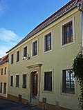 |
Façade of the western eaves side as the remains of a former residential building in closed development | Schlossstrasse 12 (map) |
Mid 18th century | Significance in terms of building history and urban development history, shaping the streetscape. Building demolished except for the facade, these are the remainder of the historical development of the street after the city fire of 1741 in the immediate vicinity of Klippenstein Castle, therefore of indispensable value for defining the street scene. |
09285157 |
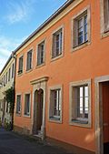 |
Façade on the western eaves side as the remainder of a single-storey residential building in a closed development | Schloßstraße 13 (map) |
Marked 1747 | Significance in terms of building history and urban development history, shaping the streetscape. The building has been demolished except for the facade, which is the remnant of the historical development of the street after the city fire of 1741 in the immediate vicinity of Klippenstein Castle, therefore of indispensable, street-defining value, marked in the keystone. |
09285158 |
 |
Residential house in closed development and corner location | Schloßstraße 14 (map) |
Mid 18th century | Architecturally important, corner house on Niederstrasse, original door |
09285159 |
 |
Langbeinscher garden with summer house; Pleasure garden, in it a classicist garden house, small staircase and quarry stone wall along the way and barn outside the enclosure | Schloßstraße 16 (map) |
18th century (barn and stone wall); 1st half of the 19th century (garden house); Lustgarten laid out in 1763 | Architecturally, landscape-shaping and local history of importance, pleasure garden laid out in 1763 by judicial officer Ludwig Langbein, small staircase with two sandstone pillars and spherical attachments, barn upper floor half-timbered |
09285518 |
 |
House Rödertal (formerly); So-called bone punch; Residential house in the Swiss house style | Schlossstrasse 20 (map) |
Marked 1860 | Architecturally important. Built by Missbach, the owner of the Hüttermühle, with a mezzanine with double arched windows. Cancellation of the bridge in 2013: after structural changes, the monument value is no longer sufficient. |
09285334 |
 |
Hüttermühle (front part including half-timbered part), mill ditch with weir, mill wheel and two pillars with spherical attachments | Schlossstrasse 21 (map) |
2nd half of the 19th century | One of several mills in the Hüttertal along the Große Röder, an inn and popular excursion destination since 1870, of local significance, without a rear annex, pillars (bricked or sandstone) plastered |
09285522 |
| Single arch bridge | Schloßstraße 21 (before) (map) |
Marked 1761 | Access bridge to the Hüttermühle, important in terms of building history and landscape. Sandstone and granite, concrete over the arch, retrofitted iron railing, not listed. |
09285521 |
|
| Factory owner's villa of a glass factory with entrance house, fencing and connecting passage to the house | Schönfelder Strasse 1 (map) |
1910s | Structurally and historically important, original arched windows |
09285451 |
|
 |
primary school | Schulstrasse 1 (map) |
1876/1877 | Formerly a girls' school, of architectural and local significance, plastered building with sandstone architectural elements. Wing extension at Niedergraben 1907, school was listed under number 1 in the list of monuments until February 2008, according to ALK data this building has number 2 |
09285001 |
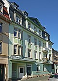 |
Apartment building in closed development, with shop and boundary wall with built-in coach house and transformer house | Schulstrasse 3 | Around 1908 | Significant in terms of building history and urban development, demolition permit for ancillary building granted in 2003, building was previously listed under number 3 in the list of monuments, according to ALK data this building has number 1, the ancillary building has been demolished, boundary wall along the right-hand property line. |
09285002 |
| Villa with enclosure | Sonnenweg 2 (formerly Sommerweg 2) (map) |
Late 19th century | Architecturally important, clinker base and clinker top, sandstone walls, lavishly designed central window with plastic jewelry |
09285263 |
|
| Herzog's restaurant; Residential house in open development | Steinstrasse 1 (map) |
Late 19th century | Architecturally important, clinker cladding above ground floor windows, roof overhang |
09285495 |
|
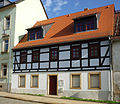 |
Residential building in closed development | Stolpener Strasse 3 (map) |
1st half of the 19th century | Half-timbered structure, of importance in terms of building history |
09285217 |
 |
Residential building in closed development | Stolpener Strasse 5 (map) |
1st half of the 19th century | Architecturally important |
09285216 |
 More pictures |
Semi-open residential building with a memorial plaque | Stolpener Strasse 7 (map) |
1st half of the 19th century | Birthplace of the composer Johannes Gelbke , plaque above the door, of architectural and local significance. Overformed facade, modern single pane windows. The musician Johannes Gelbke was born in 1846. |
09285215 |
| Apartment building in semi-open development and corner location | Stolpener Strasse 9 (map) |
Before 1900 | Architecturally important. Upper floor clinker facade. Conceived as a corner building (beveled corner). |
09285212 |
|
| Apartment building in closed development | Stolpener Strasse 11 (map) |
Before 1900 | Architecturally important. Upper floor clinker facade. Original front door. Secret annexe no longer a memorial since August 15, 1996. |
09285213 |
|
| Apartment building in half-open development | Stolpener Strasse 13 (map) |
Before 1900 | Architecturally important. Clinker brick facade on the upper floor. Original front door. Most of the rear buildings demolished. |
09285214 |
|
| Residential house with enclosure | Stolpener Strasse 15 (map) |
Late 19th century | Architecturally important, side gable |
09285514 |
|
| Residential house in open development | Stolpener Strasse 15a (map) |
1st half of the 19th century | Architecturally important, sandstone walls |
09285515 |
|
| Residential house with enclosure | Stolpener Strasse 17 (map) |
Marked 1858 | Architecturally important, central gable |
09285513 |
|
| Former Catholic school, now Kolping Educational Center | Road of Peace 1 (map) |
1890s | Significant in local history, with two gables, sandstone walls, clinker brick |
09285490 |
|
| Apartment building in closed development | Road of Peace 2 (map) |
Late 19th century | Clinker brick, historically important, third floor subsequently added |
09285211 |
|
| Apartment building in closed development | Road of Peace 4 (map) |
Late 19th century | Clinker brick, important in terms of building history |
09285491 |
|
| Apartment building in closed development | Road of Peace 6 (map) |
Late 19th century | Clinker brick, important in terms of building history |
09285492 |
|
 |
Single arch sandstone block bridge | Talstrasse (map) |
19th century | Architecturally important |
09285506 |
| villa | Talstrasse 1 (map) |
Around 1900 | Architecturally important |
09285496 |
|
| villa | Talstrasse 2 (map) |
Late 19th century | Clinker brick, important in terms of building history |
09285500 |
|
| Residential house with enclosure | Talstrasse 3 (map) |
Around 1880 | Structurally important, plastered construction, roof overhang |
09285501 |
|
| Villa with enclosure | Talstrasse 5 (map) |
Late 19th century | Architecturally important. With rich decor on the plaster, central projection, roof overhang, outside staircase (wooden porch). |
09285502 |
|
| Tobiasmühle; Farm buildings | Talstrasse 59 (map) |
2nd quarter of the 19th century | With large wooden gates, of economic importance |
09285430 |
|
| Valley mill; Residential mill house (mill building or miller's house), shed (some with half-timbered) and three side buildings as well as a mill ditch | Talstrasse 60 (map) |
18th century and later | Structurally and locally of importance. Left part of the building: windows with clinker facing arches. Cancellation of the outbuildings in 12/2015 due to insufficient historical informative value. |
09285505 |
|
| Two buildings and chimney of the former file factory (today's enamel smelter) | Talstrasse 64 (map) |
Around 1900 | Significant in terms of building history and technology. From the rear building only the front part without right-angled additions, from this building administration on the left, production hall on the right, solid buildings, large arched windows with clinker surrounds (blind arches). Chimney: clinker brick, decorative cuboid base decorated with clinker strips. |
09285504 |
|
| Residential building of a residential complex with central gable and clock tower, passage to the courtyard and side wing structures | Torweg 13, 14, 15, 16 (Hügelweg 29, 31) (map) |
Around 1910 | A complex structure with six entrances - see also Torweg 13, 14, 15 and 16, of architectural and local significance, belongs to the WBG (Radeberg housing cooperative), originally built as a residential complex of the Feuerwerklaboratorium building cooperative, this building cooperative was founded in 1914/1916 |
09285455 |
|
 |
Ticket booths and changing rooms of the Stadtbad | Waterway (map) |
Around 1900 | Significant building and local history. Ticket booth: solid construction, wood-clad. Changing rooms: wooden structures placed on the right and left of the cash desk. One-storey, typical spa architecture from around 1900, renovated. |
09300940 |
| Residential house in open development | Waterway 2 (map) |
2nd quarter of the 19th century | Architecturally important, original windows and front door |
09285150 |
|
| Mountain mill, angled barn with an open gallery, small barn and feed and seed cellar | Wasserstraße 11 (map) |
18th century (mill); marked 1810 (barn with open gallery); marked 1815 (quarry stone barn); marked 1826 (small barn) | Oldest mill in the city, of architectural and local importance. Mill (ruinous), angled barn with an open gallery with half-timbering on the upper floor, marked 1810, small barn marked 1826 and feed and seed cellar (quarry stone barn, marked 1815 in the arched portal). |
09285512 |
|
| Residential building | 20b waterway (map) |
Before 1850 | Architecturally important, original windows and front door |
09285151 |
|
| Residential building | Waterway 21 | Around 1800 | Architecturally and historically important, original windows and front door, very ruinous |
09285152 |
|
| Rental villa in open development and fencing | Weststrasse 2 (map) |
Marked 1900 | Elaborate facade design, of architectural and urban significance, clinker construction in German neo-Renaissance |
09285301 |
Deletions from the list of monuments
| image | designation | location | Dating | description | ID |
|---|---|---|---|---|---|
| Memorial (Battle of Bautzen?) | At the church | After 1764 |
|
||
 |
Apartment building in semi-open development with a rear building | August-Bebel-Strasse 3 (map) |
Before 1900 | Of importance in urban planning. Demolished in 2017, future use of the area in the "Green Belt" funding area concept along the Röder. |
09285237 |
 |
Apartment building in half-open development | August-Bebel-Strasse 5 (map) |
Around 1910 | Of importance in urban planning. Demolished in 2017, future use of the area in the "Green Belt" funding area concept along the Röder. |
09285236 |
| Residential house in open development and front garden | Badstrasse 67 (map) |
Marked with 1901 | Plaster facade |
|
|
| Eschebach factory ; Factory with different buildings: House 1 (main building along the street), House 8 (left and right part, without connecting piece with glass roofs) | Bahnhofstrasse 9, 10 (map) |
Around 1910 | Significant industrial history and a value that defines the street scene:
|
09285486 |
|
 |
Former inn (formerly German House and North German Court) | Bahnhofstrasse 17 (map) |
3rd quarter of the 19th century | Of local history of importance; Removed from the list of monuments after 2014 |
09285488 |
| “Friedrichschlößchen” restaurant, now a residential building | Dr.-Rudolf-Friedrichs-Strasse 1 (map) |
1894 |
|
||
| Residential house (free-standing) with shop and enclosure | Dr.-Rudolf-Friedrichs-Strasse 3 (map) |
Before 1900 |
|
||
| Residential house (free-standing) with enclosure | Dr.-Rudolf-Friedrichs-Strasse 5 (map) |
Before 1900 |
|
||
 |
Residential house in development closed to the right | Dr.-Wilhelm-Külz-Strasse 9a (map) |
Around 1830 |
|
|
| Residential house in closed development, with rear building | Dr.-Wilhelm-Külz-Strasse 13 (map) |
Early 19th century | Demolished between 2008 and 2011 |
|
|
| Residential building in closed development | Dr.-Wilhelm-Külz-Strasse 14 (map) |
Early 19th century | Tore off |
|
|
| Former laundry factory building, now a residential building | Dresdener Strasse 1d | Around 1870 | Demolished between 2008 and 2011 |
|
|
| Administrative building of a former factory | Dresdener Strasse 1e | Around 1910 | Demolished between 2008 and 2011 |
|
|
| Former town mill with a mill ditch, mill wheel and two sandstone bridges | Dresdener Strasse 38 (map) |
18th century | Significant in terms of building history and technology history; Removed from the list of monuments after 2014 |
09285507 |
|
 More pictures |
Ernst-Braune-Siedlung (aggregate) | Ernst-Braune-Strasse, Gartenstrasse (map) |
Around 1910 |
|
|
| Feierabendheim Friedrichstal (formerly); Lahmannsches Gut (formerly); Vorwerk Friedrichstal (formerly); Side building (No. 4) of the former Vorwerk | Friedrichstal 4, 6 (map) |
Structurally and locally of importance; Removed from the list of monuments after 2014 |
09285439
|
||
 |
Residential house (formerly a guest house) in closed development and corner location | Hauptstrasse 14 (map) |
Core 18th century, remodeling marked 1854 |
|
|
| Residential building in closed development | Hauptstrasse 46 (map) |
After 1800 | Demolished between 2001 and 2008 |
|
|
 |
Residential house in closed development, with shop | Hauptstrasse 49 (map) |
Marked 1842 |
|
|
| Residential building in closed development | Hauptstrasse 54 (map) |
2nd half of the 19th century | Demolished between 2001 and 2008 |
|
|
| Residential house in development open to the left, with later extension | Hauptstrasse 56 (map) |
2nd half of the 19th century | Demolished between 2001 and 2008 |
|
|
| Residential building (detached) | Karlstrasse 12 (map) |
Around 1900 |
|
||
| Factory building (free-standing) | Landwehrweg 22 (map) |
About the First World War | Demolished before 2001 |
|
|
| Farm with house and barn | Lotzdorfer Strasse 2 (map) |
2nd half of the 19th century | Structurally and economically important; Removed from the list of monuments after 2014 |
09285264 |
|
| Rural house with extension in the corner | Lotzdorfer Strasse 4 (map) |
1st half of the 19th century | Upper floor half-timbered plastered; demolished between 2011 and 2015 |
|
|
 |
Residential house in closed development with shop and courtyard wing | Market 4 (map) |
Before 1800, remodeled around 1830 | Former inn "Zum Anker" |
|
 |
Residential house in closed development, with shop | Markt 13 (map) |
Before 1800, remodeled around 1905 |
|
|
 |
Apartment house in closed development with shop, with right wing of the courtyard | Market 14 (map) |
Before 1800, remodeled around 1860 |
|
|
 |
Residential house in closed development, with rear building | Mittelstrasse 8 (map) |
1st half of the 19th century |
|
|
| Bahnerhaus (brick), next to the water tower | Mühlstrasse 9 (map) |
Late 19th century |
|
||
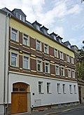 |
Apartment building in closed development, with shop | Mühlstrasse 18 (map) |
Around 1900 |
|
|
 |
Residential building in closed development | Niedergraben 5 (map) |
Marked 1799 |
|
|
 |
Residential building in closed development | Niederstrasse 2 (map) |
Around 1830 |
|
|
 |
Residential building in closed development | Obergraben 6 (map) |
Of importance in terms of building history and urban planning; Removed from the list of monuments after 2014 |
09285055 |
|
| Residential house, detached | Obergraben 12 (map) |
Around 1820 | Demolished between 2001 and 2008 |
|
|
| Residential house, detached | Obergraben 13 (map) |
Around 1820 | Tore off |
|
|
| Residential building | Obergraben 15 (map) |
Around 1820 | Of importance in terms of building history and urban planning; Removed from the list of monuments after 2014 |
09285041 |
|
| Residential house in closed development, set back | Oberstrasse 10 (map) |
Marked 1893 | Tore off |
|
|
| Former “Sächsischer Reiter” restaurant, later the administration building of the IFA bodyworks in Radeberg | Oberstrasse 16 (map) |
Around 1880 | Demolished between 2001 and 2008 |
|
|
| Rural house, detached, gable side to the street | Oberstrasse 18 (map) |
18th century | Tore off |
|
|
| Rural house in closed development | Oberstrasse 23 (map) |
18th century | Demolished between 2011 and 2015 |
|
|
| Rural house in closed development | Oberstrasse 24 (map) |
2nd quarter of the 19th century | Upper floor half-timbered, plastered; demolished between 2011 and 2015 |
|
|
| Rural house in closed development | Oberstrasse 25 (map) |
Early 19th century | Demolished between 2011 and 2015 |
|
|
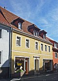 |
Residential house in half-open development with the left courtyard wing | Oberstrasse 32 (map) |
Before 1850 | Of importance in urban planning |
09285171 |
| House in a corner | Otto-Bauer-Strasse 2 (map) |
After 1900 | Urban planning of importance; Removed from the list of monuments after 2014 |
09285433 |
|
| Detached house in a corner | Otto-Bauer-Strasse 10 (map) |
Around 1900 |
|
||
| Apartment building in development closed to the right | Pillnitzer Strasse 8 (map) |
|
|||
 |
Residential house in closed development with shop, with all courtyard buildings | Pirnaer Strasse 9 (map) |
2nd half of the 18th century |
|
|
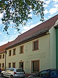 |
Rural house in closed development, with left courtyard wing | Pirnaer Strasse 33 (map) |
1st half of the 18th century |
|
|
| Herrenmühle | Pulsnitzer Strasse 1 (map) |
18th century; 1920s (villa) | The oldest building, set back in parallel behind the newer building along Pulsnitzer Strasse, as well as a factory villa (round stair tower) and a park-like garden; demolished between 2008 and 2011 |
|
|
 |
Residential house in closed development, at right angles to Pulsnitzer Strasse | Pulsnitzer Strasse 10, 12 (map) |
Around 1925 |
|
|
 |
Rural house, of the type in closed development | Pulsnitzer Strasse 19 (map) |
2nd quarter of the 19th century |
|
|
| Residential house in development closed to the right, with courtyard buildings | Pulsnitzer Strasse 29 (map) |
Reshaped around 1870, around 1910 | Demolished between 2011 and 2015 |
|
|
| Residential building in closed development | Pulsnitzer Strasse 31 (map) |
1850s | Demolished between 2011 and 2015 |
|
|
| Rural house in development closed to the left | Pulsnitzer Strasse 33 (map) |
Around 1850 | Demolished between 2011 and 2015 |
|
|
| Residential building | Pulsnitzer Strasse 41 (map) |
Demolished between 2001 and 2008 |
|
||
 |
Garden house of the former rifle house | Pulsnitzer Strasse 67 (map) |
1st half of the 19th century |
|
|
| Residential house in development closed to the left, free-standing to the right | Röderstrasse 19 (map) |
2nd quarter of the 19th century | Tore off |
|
|
 |
Residential house (half-timbered), free-standing | Schloßstraße 3 (map) |
1st half of the 19th century |
|
|
| Residential house, detached | Schloßstraße 4 (map) |
Marked 1899, core older | Demolished between 2001 and 2008 |
|
|
| Farm with a rural house and side wing with shed (clinker brick) | Schlossstrasse 5 (map) |
Around 1800 | Demolished between 2001 and 20089 |
|
|
| House of a former farm | Waterway 4 (map) |
2nd half of the 19th century | Demolished between 2011 and 2015 |
|
See also
Remarks
- This list is not suitable for deriving binding statements on the monument status of an object. As far as a legally binding determination of the listed property of an object is desired, the owner can apply to the responsible lower monument protection authority for a notice.
- The official list of cultural monuments is never closed. It is permanently changed through clarifications, new additions or deletions. A transfer of such changes to this list is not guaranteed at the moment.
- The monument quality of an object does not depend on its entry in this or the official list. Objects that are not listed can also be monuments.
- Basically, the property of a monument extends to the substance and appearance as a whole, including the interior. Deviating applies if only parts are expressly protected (e.g. the facade).
Detailed memorial texts
-
↑ Dehio - Handbook of German Art Monuments / Saxony Volume 1:
Evangelical City Church. Located northeast on a hill on the former city wall. Late Gothic core building around 1486, on the former sacristy a simple Gothic door panel with the date 1498 has been moved there. The church was rebuilt after the fire of 1714, consecrated in 1730, reconstruction by Georg Weidenbach and Anton Kaeppler from 1887–89, new construction of the 61 m high south tower at the location of an older tower. 1969–71 Renewal of the external plaster, the roof and gutting of the interior. Simple hall church with adjoining, strikingly elongated choir with a 5/8 end. Outer facade with uniform, high round arched windows with sandstone walls, pilaster strips and a steep hipped roof. Slender, cityscape-defining south tower attached to the hall, listed as an octagon on a high, square basement, finished with a hood, lantern and pointed spire. After removing the fixtures from 1889, the interior is just a very sober, flat-roofed room. Only the baroque sandstone baptism in purely decorative form and the splendid baroque sandstone pulpit by Johann Christian Feige the Elder are available. Ä. obtained from 1730. At the base of the pulpit Moses, on the basket the evangelists and in the cartouches inscriptions on the Augsburg Confession, the place of the sermon and the family of the founders, the sound cover probably still original. On the north-east side of the church there is a baroque grave monument of the mayor Christoph Seydel († 1747), who founded the Augustusbad (1720) after the discovery of healing water springs in the nearby Tannengrund. - ↑ Extensive facility that was founded in 1719. In 1717 and after 1767 various fairly pure iron springs were found that formed the basis for medicinal baths. Various changes of ownership in the 18th and 19th centuries, various construction activities on the site of the Augustus baths. 1905 five different sources are used for baths and drinking cures. 1896 Purchase of the Augustusbad by Leipzig pharmacist Willmar Schwabe , combined with Gütern Förstel and Gleesberg to form a non-profit family foundation for the poor and needy. Long and eventful history of the Augustusbad. In 1898–1903, 9603 patients were admitted. After the Second World War 1945 the baths were occupied by the Red Army. 1959 public property. Taken over by the People's Police in 1952 and used as a police school until 1989. In the area around Luisenhof there was a retirement home ("Feierabendheim") in GDR times. 1992 Transfer of Augustusbad back to the newly founded “Dr. Willmar Schwabesche Heimstättenstiftung ”. An attempt at revitalization has only been planned so far, at present the buildings and facilities are becoming increasingly decayed and the park is overgrown.
-
^ Dehio - Handbook of German Art Monuments / Saxony Volume 1:
Klippenstein Castle, today a local history museum. Located on the eastern outskirts at the entrance of the Hüttertal on a rock, on the city side, the castle pond. Probably originated around 1200, first documented mention in 1289 as "Castrum Radberch". Destroyed after the attack by the Hussites, expansion as an official and hunting palace under Duke Moritz von Sachsen in the mid-16th century, construction of the outer bailey in the 1st half of the 16th century. First bailiff Hans von Dehn-Rothfelser, who presumably led the renovation to a renaissance castle. Restored in 1628 by Ezekiel Eckhardt, in 1715 demolition of the round tower, in 1772 the Renaissance gable was demolished, the former wooden portico to the castle courtyard was replaced by an arcade, the now widened building was covered with a new gable roof. Changes and extensions to the outer bailey at the end of the 18th century. Until 1952 district court, the outer bailey prison complex. 1953 establishment of a local museum. From 1993 renovation of the outer facade of the main building. Two-storey, closed three-wing complex on a high substructure around an acute-angled inner courtyard. Main facade south to the Großer Röder with the prince's staircase and magnificent Renaissance portal in sandstone aedicula, coupled windows with sandstone walls in the style of the Dresden early Renaissance, in the basement with segmental arches. On the inside facing the courtyard there is an arcade, which was closed in 1840. At the same time, a ceiling was probably added to the current entrance hall. At the western tip, a component of medieval origin on a square floor plan with a barrel-vaulted room. In the basement of the main wing, a series of groin-vaulted rooms with Renaissance door frames, the south-easternmost with a central column. Upstairs, simple halls with simple stucco ceilings, probably from the renovation in 1772. Remains of a Renaissance gable in the roof structure. The outer bailey closes around the wing on the city side, on the courtyard side, presumably, partially using the old castle walls. Passage to Schloßstraße with half-timbered upper floor, 18th century. The ruins of the owl tower on the east side of the medieval castle are still preserved. -
↑ The object in question was entered into the list of monuments of the city of Radeberg in accordance with Section 2 of the SächsDSchG as part of the registration of cultural monuments in the Free State of Saxony on January 1, 1992, due to its architectural and landscape- defining importance . The bridge is located in the Hüttertal, which - between Wallroda and Radeberg - has been a designated landscape protection area with an area of 54 hectares since 1954 and lies in the transition area from the West Lusatian hills and mountains to the Schönfeld highlands. The Große Röder flows through the Hüttertal towards Radeberg. Historians locate the Altrabig desert (also known as Aldenradeberg and Altradeberg) in the area of the current Hüttermühle, to which the bridge to be named here serves. According to a legend, it is said to have been the town of Radeberg itself before it was built at its current location. The settlement had already been abandoned before 1349/50, because in the feudal book of Friedrich des Strengen, Margrave of Meißen and Landgrave of Thuringia, the disappeared Aldenradenberg is already mentioned. The local researcher Alfred Meiche noted in his mill book in 1927 that he assumed the location of the Altradeberger mill to be roughly at the location of today's Hüttermühle. The parcels and fields in this part of the Hüttertal were formerly called Altradeberger pieces and thus indicate the former settlement. In the years 1590/91 the Hüttermühle was built by Blasius Lorentz on the site of the old grinding mill. The water mill initially served as a fulling mill. Christian Zschiedrich converted the mill into a board mill in the 17th century. Well-known owners of the mill were, for example, Ernst Friedrich von Döhlau, Johann Christoph von Naumann and Gottfried Arnhold. [also Arnoldsmühle] At the beginning of the 19th century, the Hüttermühle functioned as a sawmill as well as a tindermill. Horse and cow stables and other farm buildings were built on the site. The mill operation was maintained until 1870. The Hüttermühle itself was licensed in 1877. The company ran, including the use of the mill pond for gondolas and ice skating, until the beginning of the 20th century, before the restaurant went into economic ruin. In 1973 numerous renovation work was carried out on the mill building as well as on the pond and the surrounding area. Until the end of the GDR in 1989, the operation in the Hüttermühle was continued as a public restaurant and then run entirely privately. Parts of the Hüttermühle as well as the Mühlgraben with weir and the bridge leading to the mill over the Röder, surrounded by extensive meadows of the Röder-Aue, are under monument protection.
With regard to the description, the historical and local classification of the building, I can only refer to the statements made by the responsible cross-sectional specialist for technical monuments, Dr. Streetz, who stated the following in his expert opinion on the application for monument protection approval of the demolition of the bridge to the Lower Monument Protection Authority of 09.08.2016: “The building is a cultural monument according to § 2 SächsDSchG for historical and landscape-shaping reasons (general legal definitions). Specifically, it is a single-arch natural stone bridge with a laid-on roadway, which structurally consists of the load-bearing arch between two massive abutments, end walls sitting on them and a modern cross-bar railing. It is a typical regional bridge that characterizes the landscape - here an extensive floodplain - in the course of a small access road to the Hüttermühle. The bridge is dated on the keystone to 1761. It cannot be ruled out that this is a spoof from a previous building, because the letter from the city of Radeberg dated March 19, 2015, refers to machine-worked sandstones in the supporting arch. Since the preservation of monuments does not automatically aim at an imaginary original condition, but with most objects one has to deal with a grown condition, the history of which contributes to the monument value, the question of the originality is not decisive here. Should it be a question of an extensive repair from later centuries, exactly what is now in danger of being lost has been taken into account: the construction and appearance have been faithfully preserved and only reproduced to the extent necessary. The harmonious embedding in the valley was always guaranteed. The mentioned year 1761 also indicates that it is a long-standing bridge location that was given a stone structure very early on. This is probably related to the economic use of the mill opened up by the bridge and is of regional historical relevance. ”
This bridge structure, which has existed for several centuries and was probably repaired several times on the occasion of past floods, contributes to the regional identity with its characteristic construction. The public interest in preservation (monument worthiness) of the object designated as a cultural monument according to § 2 SächsDSchG is justified by the existence of the scientific-documentary testimony value of the same, which is due to its described degree of authenticity. In addition, the bridge is an important part of the site or landscape section of the above. Hüttertal and the associated historical development in connection with the immediately neighboring Hüttermühle, also mentioned in the text.
swell
- List of listed monuments of the State Office for the Preservation of Monuments in Saxony, as of April 15, 2014
- Architectural cultural monuments of the core city and the districts of Radeberg (PDF; 113 kB), as of Radeberg: June 14, 2007
- Monument map of Saxony , accessed on August 18, 2017
Individual evidence
- ↑ a b City of Radeberg - draft resolution for the “Green Belt” Radeberg funding area concept. City of Radeberg, accessed on January 21, 2018 .
- ↑ Geoportal of the district of Bautzen. In: cardomap.idu.de. Bautzen district office, accessed on June 29, 2017 .
- ↑ Geoportal of the district of Bautzen. In: cardomap.idu.de. Bautzen district office, accessed on June 29, 2017 .
- ↑ Geoportal of the district of Bautzen. In: cardomap.idu.de. Bautzen district office, accessed on June 29, 2017 .
- ↑ Geoportal of the district of Bautzen. In: cardomap.idu.de. Bautzen district office, accessed on June 29, 2017 .
- ↑ Geoportal of the district of Bautzen. In: cardomap.idu.de. Bautzen district office, accessed on June 29, 2017 .
- ↑ Geoportal of the district of Bautzen. In: cardomap.idu.de. Bautzen district office, accessed on June 29, 2017 .
- ↑ Geoportal of the district of Bautzen. In: cardomap.idu.de. Bautzen district office, accessed on June 29, 2017 .
- ↑ Geoportal of the district of Bautzen. In: cardomap.idu.de. Bautzen district office, accessed on June 27, 2017 .
- ↑ Geoportal of the district of Bautzen. In: cardomap.idu.de. Bautzen district office, accessed on June 27, 2017 .
- ↑ Geoportal of the district of Bautzen. In: cardomap.idu.de. Bautzen district office, accessed on June 27, 2017 .

