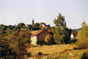
Lostanges
|
Lostanges Lostanjas |
||
|---|---|---|

|
|
|
| region | Nouvelle-Aquitaine | |
| Department | Corrèze | |
| Arrondissement | Brive-la-Gaillarde | |
| Canton | Midi Corrézien | |
| Community association | Midi Corrézien | |
| Coordinates | 45 ° 4 ′ N , 1 ° 46 ′ E | |
| height | 146-515 m | |
| surface | 9.46 km 2 | |
| Residents | 139 (January 1, 2017) | |
| Population density | 15 inhabitants / km 2 | |
| Post Code | 19500 | |
| INSEE code | 19119 | |
| Website | www.lostanges.com | |
 Lostanges |
||
Lostanges ( Occitan Lostanjas ) is a French commune with 139 inhabitants (as of January 1, 2017) in the Corrèze department on the western edge of the Massif Central . The inhabitants call themselves Lostangeois (es).
geography
Tulle , the prefecture of the department, is about 29 kilometers north, Brive-la-Gaillarde about 29 kilometers northwest and Beaulieu-sur-Dordogne about 14 kilometers southeast.
Neighboring communities
The neighboring municipalities of Lostanges are Ménoire in the north, Chenailler-Mascheix in the east, Tudeils in the south, Marcillac-la-Croze in the southwest, Saint-Bazile-de-Meyssac in the west and Le Pescher in the northwest.
traffic
Junction 52 to Autoroute A20 is about 28 kilometers northwest.
coat of arms
Description : In silver an upright, red, blue-tongued and armored lion with a blue crown surrounded by five red five-pointed stars .
Population development
| year | 1962 | 1968 | 1975 | 1982 | 1990 | 1999 | 2007 | 2016 |
| Residents | 176 | 171 | 140 | 147 | 127 | 134 | 129 | 134 |
Attractions
In Lostanges, the Jardin de Lostanges is a small, private botanical garden, over 500 exotic and native plants can be admired on an area of two hectares.
