Mähring
| coat of arms | Germany map | |
|---|---|---|

|
Coordinates: 49 ° 54 ' N , 12 ° 32' E |
|
| Basic data | ||
| State : | Bavaria | |
| Administrative region : | Upper Palatinate | |
| County : | Tirschenreuth | |
| Height : | 652 m above sea level NHN | |
| Area : | 72.92 km 2 | |
| Residents: | 1751 (Dec. 31, 2019) | |
| Population density : | 24 inhabitants per km 2 | |
| Postal code : | 95695 | |
| Area code : | 09639 | |
| License plate : | TIR, KEM | |
| Community key : | 09 3 77 139 | |
| Market structure: | 19 districts | |
Market administration address : |
Großkonreuth 24 95695 Mähring |
|
| Website : | ||
| Mayor : | Josef Schmidkonz ( FW ) | |
| Location of the Mähring market in the Tirschenreuth district | ||
Mähring is a market in the Upper Palatinate district of Tirschenreuth . Mähring is located in the north of the Upper Palatinate in Stiftland on the border with the Czech Republic on the Lohbach , a tributary of the Mies .
geography
Not far from Mähring is the Sibyllenbad . Beyond the Czech border are the famous Bohemian baths Marienbad and Franzensbad .
Community structure
Mähring has 19 districts:
|
history
Until the church is planted
A large part of the municipality belonged to the Hohenstein Propstei, which first belonged to the land and court rule of the Reichenbach Monastery and was purchased by the Waldsassen Monastery in 1442 . Mähring became the center of a judge's office in the Stiftland. In the freedom letter of 1566 the place was already referred to as a stain (market). The political municipality was established in 1818.
The Mähring uranium mining project, which was operated as part of the Cold War, was discontinued in 1982.
Incorporations
On May 1, 1978, the previously independent communities of Dippersreuth, Griesbach and Großkonreuth (from January 9, 1952, previously officially Poppenreuth ) were incorporated.
Population development
Between 1988 and 2018, the population fell from 1892 to 1776 by 116 or 6.1%.
politics
Municipal council
The twelve seats are distributed as follows:
mayor
- Mayor: Josef Schmidkonz, UWG
- Mayor: Walter Frank, FW
coat of arms
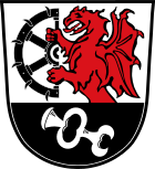
Blazon: "Above a black shield base, inside a slanted silver door hinge, in silver a growing red dragon holding half a black wheel studded with knives." The community has had the coat of arms since 1979.
Culture and sights
Museums
- Mineral Museum - Ferdinand Wagner
- Museum room Mähring - Lohäuser in the old town hall Mähring
Buildings
- St. Anna Memorial Church on the Pfaffenbühl.
- The chapel, originally consecrated in 1953, was expanded in 1967 and 1987. It is reminiscent of the Egerland pilgrimage church of the same name in the Bohemian Plan- Weseritz in what was then the Sudetenland, 13 kilometers away . The 17 meter high observation tower added to the side of the building in 1973. Especially in the times of the Cold War and the Iron Curtain , it served the expellees as a vantage point for a “look into their old homeland” and a “symbol of vigilance and resistance to the communist East”.
- Parish Church of St. Catherine
- Chapel to the Old Lord in the forest
- Nikolauskirche Högelstein a historic forest church on the road to Neualbenreuth
- Hammer stairs stone , former iron hammer in stairs stone
Fire brigades
Voluntary fire brigades exist in Mähring, Griesbach, Großkonreuth, Poppenreuth, Dippersreuth and Redenbach.
societies
|
|
Regular events
- Home meeting of the Plan-Weseritzer in the last week of July
tourism
The Mähring market is developing more and more into a tourist destination, not least due to the proximity of the spa triangle Marienbad - Franzensbad - Karlsbad , which can be reached via the Mähring / Broumov border crossing . The low mountain range , which invites you to go on long hikes, or the many fishing waters for anglers are also reasons for its increasing popularity.
traffic
State road 2167 ends at the border crossing Mähring - Broumov / Promenhof in the Czech Republic in the Mähring district of stairs stone .
Bus routes 2702 and 2704 run by Eska Stiftlandkraftverkehr on weekdays .
Individual evidence
- ↑ "Data 2" sheet, Statistical Report A1200C 202041 Population of the municipalities, districts and administrative districts 1st quarter 2020 (population based on the 2011 census) ( help ).
- ^ Mähring community, M in the local database of the Bavarian State Library Online . Bavarian State Library, accessed on August 29, 2017.
- ^ Wilhelm Volkert (ed.): Handbook of Bavarian offices, communities and courts 1799–1980 . CH Beck, Munich 1983, ISBN 3-406-09669-7 , p. 580 .
- ^ Federal Statistical Office (ed.): Historical municipality directory for the Federal Republic of Germany. Name, border and key number changes in municipalities, counties and administrative districts from May 27, 1970 to December 31, 1982 . W. Kohlhammer, Stuttgart / Mainz 1983, ISBN 3-17-003263-1 , p. 664 .
- ↑ St. Anna Church ( Memento of the original from February 25, 2016 in the Internet Archive ) Info: The archive link was inserted automatically and has not yet been checked. Please check the original and archive link according to the instructions and then remove this notice. on the website Heimatkreis Plan-Weseritz e. V.
- ↑ State home policy and home discourses in Bavaria 1947 to 1970, Ulla-Britta Vollhardt, 2008, ISBN 383-1608156 [1]
- ↑ 3 associations in the community of Mähring on the website vereinswappen.de
- ^ Associations in Markt Mähring on the website of the market town of Mähring
- ↑ Modellsportverein Großkonreuth e. V.
- ↑ The association introduces itself at grosskonreuther-blasmusik.de, accessed on May 14, 2018
- ^ Government of the Upper Palatinate, border crossings , Government of the Upper Palatinate
Web links
- Entry on the coat of arms of Mähring in the database of the House of Bavarian History


