Molate
| Molate | ||
|---|---|---|
| Molat satellite image | ||
| Waters | the Adrian Sea | |
| Geographical location | 44 ° 14 ' N , 14 ° 51' E | |
|
|
||
| length | 11 km | |
| width | 2 km | |
| surface | 22.17 km² | |
| Highest elevation | Lokardenik 148 m |
|
| Residents | 197 (2011) 8.9 inhabitants / km² |
|
| main place | Molat (place) | |
| Situation map | ||
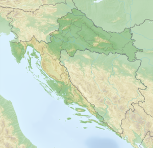
Molat is a Croatian island in the Adriatic Sea 27 km northwest of the city of Zadar in the Dalmatia region .
geography
The irregularly shaped island is 11 km long and a maximum of 2 km wide. The area is 22.17 km² , the coastline measures over 51 km.
Molat is separated from the mainland by the Zapuntelstrasse ( Croat . Prolaz Zapuntel ). In 2011 the island had 197 inhabitants. These are spread over the three villages of Molat (107), Brgulje (48) and Zapuntel (42). The highest point on the island is Lokardenik at 148 meters. The island's flora consists mainly of conifers .
history
After the Roman times the island came to the Byzantine Dalmatia . In 1151 it came into the possession of the Benedictine monastery of St. Krševan in Zadar. In 1490 the Venetians took power. In the peace of 1540 the island came to the Ottoman Empire . By the Peace of Karlowitz (1645) she got back to Venice; 1718 Austria-Hungary treaty of Passarowitz . With the Peace of Pressburg it came to France in 1805, although Russia made claims. After the Congress of Vienna in 1814/1815, the island came to the Austrian Empire as part of the crown land of Dalmatia . With the settlement of 1867, the island remains in the Austrian part (Cisleithanien) of the dual monarchy. In June 1918 the SMS Szent István sank after two torpedo hits off Molat. In 1918/1919 the island became part of the Kingdom of Serbs, Croats and Slovenes , from 1929 " Yugoslavia ".
In 1939 the British King Edward VIII visited the island while on a cruise. Molat was occupied by Italy from 1941 to 1944 . The Italian fascists built a concentration camp on the island for Slovenian , Croatian and Serbian civilians. After the Second World War, the island fell to Yugoslavia. Since 1991 it has belonged to the independent Republic of Croatia.
tourism
The island has a lot of bays. The port in the Lučina Bay is valued by yachtsmen for its calm and sheltered location (protection against winds from all directions except the southwest and west). The village of Molat is in a slightly higher position. In the village there are a few shops and also a fish restaurant.
Web links
Individual evidence
- ↑ Duplancic leather, T .; Ujević, T .; Čala, M. (2004): Duljine obalne crte i površine otoka na hrvatskom dijelu Jadranskog mora određene s topografskih karata mjerila 1:25 000 , Geoadria, Vol. 9, No. 1, 5-32.
- ↑ Statistics 2011
- ↑ Carlo Spartaco Capogreco: I Campi del duce . Giulio Einaudi 2004, ISBN 88-06-16781-2 , p. 271 ff.


