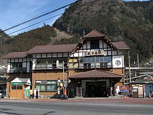
Okutama (Tokyo)
| Okutama-machi 奥多摩 町 |
||
|---|---|---|
| Geographical location in Japan | ||
|
|
||
| Region : | Kanto | |
| Prefecture : | Tokyo | |
| Coordinates : | 35 ° 49 ' N , 139 ° 6' E | |
| Height : | 339 m | |
| Basic data | ||
| Surface: | 225.63 km² | |
| Residents : | 4913 (October 1, 2019) |
|
| Population density : | 22 inhabitants per km² | |
| Community key : | 13308-6 | |
| Symbols | ||
| Flag / coat of arms: | ||
| Tree : | Crescent fir | |
| Flower : | Rhododendron dilatatum | |
| Bird : | Copper pheasant | |
| town hall | ||
| Address : |
Okutama Town Hall 215 - 6 , Hikawa Okutama -machi, Nishitama-gun Tōkyō 198-0212 |
|
| Website URL: | http://www.town.okutama.tokyo.jp/ | |
| Location of Okutamas in Tokyo Prefecture | ||
Okutama ( Japanese 奥多摩 町 , - machi ) is a village in Nishitama County in Tokyo Prefecture , Japan .
geography
Okutama is located in the middle of the mountains of the same name , the highest point of which is the Kumotori at 2,017 m. Some of the highest peaks in Okutama lie along the Ishione , a ridge that extends from the Kumotori. The Tama flows through the valley south of the Ishione , from which the name of the place and the area ("Inner Tama") is derived.
On the western edge of the urban area is the Okutama Lake , which is drained by the Tama at its eastern end at the Ogōchi Dam ( 小河 内 ダ ム ). In the district of Shiromaru there is the Shiromaru Lake, a reservoir of the Tama through the Shiromaru Dam ( 白 丸 ダ ム ).
history
The community was originally called Hikawa and was made machi ( 氷川 町 ) on February 11, 1940 . On April 1, 1955, Hikawa and the villages ( mura ) Kori ( 古 里 村 , -mura ) and Ogōchi ( 小河 内 村 , -mura ) merged to form the community of Okutama.
In 1957, the construction of the Ogochi Dam, begun in 1936, was completed.
Attractions
Sights include the Okutama Lake, the Hatonosu Gorge ( 鳩 ノ 巣 渓 谷 ), the Nippara stalactite cave ( 日 原 鍾乳 洞 ) and the Ogōchi-no-Kashima-Odori ( 小河 内 の 鹿島 踊 ), a dance that takes place every year on the 15th September is performed at the Ogōchi Shrine ( 小河 内 神社 ) and was recognized as an important intangible cultural asset.
traffic
The Ōme Line of JR East stops at stations Kawai ( 川井駅 , -eki ), Kori ( 古里駅 , -eki ) Hatonosu ( 鳩ノ巣駅 , -eki ) Shiromaru ( 白丸駅 , -eki ) and Oku -Tama ( 奥多摩 駅 , -eki ).
Okutama is connected to the trunk road network with national roads 139 and 411. In the former, it forms an end point, while the starting point is in Fuji in Shizuoka Prefecture . The national road 411 in turn connects Hachiōji in Tokyo prefecture with Kofu in Yamanashi prefecture .
education
The city has two municipal primary schools, Hikawa and Kori, and two municipal middle schools, Hikawa and Kori.


