Paulusmühle (Hilpoltstein)
|
Paulusmühle
City of Hilpoltstein
Coordinates: 49 ° 11 ′ 14 " N , 11 ° 9 ′ 38" E
|
|
|---|---|
| Height : | 364 m |
| Residents : | 3 (1987) |
| Incorporation : | January 1, 1972 |
| Postal code : | 91161 |
| Area code : | 09179 |
|
Paulusmühle
|
|
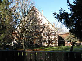
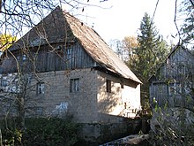
The Paulusmühle is part of the municipality of Hilpoltstein in the Middle Franconian district of Roth in Bavaria .
location
The district is located on the Mühlbach, which is derived from the Roth , about 3.5 km west of the center of Hilpoltstein.
history
The Einödmühle belonged to the southern Hofstetten and Schweizermühle the Cistercian monastery Walderbach in Roding in today's district of Cham . In 1434, Ott Wenger sat on it, who gave its name to the "Wengersmühle", the old name for the Paulusmühle. In 1581 the miller's name was Paulus Pößel, who was also the village judge of Hofstetten; his first name became the new mill name that is still used today. The high and lower jurisdiction held the rule (Hilpolt) -Stein. In a description of the Palatinate-Neuburgic office of Hilpoltstein from 1604 there is talk of the "Wen (n) inger (s) - or Paulsmuhl".
After the Reichsdeputationshauptschluss had brought the secularization of the Walderbach monastery, the mill became Bavarian in 1806. In the new kingdom she came to the Heuberg tax district , then to the Hofstetten rural community ; this was incorporated into the town of Hilpoltstein in the district of Roth in the course of the regional reform in Bavaria on January 1, 1972.
In 1813, the indebted master miller Franz Anton Angermeyer ceded the Paulusmühle to his son-in-law Johann Georg Gemelch (the Angermeier miller family was already at the mill in 1610); the daughter Josepha Angermeyer married the Munich “suburban butcher” Franz Xavier Reichl in 1826 . In 1832 it is reported that the mill has a grinding mechanism. In 1861 Franz Gmelch owned the mill.
A saw and agriculture were attached to the mill. In 1875 the miller kept two horses and nine cattle. The mill belonged to the Catholic parish of Zell and the Protestant parish of Eckersmühlen. The children attended the Catholic school in Hofstetten and the Protestant school in Hilpoltstein. In 1917 the miller family Wurm took over the mill, which replaced the water wheel with a turbine, but in 1970 they stopped grinding and gave up sawing.
Population development
- 1818: 9 (2 hearths, 1 family)
- 1836: 12 (2 houses)
- 1861 9 (3 buildings)
- 1871: 5 (4 buildings)
- 1904: 7 (1 residential building)
- 1937: 3
- 1950: 3 (1 residential building)
- 1961: 1 (1 residential building)
- 1973: 1
- 1987: 3 (2 residential buildings, 2 apartments)
traffic
From Hilpoltstein you get to the Seitzenmühle on Bahnhofstraße and from there about 500 m further to the Paulusmühle. From Hofstetten, take the “Am Mühlbach” road north and turn left to the Paulusmühle shortly before the Seitzenmühle.
The “Mühlenweg” hiking trail in the Roth district touches the Paulusmühle. In addition, hiking trail no. 10 leads from the Seezentrum Heuberg via the Paulusmühle to Hilpoltstein.
literature
- Sonja Maier et al. (Red.): The Mühlenweg from Hilpoltstein to Roth , Roth o. J. (2008)
- The Paulusmühle near Hofstetten . In: Heimatblätter for Hilpoltstein, Allersberg, Greding, Heideck and Thalmässing, 47 (2006), No. 10, p. 2
- Wolfgang Wiessner: Hilpoltstein . In: Commission for Bavarian State History at the Bavarian Academy of Sciences (Hrsg.): Historical Atlas of Bavaria . Part Franconia, Series I, Issue 24. Munich 1978, ISBN 3-7696-9908-4 ( digitized version ).
Web links
Individual evidence
- ^ Wolfgang Wiessner: Hilpoltstein . In: Commission for Bavarian State History at the Bavarian Academy of Sciences (Hrsg.): Historical Atlas of Bavaria . Part Franconia, Series I, Issue 24. Munich 1978, ISBN 3-7696-9908-4 , p. 228 ( digitized version ).
- ↑ Money from the Paulusmühle in the Upper Palatinate Forest . In: Hilpoltsteiner Kurier from June 10, 2014
- ↑ Mühlenweg, p. 8
- ↑ p. 31
- ↑ a b Wolfgang Wiessner: Hilpoltstein . In: Commission for Bavarian State History at the Bavarian Academy of Sciences (Hrsg.): Historical Atlas of Bavaria . Part Franconia, Series I, Issue 24. Munich 1978, ISBN 3-7696-9908-4 , p. 253 ( digitized version ).
- ↑ [1] Accessed January 13, 2016
- ↑ Königlich-Baierisches Intellektivenblatt for the Upper Danube District , Eichstätt, March 1, 1813, Sp. 330; Der Bayerische Volksfreund , Munich, February 11, 1826, p. 76
- ^ Repertory of the topographical atlas sheet Schwabach , 1832, p. 25
- ↑ Overview of the foundations ... In: (Supplement to) the Royal Bavarian District Office Gazette for Upper Palatinate and Regensburg for 1861, No. 7, Col. 16
- ↑ a b Kgl. Statistical Bureau (ed.): Complete list of localities of the Kingdom of Bavaria. According to districts, administrative districts, court districts and municipalities, including parish, school and post office affiliation ... with an alphabetical general register containing the population according to the results of the census of December 1, 1875 . Adolf Ackermann, Munich 1877, 2nd section (population figures from 1871, cattle figures from 1873), Sp. 889 , urn : nbn: de: bvb: 12-bsb00052489-4 ( digital copy ).
- ↑ a b K. Bayer. Statistical Bureau (Ed.): Directory of localities of the Kingdom of Bavaria, with alphabetical register of places . LXV. Issue of the contributions to the statistics of the Kingdom of Bavaria. Munich 1904, Section II, Sp. 1219 ( digitized version ).
- ↑ Mühlenweg, p. 8
- ↑ Alphabetical index of all the localities contained in the Rezatkkreis according to its constitution by the newest organization: with indication of a. the tax districts, b. Judicial Districts, c. Rent offices in which they are located, then several other statistical notes . Ansbach 1818, p. 71 ( digitized version ).
- ↑ Th. D. Popp: Register of the Bissthumes Eichstätt . Eichstätt: Ph. Brönner 1836, p. 165 (No. 199)
- ^ Joseph Heyberger, Chr. Schmitt, v. Wachter: Topographical-statistical manual of the Kingdom of Bavaria with an alphabetical local dictionary . In: K. Bayer. Statistical Bureau (Ed.): Bavaria. Regional and folklore of the Kingdom of Bavaria . tape 5 . Literary and artistic establishment of the JG Cotta'schen Buchhandlung, Munich 1867, Sp. 713 , urn : nbn: de: bvb: 12-bsb10374496-4 ( digitized version ).
- ^ Franz Xaver Buchner: The diocese of Eichstätt. Volume I: Eichstätt 1937, p. 507
- ↑ Bavarian State Statistical Office (ed.): Official city directory for Bavaria, territorial status on October 1, 1964 with statistical information from the 1961 census . Issue 260 of the articles on Bavaria's statistics. Munich 1964, DNB 453660959 , Section II, Sp. 795 ( digitized version ).
- ^ Wolfgang Wiessner: Hilpoltstein . In: Commission for Bavarian State History at the Bavarian Academy of Sciences (Hrsg.): Historical Atlas of Bavaria . Part Franconia, Series I, Issue 24. Munich 1978, ISBN 3-7696-9908-4 , p. 262 ( digitized version ).
- ↑ Bavarian State Office for Statistics and Data Processing (Ed.): Official local directory for Bavaria, territorial status: May 25, 1987 . Issue 450 of the articles on Bavaria's statistics. Munich November 1991, DNB 94240937X , p. 348 ( digitized version ).
- ↑ Directions on landratsamt-roth.de
- ↑ Directions on rothsee.de


