
Rekingen
| Rekingen | |
|---|---|
 |
|
| State : |
|
| Canton : |
|
| District : | Zurzach |
| BFS no. : | 4315 |
| Postal code : | 5332 |
| UN / LOCODE : | CH RKG |
| Coordinates : | 666 593 / 269196 |
| Height : | 341 m above sea level M. |
| Height range : | 322–555 m above sea level M. |
| Area : | 3.10 km² |
| Residents: | 944 (December 31, 2019) |
| Population density : | 305 inhabitants per km² |
|
Proportion of foreigners : (residents without citizenship ) |
34.3% (December 31, 2019) |
| Website: | www.rekingen.ch |
 Rekingen (in the background Reckingen / Baden) |
|
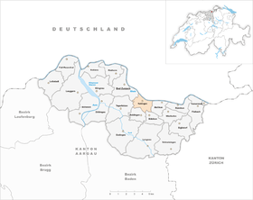
| Location of the municipality | |
  |
|
Rekingen ( Swiss German : ['rækχɪŋːə] ) is a municipality in the Swiss canton of Aargau . It belongs to the Zurzach district and is located on the Upper Rhine on the border with Germany .
geography
The village on the northern edge of the Table Jura stretches in an east-west direction in the narrow plain along the Rhine . There are extensive factories at both the western and eastern ends of the village . The narrow and in places up to 120 meters deep gorge of the Chrüzlibach runs from south to north . To the east of the gorge rises the 556 meter high Güggehübuck, to the west of it the 545 meter high Obergrüt. Both hills are extremely steep in the lower area and become significantly flatter towards the top.
The Musital branches off to the west about half a kilometer south of the village. There, on the southern slope of the Obergrüt, is the extensive former Schümel quarry . From 1913 to 1980, this supplied the raw material for the now closed cement factory on the eastern edge of the village. The excavated material was transported by a 1.3 kilometer long conveyor belt. This first ran high above the gorge and then through a tunnel over 900 meters long under the northern foothills of the Güggehübuck.
The area of the municipality is 310 hectares , 188 hectares of which are forested and 69 hectares are built over. The highest point is at 556 meters on the Guggenhübuck plateau, the lowest at 323 meters on the Rhine. Neighboring communities are Küssaberg with the district Reckingen in the north, Mellikon in the east, Böbikon in the southeast, Baldingen in the south, Tegerfelden in the southwest and Bad Zurzach in the west.
history
The area was already settled during the Bronze Age , as is shown by finds of graves, weapons and objects. During the Roman rule there was a large estate in Rekingen . It was built around 50 AD, served to supply the legionary camp in Vindonissa and was discovered in 1956 during construction work for the gym. The Tenedo settlement ( Bad Zurzach ) was in the immediate vicinity . 260 that burned Alemanni settle the estate to 370, the Rhine was the northern border of the Roman Empire. There were two watchtowers at Rekingen; the first was dismantled in 1876 while the railway was being built, the second uncovered, researched and then covered again in 1936 At the beginning of the 5th century, the Romans finally withdrew.
About a hundred years later, the Alemanni settled the area, and numerous graves date from this time. In the High Middle Ages, the Counts of Lenzburg ruled first , then the Kyburgs and from 1273 the Habsburgs . It was first mentioned in a document in 1261, when Cuonrad for Rechunch was named as the landowner and Burcardus de Rechunch as a witness. The place name comes from the Old High German Reccingun and means "among the people of Recco".
The Swiss conquered Aargau in 1415 and Rekingen now belonged to the Ehrendingen office in the county of Baden , a common rule . The Bishop of Constance exercised the lower jurisdiction and was represented by the canons of the Zurzach Verena Minster . In 1529 a large part of the population converted to the Reformation . To prevent the whole village from being reformed, the canon had a Catholic chapel built in 1678. The school system began in 1790, but remained denominationally separate until 1852. In 1798 the French took Switzerland and proclaimed the Helvetic Republic . Rekingen was initially a municipality in the short-lived canton of Baden , since 1803 it has belonged to the canton of Aargau.
The industry arrived in 1864 with the opening of a lime factory, which existed until 1989. On August 1, 1876 opened Swiss Northeastern Railway , the railway line Winterthur-Koblenz . In 1914, the Schweizerische Sodafabrik AG (now Solvay Switzerland ) was founded in Zurzach , which exploited the rich salt deposits ; the factory site is partly on Rekinger soil. In 1975, Holderbank Cement AG (today LafargeHolcim ) started producing cement on the eastern edge of the village , but the factory ceased operations in 1995.
In 2009 Rekingen joined the administrative cooperation "Verwaltung2000", which takes care of the administrative tasks of seven communities in the neighborhood. The municipality has been involved in the “Rheintal +” project since 2014, which envisages the merger of nine municipalities to form the municipality of Zurzach . After the community assembly approved the merger on May 23, 2019 with 144 to 7 votes, the decision was confirmed in a referendum on September 8, 2019 with 201 to 63 votes. This means that the merger will take place on January 1, 2022 (but without Mellikon , which narrowly refused).
Attractions


The Musital with the former Schümel quarry is located between Rekingen and Baldingen . This has been declared a nature reserve and is being renatured. The characteristic mining ramps will be preserved and there will be no active reforestation.
coat of arms
The blazon of the municipal coat of arms reads: "Divided by yellow with a black R and by blue with half a yellow mill wheel." The coat of arms was first depicted on the municipal seal from 1851. The mill wheel is reminiscent of the three mills that once existed in Rekingen.
population
The population developed as follows:
| year | 1780 | 1850 | 1900 | 1930 | 1950 | 1960 | 1970 | 1980 | 1990 | 2000 | 2010 |
| Residents | 259 | 348 | 270 | 445 | 710 | 827 | 883 | 764 | 924 | 998 | 962 |
On December 31, 2019, 944 people lived in Rekingen, the proportion of foreigners was 34.3%. In the 2015 census, 32.6% described themselves as Roman Catholic and 22.4% as Reformed ; 45.0% were non-denominational or of other faiths. In the 2000 census, 84.2% stated German as their main language, 5.8% Albanian , 3.8% Italian and 1.0% each of English , Portuguese and Serbo-Croatian .
Politics and law

The assembly of those entitled to vote, the municipal assembly , exercises legislative power. The executing authority is the five-member municipal council . He is elected by the people in the majority procedure, his term of office is four years. The parish council leads and represents the parish. To this end, it implements the resolutions of the municipal assembly and the tasks assigned to it by the canton. The Zurzach District Court is the first instance responsible for legal disputes . Rekingen belongs to the XVII peace judges' circle (Zurzach).
economy
According to the company structure statistics (STATENT) collected in 2015, there are around 400 jobs in Rekingen, 14% of them in industry and 86% in the service sector. Although part of the factory site of the chemical company Solvay is on Rekinger soil, the jobs there are in the statistics of Bad Zurzach . Most of the employed are therefore considered to be commuters and work in Bad Zurzach and the surrounding area.
Since the beginning of 2002 there has been a transshipment point for container traffic by rail on the former cement works site . This is partly located on the soil of the neighboring municipality of Mellikon . After initial difficulties and the takeover of the container terminal by Swissterminal in 2006, container traffic is picking up markedly. Trains from large ports such as Hamburg now come directly to Rekingen every day .
traffic
The Hauptstrasse 7 of Basel to Winterthur extends between the center and the Rhine. From here the canton road 432 branches off in the direction of Baldingen . At the eastern edge of the village there is a train station on the SBB railway line Koblenz AG – Bülach – Winterthur . A post bus line connects Bad Zurzach train station with Rekingen and Böbikon .
education
The community has a kindergarten and a school house where primary school is taught. All upper levels ( Realschule , Secondary School and District School ) can be attended in Bad Zurzach . The closest grammar schools are the Baden Cantonal School and the Wettingen Cantonal School .
Web links
- Official website of the community of Rekingen
- Administration2000 (administrative cooperation)
- Christoph Herzig: Rekingen. In: Historical Lexicon of Switzerland .
Individual evidence
- ↑ Cantonal population statistics 2019. Department of Finance and Resources, Statistics Aargau, March 30, 2020, accessed on April 2, 2019 .
- ↑ Cantonal population statistics 2019. Department of Finance and Resources, Statistics Aargau, March 30, 2020, accessed on April 2, 2019 .
- ^ According to unpublished material from the Linguistic Atlas of German-speaking Switzerland . According to Beat Zehnder: The community names of the Canton of Aargau, ed. of the Historical Society of the Canton of Aargau, Sauerländer Aarau 1991, pp. 345–347 (Argovia 100), however, ['rɛkxɪgə] should be used; this sound was taken over into the lexicon of Swiss community names (Frauenfeld / Laussanne 2005). The warranty person ultimately what the Rekinger Wenkersätze (see Regionalsprache.de ) has answered, are [ 'ræːkxɪŋːə] on.
- ^ National map of Switzerland, sheet 1050, Swisstopo.
- ↑ Old Quarry - New Perspectives. (PDF, 13.6 MB) Schümel Nature Conservation Foundation, accessed on June 17, 2019 .
- ↑ Standard area statistics - municipalities according to 4 main areas. Federal Statistical Office , November 26, 2018, accessed on June 17, 2019 .
- ^ Martin Hartmann, Hans Weber: The Romans in Aargau . Verlag Sauerländer, Aarau 1985, ISBN 3-7941-2539-8 , p. 193-194 .
- ↑ Aargauer Zeitung of December 29, 2010, p. 34.
- ^ Beat Zehnder: The community names of the canton of Aargau . In: Historical Society of the Canton of Aargau (Ed.): Argovia . tape 100 . Verlag Sauerländer, Aarau 1991, ISBN 3-7941-3122-3 , p. 345-347 .
- ↑ About us. Verwaltung2000, accessed June 17, 2019 .
- ^ Philipp Zimmermann, Andreas Fretz, David Rutschmann: Grossfusion im Zurzibiet: 9 municipalities say yes to «Zurzach» - Fisibach refuses to join. Aargauer Zeitung , May 24, 2019, accessed on June 17, 2019 .
- ↑ Pirmin Kramer, Daniel Weissenbrunnen: Zurzibieter large merger is perfect! Eight municipalities say yes, only Mellikon refuses. Aargauer Zeitung , September 8, 2019, accessed on September 10, 2019 .
- ^ Joseph Galliker, Marcel Giger: Municipal coat of arms of the Canton of Aargau . Lehrmittelverlag des Kantons Aargau, book 2004, ISBN 3-906738-07-8 , p. 249 .
- ↑ Population development in the municipalities of the Canton of Aargau since 1850. (Excel) In: Eidg. Volkszählung 2000. Statistics Aargau, 2001, archived from the original on October 8, 2018 ; accessed on June 17, 2019 .
- ↑ Resident population by religious affiliation, 2015. (Excel) In: Population and Households, Community Tables 2015. Statistics Aargau, accessed on June 17, 2019 .
- ↑ Swiss Federal Census 2000: Economic resident population by main language as well as by districts and municipalities. (Excel) Statistics Aargau, archived from the original on August 12, 2018 ; accessed on June 17, 2019 .
- ↑ circles of justice of the peace. Canton of Aargau, accessed on June 17, 2019 .
- ↑ Statistics of the corporate structure (STATENT). (Excel, 157 kB) Statistics Aargau, 2016, accessed on June 17, 2019 .
- ↑ Hub for railway containers at the gates of Zurich. Neue Zürcher Zeitung , November 23, 2006, accessed on March 24, 2019 .
Bad Zurzach | Baldingen | Böbikon | Böttstein | Döttingen | Endingen | Fisibach | Full-Reuenthal | Kaiserstuhl | Klingnau | Koblenz | Leibstadt | Lengnau | Leuggern | Mellikon | Rekingen | Rietheim | Rümikon | Schneisingen | Siglistorf | Tegerfelden | Wislikofen
Former municipality: Mellstorf | Oberleibstadt | Unterendingen | Unterleibstadt
Canton of Aargau | Districts of the Canton of Aargau | Municipalities in the Canton of Aargau