Rorà
| Rorà | ||
|---|---|---|
|
|
|
|
| Country | Italy | |
| region | Piedmont | |
| Metropolitan city | Turin (TO) | |
| Coordinates | 44 ° 48 ' N , 7 ° 12' E | |
| height | 967 m slm | |
| surface | 12.26 km² | |
| Residents | 231 (Dec. 31, 2019) | |
| Population density | 19 inhabitants / km² | |
| Post Code | 10060 | |
| prefix | 0121 | |
| ISTAT number | 001226 | |
| Popular name | Rorenghi | |
| Patron saint | Sant'Anna | |

|
||
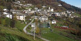
Rorà ( Occitan Rourà ) is a small community with 231 inhabitants (as of December 31, 2019) in the Italian metropolitan city of Turin (TO), Piedmont region .
The community consists of the districts Ruà and Rorà.
geography
The place is located on the southern edge of the Val Pellice at an altitude of 967 m above sea level. The municipality covers an area of 12.26 km².
The neighboring municipalities are Bagnolo Piemonte ( CN ), Luserna San Giovanni , Torre Pellice and Villar Pellice .
Individual evidence
- ↑ Statistiche demografiche ISTAT. Monthly population statistics of the Istituto Nazionale di Statistica , as of December 31 of 2019.
Web links
Commons : Rorà - collection of images, videos and audio files
- Information at comuni-italiani.it (Italian)

