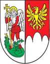
Sulín
| Sulín | ||
|---|---|---|
| coat of arms | map | |

|
|
|
| Basic data | ||
| State : | Slovakia | |
| Kraj : | Prešovský kraj | |
| Okres : | Stará Ľubovňa | |
| Region : | Spiš | |
| Area : | 20.17 km² | |
| Residents : | 316 (Dec 31, 2019) | |
| Population density : | 16 inhabitants per km² | |
| Height : | 400 m nm | |
| Postal code : | 065 22 | |
| Telephone code : | 0 52 | |
| Geographic location : | 49 ° 22 ' N , 20 ° 45' E | |
| License plate : | SL | |
| Kód obce : | 527025 | |
| structure | ||
| Community type : | local community | |
| Structure of the municipality: | 2 parts of the community | |
| Administration (as of November 2018) | ||
| Mayor : | Anna Hiľáková | |
| Address: | Obecný úrad Sulín 99 06546 Malý Lipník |
|
| Website: | www.sulin.ocu.sk | |
| Statistics information on statistics.sk | ||
Sulín (German very rarely Sulm , Hungarian Szulin ) is a municipality in northeast Slovakia in the Okres Stará Ľubovňa . Sulín lies in the valley of the Palenický jarok and Poprad , which forms the border between Poland and Slovakia here.
The municipality was created in 1960 through the merger of the two places Malý Sulín (in the former Sharosh county ) and Veľký Sulín (in the former Zips county ). Until about 1888 and 1920-1927, however, the name Sulín was used for both places. In addition to the main town Sulín, the northwestern town of Zavodie is one of the districts .
In the village there is a neoclassical Orthodox church from 1879, which is dedicated to St. Michael the Archangel .
See also: List of listed objects in Sulín
Web links
Commons : Sulín - collection of images, videos and audio files

