
Künten
| Künten | |
|---|---|
 |
|
| State : |
|
| Canton : |
|
| District : | to bathe |
| BFS no. : | 4031 |
| Postal code : | 5444 |
| UN / LOCODE : | CH KNN |
| Coordinates : | 667 322 / 249134 |
| Height : | 426 m above sea level M. |
| Height range : | 352-536 m above sea level M. |
| Area : | 4.89 km² |
| Residents: | 1789 (December 31, 2019) |
| Population density : | 366 inhabitants per km² |
|
Proportion of foreigners : (residents without citizenship ) |
15.9% (December 31, 2019) |
| Website: | www.kuenten.ch |
 Künten |
|
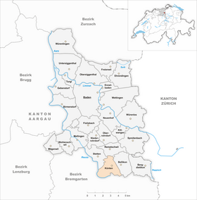
| Location of the municipality | |
  |
|
Künten ( Swiss German : ˈχøntə ) is a municipality in the Swiss canton of Aargau . It belongs to the Baden district and is located in the Reuss Valley between Mellingen and Bremgarten .
geography
Künten is located on the eastern side of the Reuss Valley on a saddle between the western slope of Clear Mountain and the Talhau, a wooded moraine hills , which at the end of Würm during the retreat of the Reuss glacier originated. Separated by a step of around 50 meters, the street village of Sulz is located on an oxbow river in the Reuss plain, around one kilometer southwest of Künten. At the western boundary of the municipality, the Reuss has created a gorge around 25 meters deep through erosion.
The area of the municipality is 489 hectares , of which 133 hectares are covered with forest and 69 hectares are built over. The highest point is at 530 meters on the eastern border of the municipality, the lowest at 354 meters on the Reuss. Neighboring communities are Remetschwil in the north, Bellikon in the east, Eggenwil and Fischbach-Göslikon in the south, Niederwil in the west and Stetten in the north-west.
history
Various finds indicate an early settlement. Coins, shards, bronze and iron utensils from a Roman settlement from the early 2nd century came to light near Künten, and archaeologists discovered a burial mound near Sulz . Chünten and Sulzo were first mentioned in a document around 1160 in the Acta Murensia , which identified the villages as the property of the Muri monastery. The place name Künten comes from the late Latin (praedium) Quintinacum and means "estate belonging to the Quintinus". The current form of the name emerged from the Old High German Chüntinacha by shifting sounds .
In the Middle Ages, the municipality was under the rule of the Habsburgs , who also exercised blood jurisdiction. The lower jurisdiction was for the most part in the hands of the Hermetschwil monastery . From 1392 a farm in Künten belonged to the St. Nicholas Chapel in Baden . In 1415 the confederates conquered Aargau. Both villages were now part of the office Rohrdorf in the county of Baden , a common rule . After the Reformation was introduced in 1529 , after the Second Kappel War of 1531 , the inhabitants had to reassume the Catholic denomination.
In March 1798 the French took Switzerland and proclaimed the Helvetic Republic . Künten and Sulz initially belonged to the short-lived canton of Baden , from 1803 to the canton of Aargau. Both villages formed a common municipality , but were also two separate local civil parishes with a certain degree of autonomy. This structure lasted until 1973, when the local civil parishes were dissolved and they were united with the community. On June 10, 1866, a major fire in Künten destroyed 14 thatched houses. Until well into the 20th century, Künten was shaped by agriculture . With the opening of the nearby motorway, the number of inhabitants began to increase significantly and has more than doubled since then.
In order to do justice to the growing population, the Church of the Holy Cross was built in 1964–65 as a replacement for a smaller previous church. It was built according to plans by the architect Walter Moser and contains works of art by Max Rüedi and Alfred Huber.
coat of arms
The blazon of the municipal coat of arms reads: "Split of white with a pawed red high cross and of red with a white oblique flow." This coat of arms was depicted on the municipal seals from 1827 and 1872; the split line was also occupied by a vine, which was left out after 1915. The cross is reminiscent of the miraculous cross that once stood outside the village of Künten and, according to ancient tradition, was replaced by the chapel, the predecessor of the later parish church, in the 18th century. The river symbolizes the Reuss.
population
The population developed as follows:
| year | 1798 | 1850 | 1900 | 1930 | 1950 | 1960 | 1970 | 1980 | 1990 | 2000 | 2010 | 2015 |
| Residents | 350 | 609 | 449 | 439 | 574 | 684 | 819 | 1114 | 1320 | 1486 | 1586 | 1671 |
On December 31, 2019, 1789 people lived in Künten, the proportion of foreigners was 15.9%. In the 2015 census, 45.4% described themselves as Roman Catholic and 19.6% as Reformed ; 35.0% were non-denominational or of other faiths. In the 2000 census, 93.1% stated German as their main language, 1.5% Albanian and 0.9% each English and Turkish .
Politics and law
The assembly of those entitled to vote, the municipal assembly , exercises legislative power. The executing authority is the five-member municipal council . He is elected by the people in the majority procedure, his term of office is four years. The parish council leads and represents the parish. To this end, it implements the resolutions of the municipal assembly and the tasks assigned to it by the canton. The Baden District Court is responsible for litigation in the first instance . Künten belongs to the Friedensrichterkreis V (Mellingen).
economy
According to the company structure statistics (STATENT) collected in 2015, Künten has around 420 jobs, 10% of them in agriculture, 35% in industry and 55% in the service sector. Most of the gainfully employed are commuters and work in the surrounding communities or in the Baden agglomeration .
traffic
Künten is located on Kantonsstrasse 281 between Baden and Bremgarten , about eight kilometers south of the Dättwil junction of the A1 motorway . The connection to the public transport network is made by a post bus line from Baden train station via Stetten to Bremgarten, and a night bus runs on the same route on weekends.
Associations and tourism
Künten has more than three dozen associations in the fields of society, culture, music and sport. Your events are coordinated by the “United Associations”. A special feature is the Sulz-Fischbach ferry association, which operates a passenger ferry across the Reuss on weekends in summer, which is mainly used by hikers. There is a seasonal campsite right on the Reuss in the Sulz district.
education
The community has a kindergarten and a school house where primary school is taught. All upper levels ( Realschule , Secondary School and District School ) can be attended in Mellingen . The closest grammar schools are the Baden Cantonal School and the Wettingen Cantonal School .
Current and historical photographs

Last stagecoach ride through Künten, taken in 1924 in front of the post office.
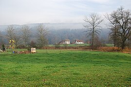
District Sulz

Aerial photo Künten 1947, view from the northwest

Aerial photo Künten 1964, view from the southwest

Aerial photo Künten 1967, view from the southeast


_151.jpg)
literature
- Sarah Brian Scherer: Künten. In: Historical Lexicon of Switzerland .
- Peter Hoegger: The art monuments of the canton of Aargau . Ed .: Society for Swiss Art History . Volume VI: District of Baden I. Birkhäuser Verlag, Basel 1976, ISBN 3-7643-0782-X .
Web links
Individual evidence
- ↑ Cantonal population statistics 2019. Department of Finance and Resources, Statistics Aargau, March 30, 2020, accessed on April 2, 2019 .
- ↑ Cantonal population statistics 2019. Department of Finance and Resources, Statistics Aargau, March 30, 2020, accessed on April 2, 2019 .
- ↑ a b Beat Zehnder: The community names of the canton of Aargau . In: Historical Society of the Canton of Aargau (Ed.): Argovia . tape 100 . Verlag Sauerländer, Aarau 1991, ISBN 3-7941-3122-3 , p. 235-237 .
- ^ National map of Switzerland, sheet 1090, Swisstopo.
- ↑ Standard area statistics - municipalities according to 4 main areas. Federal Statistical Office , November 26, 2018, accessed on June 3, 2019 .
- ^ Joseph Galliker, Marcel Giger: Municipal coat of arms of the Canton of Aargau . Lehrmittelverlag des Kantons Aargau, book 2004, ISBN 3-906738-07-8 , p. 195 .
- ↑ Population development in the municipalities of the Canton of Aargau since 1850. (Excel) In: Eidg. Volkszählung 2000. Statistics Aargau, 2001, archived from the original on October 8, 2018 ; accessed on June 3, 2019 .
- ↑ Resident population by religious affiliation, 2015. (Excel) In: Population and Households, Community Tables 2015. Statistics Aargau, accessed on June 3, 2019 .
- ↑ Swiss Federal Census 2000: Economic resident population by main language as well as by districts and municipalities. (Excel) Statistics Aargau, archived from the original on August 10, 2018 ; accessed on June 3, 2019 .
- ↑ circles of justice of the peace. Canton of Aargau, accessed on June 19, 2019 .
- ↑ Statistics of the corporate structure (STATENT). (Excel, 157 kB) Statistics Aargau, 2016, accessed on June 3, 2019 .
- ↑ Associations. Künten community, accessed December 12, 2018 .
Bathing | Bellikon | Bergdietikon | Birmenstorf | Things of honor | Ennetbaden | Fislisbach | Freienwil | Gibstorf | Killwangen | Künten | Mellingen | Mägenwil | Neuenhof | Niederrohrdorf | Oberrohrdorf | Obersiggenthal | Remetschwil | Spreitenbach | Stetten | Turgi | Untersiggenthal | Wettingen | Wohlenschwil | Würenlingen | Würenlos
Former municipalities: Büblikon | Dättwil | Kempfhof | Oberehrendingen | Oetlikon | Rohrdorf | Unterehrendingen
Canton of Aargau | Districts of the Canton of Aargau | Municipalities in the Canton of Aargau