
Wulsdorf
|
Wulsdorf
Wulsdbod ( Low German ) City of Bremerhaven
Coordinates: 53 ° 30 ′ 16 ″ N , 8 ° 36 ′ 4 ″ E
|
|
|---|---|
| Height : | 3 m above sea level NHN |
| Area : | 5.62 km² |
| Residents : | 10,851 (Dec. 31, 2018) |
| Population density : | 1,931 inhabitants / km² |
| Incorporation : | April 1, 1920 |
| Incorporated into: | City of Geestemünde |
| Postal code : | 27572 |
| Area code : | 0471 |
  Location of Wulsdorf in Bremerhaven
|
|
Wulsdorf ( Low German Wulsdbod ) is a district in the southern district of the municipality of Bremerhaven in the state of Bremen .
geography
location
In the south, Wulsdorf borders the municipality of Loxstedt . Otherwise, Wulsdorf is surrounded by Bremerhaven districts: the fishing port is to the west, Surheide to the east and Geestemünde to the north . Wulsdorf lies on the small river Rohr . The Weser flows in the west and the old Lune in the south-west . These two rivers used to be the municipal boundary of the place.
structure
| Districts | km² | Residents |
|---|---|---|
| Dreibergen | 1.60 | 5568 |
| Jedutenberg | 4.02 | 5283 |
(As of December 31, 2018; source :)
history
First mention and name
The place was originally laid out as a heap village and was first mentioned as Wallestorpe in 1139 in a document from the knight Trutbert that is still preserved today . The name changed in 1187 in Wolestorpe , 1313 in Woldesttorpe and 1420 in Woldestorp . This became Wolstorf and finally Wulsdorf . Wol or Wolde could have originated from the Frisian term for swampy area.
Village until the 19th century


Evidence of older settlements in the Stone, Bronze and Roman Ages have been handed down. As in Lehe, there was also a Jedutenberg , a man-made view in order to be able to recognize Norman incursions on the Weser side in the 9th century. The old Wulsdorfers called the guard hill Am Jedutenberg in the old town center (today southern district of Jedutenberg) also de Borch , perhaps because there was also a permanent house here.
In 1139 the Benedictine monastery " St. Paul vor der Stadt Bremen " was given goods and land from Wulsdorf and other places in the area. At the time, Welle also belonged to the historic parish, which was in the Stotel district and is now a district of Lanhausen . The Romanesque stone church with west tower and free-standing bell tower was a fortified church from the 12th century, which was first mentioned in 1138. It should have been higher earlier. In 1463 it was reported as the Dionysius Church Wulsdorf , which sealed a certificate from Vieland.
Around 1500 the village belonged to Vieland , a judicial district and later office to which Bramel , Geestendorf and Schiffdorf also belonged and which is still remembered today by the Vieländer Weg. In the Middle Ages, Vieland was part of the secular possession of the Diocese of Bremen , when the Archbishops of Bremen succeeded in creating a territory around Bremen that they ruled from the 11th century .
In 1648, due to the Peace of Westphalia, the Archdiocese of Bremen - and so also Wulsdorf - came under Swedish sovereignty as part of the Swedish Duchy of Bremen . In 1712 Wulsdorf and the Duchy of Bremen came to Denmark and in 1715 it was sold to the Electorate of Braunschweig-Lüneburg . From then on, Wulsdorf shared the history of the state of Hanover and, from 1866, the Prussian province of Hanover. In 1753 there were 100 campfire sites in the rural village and in 1850 the around 600 residents lived in mostly thatched-roof houses around the old church. The farmhouse Allersstrasse 27 from this period is remarkable . From 1779 Wulsdorf belonged to the Stotel-Vieland office.
During the French period in Bremen , Wulsdorf formed a municipality under French law in what was then the canton of Bremerlehe for three years . In addition to Wulsdorf, this community also included Geestendorf, Schiffdorf and Bramel, until the Stotel-Vieland office was finally restored after the victory over Napoleon .
From the rural community to the district


From 1831 to 1885 Wulsdorf then belonged to the Lehe office until the place was incorporated into the newly formed Geestemünde district in 1885 . In 1840 Wulsdorf got the status of a rural community , from whose area the district of the same name was formed in 1876 .
The road to Beverstedt was built around 1850 . At its confluence, the Lindenstrasse to Weserstrasse (mostly also called Chaussee), another new center of the place gradually developed. In 1856 the mill builder Carl Wegener built a gallery Dutch windmill on the Sandfahrel for the baker Heinrich Jantzen . The mill was bought by the mayor Johann Nicolaus Brakhahn (1819–1906) in 1860.
The development of the ports in Geestemünde and Bremerhaven also gave Wulsdorf a strong boost. For the workers from the neighboring ports, inexpensive building land could be found here; the place grew continuously. Netting, ice cream, canning, hemp and rope factories and a brewery were built. The Chaussee (today Bundesstraße 6 ) to Geestendorf, Geestemünde and Bremerhaven had to be expanded. After the church cemetery had become too small, the Hackfahrel cemetery , the Alt-Wulsdorfer Friedhof , was built in 1865 west of the church . In 1866 the Altwulsdorf school on Schulstrasse (from 1920 on Sandbredenstrasse) received a new building.
In 1870/71, with the consent of Prussia, the Bremerhaven cemetery was built in Wulsdorf for the deceased from old Bremerhaven, which had no space for it on its territory. The cemetery was built according to plans by the garden architect Wilhelm Benque . In 1888 the neo-Romanesque chapel was added. The postal agency opened in 1876. The Wulsdorf Voluntary Fire Brigade was founded in 1892 . 1891, the schoolhouse was at the Weserstraße created, which the old building of about 1932 so designated today Spruce school is. From 1891 the Bremerhaven horse-drawn tram ran from Geestemünde to the border with Wulsdorf.
In 1896 the Wulsdorfer Chaussee was led over a new railway bridge (ramp) to Geestemünde on Georgstraße . In 1894/94 the Villa Busse was built at Weserstraße 237 , later Villa Schlotterhose in the Swiss house style of the neo-renaissance . It was not until 1899 that the place received a train station (today a freight yard) for the Bremen-Geestemünde railway line, which had existed since 1862 . 1905 opened the Crown Pharmacy Julius Fielitz. In 1908 the tram depot was put into operation. From 1908 to 1960 an electric tram line ran through Wulsdorf, which connected the district with Geestemünde and the fishing port and which was extended to a small train station in 1911. In 1910, 2000 citizens demonstrated in Schwiefer's garden for fairer suffrage in Prussia. From 1911 a small train ran from Wulsdorf to Farge ( Niederweserbahn ). The railway line, which was partially closed in 1931 and completely closed in 1938, was reactivated between 1943 and 1945 as far as Sandstedt due to the war. In 1912 the rural advanced training school of 1896 developed into the trade school. In 1913 the first gas lanterns stood on Weserstrasse. Since 1916 the place had its post office on Weserstraße. The popular excursion destination was Café Simon an der Chaussee. There is a high-rise building here today.
Wulsdorf near Geestemünde, Wesermünde and Bremerhaven
Due to the space requirements of the neighboring town of Geestemünde to the north, Wulsdorf was separated from the district on April 1, 1920 and incorporated into the district-free town of Geestemünde. It came in 1924 as a district to the Prussian Wesermünde and in 1947 to Bremerhaven in the state of Bremen .
In 1927 the 33 m high residential water tower Wulsdorf , which also served to supply the fishing port, was completed. In 1935, today's Liethbreden settlement was created on Poggenbruchstrasse as a result of what was then the work front . In 1936 a fire destroyed nine buildings, including six old farmhouses. In 1938 the construction of the Wulsdorf industrial estate began with the first residential buildings. The new waterworks opened in 1939. Four sports clubs merged to form the Turn-Sport-Verein Wulsdorf from 1861.
During the Second World War , Wulsdorf was largely spared from bombing raids. After the surrender of the Wehrmacht, the British 51st (Highland) Division marched through Weserstraße on May 8, 1945 at 2:30 p.m.
In 1949 the Niederweserbahn (formerly Kleinbahn Farge-Wulsdorf ) began operating between Wulsdorf and Sandstedt with a diesel multiple unit . 1957 was the consecration of the new Evangelical Lutheran. Martin Luther Church on Blumenthaler Strasse. In 1959 she was consecrated to the Catholic Church. St. Nikolauskirche on Lützowstraße by Bishop Heinrich Maria Janssen . In 2012 the building was demolished. In 1960 tram line 3 was given up in favor of a bus line.
In 1971 Wulsdorf became a district through a redistribution of the districts in Bremerhaven.
The Federal Motorway 27 has had free travel since 1974 . Wulsdorf is accessed via the Bremerhaven-Wulsdorf exit on the B 71 and Bremerhaven-Süd / Nesse on the B 6.
Population development
| year | Residents | source |
|---|---|---|
| 1850 | 600 ¹ | |
| 1890 | 2,327 | |
| 1905 | 3,747 | |
| 1910 | 4,349 | |
| 1920 | 4,930 | |
| 2000 | 11,271 | |
| 2005 | 11,173² | |
| 2010 | 10,871 | |
| 2015 | 11,505 | |
| 2018 | 10,851 |
¹ Information: about
² 4.3% share of foreigners

|
politics
All citizens - including initiatives, groups and associations, schools, kindergartens, parishes and other institutions - can participate in the public district conference Wulsdorf (STK) in the design of the district, and this through their spokesman for the magistrate of the seaside city of Bremerhaven and the Bremerhaven city council represented. The first district conference took place on August 10, 1993.
Culture and sights
Buildings

- Churches
- The approximately 1000 year old, now Protestant, Dionysius Church is located in the old village center in Wulsdorf, Am Jedutenberg 2
- The Evangelical Lutheran Martin Luther Congregation , Blumenthaler Strasse 15, was established in 1966 as the second Wulsdorf congregation
- The Catholic St. Nikolaus Chapel , Lützowstraße 22, was built in the former parish hall of the neighboring St. Nicholas Church , which was built in 1959 and profaned in 2010 ; it belongs to the parish Hl.-Herz-Jesu in Geestemünde
- New Apostolic Church, Hildesheimer Strasse 9
- Residential water tower Wulsdorf
- Dionysius Church Wulsdorf , built in the 11th century, expanded in the 13th and 15th centuries
- Bremerhaven cemetery in Wulsdorf
- Neo- Romanesque chapel from 1888 with a former crematorium, memorial for those who fell in the First World War and a small neo-Gothic mausoleum Ahlers
Sports
- Police and Schutzhundesportverein , Vieländer Weg 116
- TSV Wulsdorf , Heinrich-Kappelmann-Straße 4, operates soccer, gymnastics, athletics, table tennis, a brass band, tennis, trampoline, volleyball, cycling groups, basketball, badminton and karate
- Wulsdorf rifle club from 1861 e. V. , Heinrich-Kappelmann-Straße 4: Traditional and sport shooting
Economy and Infrastructure
Companies
Today the companies in the food industry and the fish trade are the largest employers in the population of Wulsdorf. The neighboring, developing Luneplate , with a planned offshore port for wind turbines , will also create jobs.
Public facilities
schools
- Altwulsdorfer Schule , Sandbredenstraße 11, elementary school
- Fichteschule, Heidacker 13, elementary school in two construction stages
- Paula Modersohn School, Dreibergen 21, high school as an all-day school
 Altwulsdorf School
 Spruce school
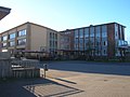 "Paula", the Paula Modersohn School

.JPG)
.JPG)
Social
- Parent-child initiative Mäuse vom Kampacker e. V.
- Evangelical-Lutheran day care center Wulsdorf "Mikado" , Am Jedutenberg 2
- Nursing service Krummenacker - BEW e. V. , Krummenacker 4
traffic
train
The district has its own train station on the Bremen – Bremerhaven railway line and the line towards Stade , from which the connection to Hamburg branches off in Bremervörde . Until 1964 there was also the Niederweserbahn , which allowed trips to the south-western area.
Public transport
In 1960 the district was also opened up by the Bremerhaven tram . Today the BremerhavenBus transport company connects the district with the city center and the northern districts on behalf of BVV. Regional buses complete the offer in the direction of Sandstedt , Dedesdorf , Hagen and Beverstedt . Public transport can be used with the uniform tariffs of the Bremen / Lower Saxony transport association.
Private transport
Individual traffic is made possible in particular by Weserstraße (the last part of the otherwise abandoned Bundesstraße 6 ), Lindenallee (formerly Bundesstraße 71 ) and the Südtangente (new Bundesstraße 71). The motorway junctions Bremerhaven-Süd (north of Nesse (Loxstedt) ) and Bremerhaven-Wulsdorf lead from the federal motorway 27 into the district.
Airfield
Personalities
Sons and daughters of the district
- Gustav Bertram (1883–1963), politician ( NSDAP )
- Robert Fiedler (1905–1974), politician ( SPD )
- Herbert Kölbel (1908–1995), chemist and professor at the Technical University of Berlin
People connected to the district
- Harry Gabcke (1927–1988), local history researcher and occasionally teacher at the Wulsdorfer Fichteschule
- Lydia Bohling (* 1930), politician ( CDU ), was a member of the Bremen citizenship , went to school in Wulsdorf
literature
- Dieter Bischop , Nicola Borger-Keweloh, Dieter Riemer (eds.): Castle and church in Wulsdorf. Bremerhaven 2014, ISBN 978-3-931771-00-3 .
- Harry Gabcke , Renate Gabcke, Herbert Körtge, Manfred Ernst: Bremerhaven in two centuries. Volumes I to III from 1827 to 1991, Nordwestdeutsche Verlagsgesellschaft, Bremerhaven 1989/1991/1992, ISBN 3-927857-00-9 , ISBN 3-927857-22-X , ISBN 3-927857-37-8 .
- Gerhard Grunwald: Chronicle of Wulsdorf. Bremerhaven 1990.
- Fritz Hörmann / Egon Stuve: Wulsdorf, older than 850 years. Bremerhaven 1989.
- Fritz Hörmann, Ude Meyer, Christian Morisse, Eberhard Nehring, Irmgard Seghorn, Egon Stuve, Else Syassen: Wesermünde field names collection - the field names of the property tax cadastre from 1876 . Ed .: Kulturstiftung der Kreissparkasse Wesermünde (= new series of special publications by the men from Morgenstern , Heimatbund an Elb- und Wesermuende eV Volume 27 ). Men from Morgenstern Verlag, Bremerhaven 1995, ISBN 3-931771-27-X , p. 23 ([ digitized version ( memento of October 26, 2007 in the Internet Archive )] [PDF; 431 kB ; accessed on October 23, 2019]).
- Egon Stuve: The Chronicle of Wulsdorf. Bremerhaven 1983.
- Egon Stuve: Wulsdorf. Historical images from two centuries. Small publications of the Bremerhaven City Archives 6, Bremerhaven 1989.
Web links
Individual evidence
- ↑ a b c d Brief statistical report. (PDF; 191 kB) 4th quarter 2018. In: Website City of Bremerhaven. Magistrat Bremerhaven - Bürger- und Ordnungsamt, December 31, 2018, p. 2 , accessed on April 6, 2020 .
- ↑ Harry Gabcke, Renate Gabcke, Herbert Körtge, Manfred Ernst: Bremerhaven in two centuries . 1919-1947. tape 2 . Nordwestdeutsche Verlagsgesellschaft, Bremerhaven 1991, ISBN 3-927857-22-X , p. 14 .
- ↑ Harry Gabcke, Renate Gabcke, Herbert Körtge, Manfred Ernst: Bremerhaven in two centuries . 1919-1947. tape 2 . Nordwestdeutsche Verlagsgesellschaft, Bremerhaven 1991, ISBN 3-927857-22-X , p. 14-15 .
- ↑ Harry Gabcke, Renate Gabcke, Herbert Körtge, Manfred Ernst: Bremerhaven in two centuries . 1919-1947. tape 2 . Nordwestdeutsche Verlagsgesellschaft, Bremerhaven 1991, ISBN 3-927857-22-X , p. 15 .
- ^ A b c Michael Rademacher: German administrative history from the unification of the empire in 1871 to the reunification in 1990. Wesermünde district. (Online material for the dissertation, Osnabrück 2006).
- ↑ Brief statistical report. (PDF; 59 kB) September 2001. In: Website City of Bremerhaven. Bremerhaven Magistrate - Statistical Office and Electoral Office, December 31, 2000, p. 2 , accessed on April 6, 2020 .
- ↑ Brief statistical report. (PDF; 153 kB) February 2006. In: Website City of Bremerhaven. Bremerhaven Magistrate - Statistical Office and Electoral Office, December 31, 2005, p. 2 , accessed on April 6, 2020 .
- ↑ Brief statistical report. (PDF; 104 kB) October 2011. In: Website City of Bremerhaven. Magistrat Bremerhaven - Bürger- und Ordnungsamt, December 31, 2010, p. 2 , accessed on April 6, 2020 .
- ↑ Brief statistical report. (PDF; 113 kB) October 2016. In: Website City of Bremerhaven. Magistrat Bremerhaven - Bürger- und Ordnungsamt, December 31, 2015, p. 2 , accessed on April 6, 2020 .
- ^ Paul Homann: Bremerhaven's route networks (ÖPNV) since 1881. (PDF; 2.7 MB) In: Website Bremerhavenbus. P. 34, bookmark January 4, 1960 , accessed June 11, 2020 .
- ^ Paul Homann: VGB-Nachrichten. (PDF; 3.1 MB) In: www.busse-weser.org. March 21, 2017, p. 470 , accessed June 11, 2020 .

Northern municipality: Weddewarden (Weddewarden) | Leherheide (Königsheide, Fehrmoor, Leherheide-West) | Lehe (Speckenbüttel, Eckernfeld, Twischkamp, Goethestrasse, Klushof, Schierholz, Buschkämpen) | Center (center-south, center-north)
District South: Geestemünde (Geestemünde-Nord, Geestendorf, Geestemünde-Süd, Bürgerpark, Grünhöfe) | Schiffdorferdamm (Schiffdorferdamm) | Surheide (Surheide) | Wulsdorf (Dreibergen, Jedutenberg) | Fischereihafen (Fischereihafen, Luneplate)
City of Bremen area: City of Bremen's overseas port area