
Ytyk-Kjujol
Village
|
||||||||||||||||||||||||||
|
||||||||||||||||||||||||||
|
||||||||||||||||||||||||||


Ytyk-Kjujol ( Russian Ытык-Кюёль ; Yakut Ытык-Күөл , unofficially also Таатта / Taatta ) is a village (selo) in the Republic of Sakha (Yakutia) with 6,828 inhabitants (as of October 14, 2010).
geography
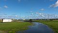
The settlement is located in the eastern part of the Central Yakut Lowlands , about 200 kilometers as the crow flies east of the republic capital Yakutsk , on the left Aldan tributary Tatta .
Ytyk-Kjujol is the administrative center of the Ulus (Rajons) Tattinski . Like the entire Ulus, the place is mainly inhabited by Yakuts ; their share in the population is over 95%.
history
The Yakut village, named after the lake of the same name on the Tatta (translated “Holy Lake”), became the administrative seat of the newly founded Alexejewski Rajon in 1930. In 1990 the Rajon got its current name, derived from the name of the river.
There are repeated strong floods in Ytyk-Kjujol , most recently in 2007, when 853 houses in the town were flooded and more than 3000 residents had to be evacuated.
Population development
| year | Residents |
|---|---|
| 1939 | 1160 |
| 1959 | 2378 |
| 1970 | 3352 |
| 1979 | 4118 |
| 1989 | 5658 |
| 2002 | 6267 |
| 2010 | 6828 |
Note: census data
Economy and Infrastructure
Ytyk-Kjujol is the center of an agricultural area with predominantly livestock husbandry (cattle and horses, especially the Yakut horse ), as well as the cultivation of potatoes, vegetables and fodder crops as well as forestry.
The place is on the R504 trunk road , which is also called Kolyma Street and connects the capital of the republic, Yakutsk, with Magadan , the center of the neighboring Magadan Oblast . On the route, which is particularly difficult to navigate in the direction of Magadan, it is almost 1,600 kilometers from Ytyk-Kjujol to Magadan, and around 250 to Jakutsk.
Picture gallery

Ytyk-Kjujol
Ytyk-Kjujol

theatre
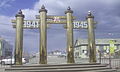
monument

monument

monument

Landscape near Ytyk-Kjujol


Individual evidence
- ↑ a b Itogi Vserossijskoj perepisi naselenija 2010 goda. Tom 1. Čislennostʹ i razmeščenie naselenija (Results of the All-Russian Census 2010. Volume 1. Number and distribution of the population). Tables 5 , pp. 12-209; 11 , pp. 312–979 (download from the website of the Federal Service for State Statistics of the Russian Federation)
- ↑ Flood in Yakutia - report on newsru.com from May 20, 2007 (Russian)
Web links
- Ulus Tattinski ( Memento from July 8, 2013 in the Internet Archive ) on a website of the University of Yakutsk (Russian)
| Cities |
Aldan R | Yakutsk S | Lensk R | Mirny R | Neryungri R | Nyurba R | Olyokminsk R | Pokrovsk R | Srednekolymsk R | Tommot | Udachny | Verkhoyansk | Wiljuisk R |
|
| Urban-type settlements |
Aichal | Allach-Jun | Almasny | Artyk | Batagai R | Belaja Gora R | Berkakit | Besymjanny | Chandyga R | Chani | Deputatski R | Jebariki-haya | Eldikan | Eat Chaija | Jugorjonok | Kyssyl-Syr | Lebediny | Leninsky | Mochsogolloch | Nagorny | Nizhnejansk | Nizhny Bestjach R | Nizhny Kuranach | Peledui | Sangar R | Schatai S | Serebryany Bor | Solnechny | Zolotinka | Swetly | Svyosdochka | Syrjanka R | Tiksi R | Torgo | Chernyshevsky | Chersky R | Tschokurdach R | Tschulman | Ust-Kuiga | Ust-Maja R | Ust-Nera R | Witim |
|
| Other Rajon centers |
Amga | Batagai-Alyta | Berdigestjach | Borogonzy | Chonuu | Namzy | Olenjok | Saskylach | Zhigansk | Suntar | Churaptscha | Verkhneviljuisk | Ytyk-Kjujol |