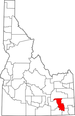
Bannock County
 Federal Building & US Courthouse in Pocatello |
|
| administration | |
|---|---|
| US state : | Idaho |
| Administrative headquarters : | Pocatello |
| Foundation : | March 6, 1893 |
| Made up from: | Bingham County |
| Demographics | |
| Residents : | 82,839 (2010) |
| Population density : | 28.7 inhabitants / km 2 |
| geography | |
| Total area : | 2972 km² |
| Water surface : | 88 km² |
| map | |
| Website : www.co.bannock.id.us | |
Bannock County is a county in the state of Idaho in the United States . It is located in the southeastern part of the state. The population is about 70,000, the area 2972 square kilometers.
Capital (County Seat) is Pocatello with almost 55,000 inhabitants . Furthermore, places like Chubbuck and Inkom belong to the county.
It is known, among other things, for the Pebble Creek ski area, which has the second steepest run in the United States.
history
Bannock County was formed on March 6, 1893 from parts of Bingham County with Pocatello as the county seat . The county was named after the Bannock Indians who previously lived in this area.
The county has a National Historic Landmark , Fort Hall . 28 other structures and sites are on the National Register of Historic Places .
Population development
| growth of population | |||
|---|---|---|---|
| Census | Residents | ± in% | |
| 1900 | 11,702 | - | |
| 1910 | 19,242 | 64.4% | |
| 1920 | 27,532 | 43.1% | |
| 1930 | 31,266 | 13.6% | |
| 1940 | 34,759 | 11.2% | |
| 1950 | 41,745 | 20.1% | |
| 1960 | 49,342 | 18.2% | |
| 1970 | 52,200 | 5.8% | |
| 1980 | 65,421 | 25.3% | |
| 1990 | 66,026 | 0.9% | |
| 2000 | 75,565 | 14.4% | |
| 2010 | 82,839 | 9.6% | |
| 1900–1990 2000 + 2010 | |||
Places in Bannock County
Census-designated places (CDP)
1 - small part in Power County
1 - partly in Bingham County
Individual evidence
- ↑ GNIS-ID: 395091. Retrieved on February 22, 2011 (English).
- ↑ Search mask database in the National Register Information System. National Park Service , accessed August 25, 2017.
- ↑ Extract from Census.gov . Retrieved February 14, 2011
- ↑ Extract from census.gov (2000 + 2010). Accessed April 2, 2012
Web links
- www.accessidaho.org (English)
- Bannock County at idaho.gov (engl.)
Coordinates: 42 ° 40 ′ N , 112 ° 13 ′ W

