
Idaho County
| administration | |
|---|---|
| US state : | Idaho |
| Administrative headquarters : | Grangeville |
| Foundation : | February 4, 1864 |
| Demographics | |
| Residents : | 15,679 (2005) |
| Population density : | 0.7 inhabitants / km 2 |
| geography | |
| Total area : | 22,021 km² |
| Water surface : | 46 km² |
| map | |
 |
|
| Website : www.idahocounty.org | |
Idaho County is a county in the state of Idaho in the United States . The administrative headquarters are in Grangeville . Idaho County is Idaho's largest county in terms of area.
geography
The county is located in central northwest Idaho and covers an area of 22,021 square kilometers; 46 square kilometers of this are water bodies. It is bordered clockwise by the following counties: Clearwater County , in Montana by Missoula County and Ravalli Counties , Lemhi County , Valley County , Adams County , in Oregon by Wallowa County , Nez Perce County, and Lewis County .
history
Idaho County was formed in 1861 as part of the Washington Territory . On February 4, 1864, Idaho County was reorganized by the new Legislative Administration of the Idaho Territory . From 1864 to 1875 Florence was the administrative seat of the county, from 1875 to 1902 it was Mount Idaho , and from 1902 Grangeville. The Idaho County was named after a steamship called "Idaho" that sailed the Columbia River .
37 structures and sites in the county are on the National Register of Historic Places .
Demographics
On July 1, 2005 there were 15,697 people in Idaho County.
age structure
| population | Years | proportion of |
|---|---|---|
| under | 18th | 25.0% |
| from | 18 - 24 | 6.3% |
| from | 25-44 | 23.3% |
| from | 45-64 | 28.4% |
| over | 65 | 17.0% |
The average age was 42 years.
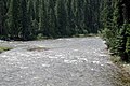
The confluence of the Selway and the Lochsa

Warm Lake

.jpg)
Places in the county
Individual evidence
- ↑ GNIS-ID: 395699. Retrieved on February 22, 2011 (English).
- ↑ Search mask database in the National Register Information System. National Park Service , accessed August 25, 2017.
Web links
List of counties in Idaho
Ada |
Adams |
Bannock |
Bear Lake |
Benewah |
Bingham |
Blaine |
Boise |
Bonn |
Bonneville |
Boundary |
Butte |
Camas |
Canyon |
Caribou |
Cassia |
Clark |
Clearwater |
Custer |
Elmore |
Franklin |
Fremont |
Gem |
Gooding |
Idaho |
Jefferson |
Jerome |
Kootenai |
Latah |
Lemhi |
Lewis |
Lincoln |
Madison |
Minidoka |
Nez Perce |
Oneida |
Owyhee |
Payette |
Power |
Shoshone |
Tetons |
Twin Falls |
Valley |
Washington
Coordinates: 45 ° 51 ′ N , 115 ° 28 ′ W