
Clamensans
| Clamensans | ||
|---|---|---|

|
|
|
| region | Provence-Alpes-Cote d'Azur | |
| Department | Alpes-de-Haute-Provence | |
| Arrondissement | Forcalquier | |
| Canton | Seyne | |
| Community association | Sisteronais-Buëch | |
| Coordinates | 44 ° 19 ′ N , 6 ° 4 ′ E | |
| height | 630-1,658 m | |
| surface | 23.73 km 2 | |
| Residents | 172 (January 1, 2017) | |
| Population density | 7 inhabitants / km 2 | |
| Post Code | 04250 | |
| INSEE code | 04057 | |
 Mairie and school |
||

Clamensane is a French municipality with 172 inhabitants (at January 1, 2017) in the department of Alpes-de-Haute-Provence in the region Provence-Alpes-Cote d'Azur . It belongs to the Arrondissement Forcalquier and the Canton of Seyne . The residents call themselves the Clamensanais .
geography
The municipality is located in the French Maritime Alps and borders on Le Caire to the north, Bayons to the east, Valavoire to the south, Châteaufort to the southwest and La Motte-du-Caire to the west . The village center is 700 meters above sea level. d. M. in the valley of the river Sasse . The Sommet de Bramefan is a 1658 meter high mountain.
Population development
| year | 1962 | 1968 | 1975 | 1982 | 1990 | 1999 | 2005 | 2012 |
|---|---|---|---|---|---|---|---|---|
| Residents | 128 | 125 | 106 | 110 | 115 | 131 | 151 | 181 |

Saint-Amand chapel
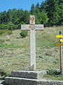
Cross from 1954

Notre-Dame church


Web links
Commons : Clamensane - collection of images, videos and audio files