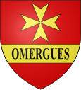
Les Omergues
| Les Omergues | ||
|---|---|---|

|
|
|
| region | Provence-Alpes-Cote d'Azur | |
| Department | Alpes-de-Haute-Provence | |
| Arrondissement | Forcalquier | |
| Canton | Sisteron | |
| Community association | Jabron-Lure-Vançon-Durance | |
| Coordinates | 44 ° 10 ′ N , 5 ° 36 ′ E | |
| height | 789-1,452 m | |
| surface | 34.22 km 2 | |
| Residents | 130 (January 1, 2017) | |
| Population density | 4 inhabitants / km 2 | |
| Post Code | 04200 | |
| INSEE code | 04140 | |
 Mairie Les Omergues |
||
Les Omergues is a French commune of 130 inhabitants (at January 1, 2017) in the department of Alpes-de-Haute-Provence in the region Provence-Alpes-Cote d'Azur . It belongs to the canton of Sisteron in the Forcalquier arrondissement .
geography
The village center is at 823 m . Around 2600 hectares of the municipality mark are forested. The municipality borders on Eygalayes to the north, Montfroc to the northeast, Redortiers to the southeast, Revest-du-Bion to the southwest, Ferrassières (point of contact) and Barret-de-Lioure to the west, and Sederon to the northwest .
Population development
| year | 1962 | 1968 | 1975 | 1982 | 1990 | 1999 | 2008 | 2013 |
|---|---|---|---|---|---|---|---|---|
| Residents | 98 | 110 | 87 | 101 | 65 | 99 | 123 | 129 |
Web links
Commons : Les Omergues - Collection of images, videos and audio files
