
Plesná
| Plesná | |||||
|---|---|---|---|---|---|
|
|||||
| Basic data | |||||
| State : |
|
||||
| Region : | Karlovarský kraj | ||||
| District : | Cheb | ||||
| Area : | 1925.6426 ha | ||||
| Geographic location : | 50 ° 13 ' N , 12 ° 21' E | ||||
| Height: | 499 m nm | ||||
| Residents : | 1,935 (Jan 1, 2019) | ||||
| Postal code : | 351 35 | ||||
| License plate : | K (old CH) | ||||
| traffic | |||||
| Railway connection: | Plauen-Cheb | ||||
| structure | |||||
| Status: | city | ||||
| Districts: | 4th | ||||
| administration | |||||
| Mayor : | Petr Schaller (as of 2018) | ||||
| Address: | 5. května 301 351 35 Plesná |
||||
| Municipality number: | 554740 | ||||
| Website : | www.mestoplesna.cz | ||||
| Location of Plesná in the Cheb district | |||||

|
|||||


Plesná ( German Fleißen ) is a town in Karlovarský kraj in the Czech Republic .
geography
Geographical location
The town belonging to the Kamenné vrchy nature park is located two kilometers east of Bad Brambach in the Bohemian Vogtland directly on the German border and belongs to the Okres Cheb . The location is in the valley of the Fleißenbach ( Plesná in Czech ) in the Elster Mountains . The 649 m high Bukový vrch ( Buchenberg ) rises to the southwest . Neighboring towns are Bad Brambach and Hohendorf in the west, Rohrbach and Smrčina in the north, Lomnička in the east and Velký Luh in the southeast. A border crossing for pedestrians and cyclists leads to the neighboring Bad Brambach in the village of Hammer along the Fleißenbach.
City structure
The town of Plesná consists of the districts Lomnička ( Steingrub ), Plesná ( Fleißen ), Smrčina ( Ermesgrün ) and Vackov ( Watzkenreuth ). Basic settlement units are Lomnička, Plesná, Smrčina, Šneky ( snails ) and Vackov.
The municipality is divided into the cadastral districts of Lomnička u Plesné, Plesná, Smrčina, Šneky and Vackov.
Neighboring places
| Bad Brambach | Luby (Schönbach) | |
.svg)
|
Nový Kostel (Neukirchen) | |
| Skalná (Wildstein) | Velký Luh (Großloh) | Křižovatka (Klinghart) |
history
The first mention of Vlizen was in the papal confirmation of Lucius III. 1185; the area had belonged to the Waldsassen monastery since 1150. In addition, since it was awarded by the monastery in 1199, there was a manor of Fleißen, whose first owner was Erchenbrecht von Fleißen. Its seat was a castle on Buchenberg, of which hardly any remains can be found. Her name was also lost; since the Josephine mapping of 1764 it was incorrectly called Neuhaus . The family died out as early as the 13th century and their goods reverted to the monastery.
When the monastery property was sold out in 1348, Rüdiger von Sparneck acquired the Schönbacher Sprengel , which also included Fleißen. The Sparnecker made the oath of allegiance to Charles IV and surrendered his property to the fiefdom of the Bohemian Crown . In 1429 the Hussites burned the place and the castle down. In the 15th century, the Schlick acquired Fleißen. The next owners from 1545 on were the lords of Wirsperg , who divided the rule into three and assigned parts of their property in Altenteich and Wildstein . The abandoned castle was captured and razed by an army from Eger in 1519 , as it had become the hideout of the Eger robber green.
The Protestant church was consecrated in 1849, previously the place was parish to Brambach and had its own Protestant parish since 1843. In 1850, around 1462 people lived in 160 houses in Fleißen, and from the middle of the 19th century the place belonged to the judicial district of Wildstein and the district of Eger . In 1863 construction began on the Voigtland state railway from Herlasgrün via Oelsnitz to Eger; the ruins of the castle were removed. The line was completed in 1869, but Fleißen only got its own train station in 1904. The town also participated in the construction of the local railway from Tirschnitz to Schönbach . During this time, factories were built, such as a shingle saw, paper mills, textile factories and a leather factory. In addition, the manufacture of musical instruments was located in Fleißen. The Johann Adam Geipel tannery became known beyond the country's borders. In 1898 the Catholic Church was consecrated. In 1900 Fleißen was granted city rights. In 1926 a Czech minority school opened.
After the Munich Agreement , the Czech minority fled the city in 1938 or was interned in Bad Brambach . At the end of the World War, the occupation of the SS officers' school in Karlsbad occupied the city against the advancing American troops and defended it from April 30th to May 2nd, 1945. During the fighting, most parts of Fleißen fell to rubble. After the end of the war, the German population was expelled from 1946; Romanians, Slovaks and Czechs from Volhynia were settled. The factories were confiscated and nationalized until 1948. The state-owned company TOSTA Plesná emerged from the textile companies, which was converted into the joint stock company TEKO Plesná after 1990 and later closed. In 1947 the town of Brod ( Henneberg ), which was located along the border and consisted of 23 chalets , was demolished . In 1949 Šneky was incorporated as Plesná II . In Plesná and Plesná II there was increased demolition of destroyed or dilapidated older buildings until 1951. The incorporation of Lomnička, Vackov and Smrčiny took place in 1965. The communist rulers demolished the castle in Lomnička in 1968 in a night and fog action, without its cultural and historical value being even examined. The castle in Plesná was also demolished in the same year.
After the textile industry collapsed, Plesná was mainly used for services and porcelain painting . Numerous prefabricated buildings were built in the city, most recently in 1993 and 2002, in which over a third of the population lives.
Population development
|
|
|
Culture and sights
- Catholic Church, built in 1898
- Jewish cemetery on the road to Velký Luh , laid out in 1895, with older tombstones
- Group of three stone crosses from the 16th century
- Burgstall Neuhaus

church
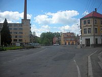
center

Stone crosses

Sand mining near Plesná, called Fleißner Sand


sons and daughters of the town
- Hermann Braun (1909–2005), folklorist and linguist, teacher and local politician in Marktredwitz
Web links
Individual evidence
- ↑ http://www.uir.cz/obec/554740/Plesna
- ↑ Český statistický úřad - The population of the Czech municipalities as of January 1, 2019 (PDF; 7.4 MiB)
- ↑ http://www.uir.cz/casti-obce-obec/554740/Obec-Plesna
- ↑ http://www.uir.cz/zsj-obec/554740/Obec-Plesna
- ↑ http://www.uir.cz/katastralni-uzemi-obec/554740/Obec-Plesna
- ↑ a b c Historický lexikon obcí České republiky - 1869-2015. (PDF) Český statistický úřad, December 18, 2015, accessed on February 11, 2016 (Czech).