Hanviller
| Hanviller | ||
|---|---|---|

|
|
|
| region | Grand Est | |
| Department | Moselle | |
| Arrondissement | Sarreguemines | |
| Canton | Bitche | |
| Community association | Pays de Bitche | |
| Coordinates | 49 ° 6 ′ N , 7 ° 28 ′ E | |
| height | 262-399 m | |
| surface | 8.66 km 2 | |
| Residents | 208 (January 1, 2017) | |
| Population density | 24 inhabitants / km 2 | |
| Post Code | 57230 | |
| INSEE code | 57294 | |
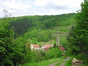
 View of Hanviller |
||
Hanviller ( German Hanweiler ) is a French commune with 208 inhabitants (as of January 1, 2017) in the northeast of the Moselle department in the Grand Est region (until 2015 Lorraine ). It belongs to the Arrondissement of Sarreguemines and the Canton of Bitche .
geography
Hanviller is located in the far northeast of Lorraine , a few kilometers south of the border with the Palatinate and directly northeast of Bitsch . After Bitsch, it is the second place on the course of the Hornbach , which rises south of the Hasselfurther Weiher .
history
Hanviller was first mentioned as Hanwylr in 1493. It belonged to the Counts of Zweibrücken-Bitsch and there to the office of Schorbach until the end of the 16th century. Before 1436, Friedrich the Elder of Zweibrücken-Bitsch built the Château de Gentersberg near Hanviller , of which a ruin northeast of the community still testifies.
Hanviller has belonged to France since 1766 and to the canton of Bitche since 1790.
Around 1850 the place still had over 500 inhabitants.
At the beginning of the Second World War , the inhabitants of the border village were evacuated to the Charente .
Population development
| year | 1962 | 1968 | 1975 | 1982 | 1990 | 1999 | 2007 | 2017 |
| Residents | 202 | 173 | 187 | 187 | 201 | 217 | 251 | 208 |
Web links
- Hanviller (French)
