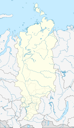
Kansk
| city
Kansk
Канск
|
||||||||||||||||||||||||||||||||||||||||||
|
||||||||||||||||||||||||||||||||||||||||||
|
||||||||||||||||||||||||||||||||||||||||||
| List of cities in Russia | ||||||||||||||||||||||||||||||||||||||||||
Kansk ( Russian Канск ) is a Russian city with 94,226 inhabitants (as of October 14, 2010) in the Krasnoyarsk region in Siberia .
geography
Kansk is located on the left bank of the Yenisei -Zuflusses Kan , at kilometer 4344 of the Trans-Siberian Railway and the 992 kilometers of the highway M53 . The distance to the regional capital Krasnoyarsk is almost 250 km to the west; the nearest town is Ilansky , 22 km east of Kansk.
history
The city is considered one of the older Siberian cities: It was built in 1636, originally as a wooden fortress (also called Ostrog ) to protect against possible Kyrgyz attacks. Until the middle of the 18th century, Kansk, whose name was based on the Kan River, was mainly considered a Cossack settlement and was repeatedly devastated during attacks.
Around 1740, the so-called Siberian tract was relocated through Kansk, which at the time was the only continuously passable connection road from Moscow to Siberia. This promoted the development of trade, but also made Kansk a place of exile, where people condemned to katorga were also sent. This fact continued into the 20th century, when Kansk was also used as a location for Gulag penal camps.
In 1822 Kansk received city rights and was an important trading center in the Krasnoyarsk region until the beginning of the 20th century. From this period, parts of the old town with former trading buildings and merchants' houses have been preserved in Kansk. From the 1940s, when several companies evacuated from European Russia as a result of the Second World War were set up in Kansk, Kansk turned into an industrial city.
Population development
| year | Residents |
|---|---|
| 1897 | 7,537 |
| 1939 | 41,584 |
| 1959 | 82,662 |
| 1970 | 94,680 |
| 1979 | 100,558 |
| 1989 | 109,607 |
| 2002 | 103,000 |
| 2010 | 94.226 |
Note: census data
economy
There are mechanical engineering, timber and textile industries in the city, many of which were closed after the collapse of the Soviet Union in the 1990s. Today wood processing and food production play an economic role in Kansk. There are several garrisons and military training areas in the vicinity of Kansk .
sons and daughters of the town
- Alexandra Ijewlewa (* 1987), figure skater
- Sergei Korastylew (* 1989), biathlete
Individual evidence
- ↑ a b Itogi Vserossijskoj perepisi naselenija 2010 goda. Tom 1. Čislennostʹ i razmeščenie naselenija (Results of the All-Russian Census 2010. Volume 1. Number and distribution of the population). Tables 5 , pp. 12-209; 11 , pp. 312–979 (download from the website of the Federal Service for State Statistics of the Russian Federation)
Web links
- Website of the city of Kansk (Russian)
- Kansk on mojgorod.ru (Russian)


