Borodino (Krasnoyarsk)
| city
Borodino
Бородино
|
||||||||||||||||||||||||||||||||||||||
|
||||||||||||||||||||||||||||||||||||||
|
||||||||||||||||||||||||||||||||||||||
| List of cities in Russia | ||||||||||||||||||||||||||||||||||||||
Borodino ( Russian Бородино ) is a city in the Krasnoyarsk region ( Russia ) with 17,416 inhabitants (as of October 14, 2010).
geography
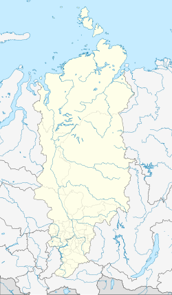
The city is located about 120 kilometers (as the crow flies) east of the regional capital Krasnoyarsk in the northern foothills of the Eastern Sayan Mountains . Near the town runs the river Irsha in the catchment area of the Yenisei -Nebenflusses Kan .
Borodino reports directly to the regional administration.
history
In the 1820s, the village of Borodino was built about five kilometers southeast of today's city center. It was founded by soldiers from the Semenovsky Regiment , an elite unit of the Russian Army , exiled to the area for disobeying orders in 1820, and named in memory of the Battle of Borodino during the Patriotic War of 1812.
In 1949 a workers' settlement ( urban type ) was built in connection with the beginning of the development of the Kansk - Atschinsk lignite basin . The Borodinski opencast mine (also Irscha-Borodinski ) started production in December of the same year.
In 1981 city rights were granted.
Population development
| year | Residents |
|---|---|
| 1959 | 9,921 |
| 1970 | 10,838 |
| 1979 | 11,331 |
| 1989 | 18,426 |
| 2002 | 19,181 |
| 2010 | 17,416 |
Note: census data
Culture and sights
Borodino has had a city history museum since 1998.
Economy and Infrastructure
City-forming enterprise is the open pit Borodinski , now south of the city of the Siberian Coal and Energy Company ( Sibirskaya ugolnaja energetitscheskaja kompanija heard Siberian Coal Energy Company, SUEK). A good 800 million tons of lignite have been mined since the open-cast mine was founded, up to 30 million tons per year.
The nearest railway station is located 15 kilometers northwest of Saosjorny on the Trans-Siberian Railway ( Saosjornaja station , route km 4264 from Moscow ). A works railway branches off here to the lignite opencast mines.
The M53 trunk road from Novosibirsk via Krasnoyarsk to Irkutsk bypasses the city to the east, not far from the old village and today's Borodino district.
sons and daughters of the town
- Olga Jakuschowa (* 1991), Russian biathlete
- Olga Medwedzewa (* 1975), Russian biathlete
- Olga Romasko (* 1968), Russian biathlete
Individual evidence
- ↑ a b Itogi Vserossijskoj perepisi naselenija 2010 goda. Tom 1. Čislennostʹ i razmeščenie naselenija (Results of the All-Russian Census 2010. Volume 1. Number and distribution of the population). Tables 5 , pp. 12-209; 11 , pp. 312–979 (download from the website of the Federal Service for State Statistics of the Russian Federation)
Web links
- Borodino at mojgorod.ru (Russian)


