
Karatusskoye
| Village
Karatusskoye
Каратузское
|
||||||||||||||||||||||||||||||||||
|
||||||||||||||||||||||||||||||||||
|
||||||||||||||||||||||||||||||||||


Karatusskoje ( Russian Карату́зское ) is a village (selo) in the Krasnoyarsk region in southern Siberia ( Russia ). The village, founded in 1787, has 7456 inhabitants (as of October 14, 2010).
geography
The place is about 270 km as the crow flies south of the regional administrative center of Krasnoyarsk and about 100 km east of Abakan , capital of the neighboring Republic of Khakassia in the foothills of Western Sayan . The Karatuska flows through the village and flows a few kilometers to the north into the Amyl River, the left source of the great Yenisei tributary Tuba .
Karatusskoje is the administrative center of the Karatusski rajon as well as the seat of the rural community (selskoje posselenije) Karatusski selsowet, which also includes the village of Sredni Kuschebar, which is 15 km south.
history
The village was probably founded in 1787 by Abakan Cossacks . The name is derived from Turkic ( Khakass ) chara tus for "black salt". In the 19th century the place was one of the most important gold prospecting centers in the region.
In 1924 Karatusskoje became the administrative seat of a Rajon named after him. At times, the shortened form of the name Karatus was also common, which is still unofficially in use today.
Karatusskoye as a Russian-German settlement center
After the decree of the Presidium of the Supreme Soviet of the Soviet Union on August 28, 1941 about the resettlement of the Germans living in the Rajons of the Volga region , the villages of the Karatusski rajon were one of the deportation destinations of the Volga Germans . Until 1955/1956 the Germans were under the command and were not allowed to move freely. After the laws were relaxed, many Germans moved to the administrative seat of the Rajon , the village of Karatusskoye. From about 1990, and especially after the dissolution of the Soviet Union relocated most ethnic German villagers, as well as from other parts of Russia and the other successor states of the Soviet Union to Germany. The high point of the move was in 1994.

Aerial view of the Karatusskoye village
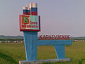
Place-name sign
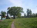
Meadow in front of a row of houses on Shevchenko Street
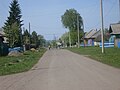
Street in Karatusskoye
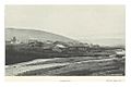
Karatusskoye in 1895
_-_Luftbild.jpg)
_-_Ortsschild.jpg)
_-_Shevchenko_Strasse.jpg)
_-_Strassenbild.jpg)
_p207_KARATUSKI.jpg)
Population development
| year | Residents |
|---|---|
| 1939 | 4582 |
| 1959 | 5527 |
| 1970 | 6610 |
| 1979 | 7501 |
| 1989 | 8864 |
| 2002 | 8025 |
| 2010 | 7456 |
Note: census data
traffic
Karatusskoje is the end point of the 04K-022 regional road, which branches off from 04K-029 Minussinsk - Artyomovsk in Kotschergino, about 40 km to the north, west of the neighboring district center of Kuragino . This connects to Abakan and Krasnoyarsk. Between Kotschergino and Kuragino there is also the nearest train station Tuba on the "South Siberian Magistrale" Abakan - Taischet .
In a southerly direction, a local road leads via Motorskoje and Schyryschtyk into Tansybei, a good 80 km away on the federal trunk road R257 (formerly M54) Krasnoyarsk - Abakan - Kyzyl - border to Mongolia . Karatusskoje itself has a bypass road on the western outskirts.
Web links
Individual evidence
- ↑ a b Itogi Vserossijskoj perepisi naselenija 2010 goda. Tom 1. Čislennostʹ i razmeščenie naselenija (Results of the All-Russian Census 2010. Volume 1. Number and distribution of the population). Tables 5 , pp. 12-209; 11 , pp. 312–979 (download from the website of the Federal Service for State Statistics of the Russian Federation)