Igarka
| city
Igarka
Игарка
|
||||||||||||||||||||||||||||||||||||||||
|
||||||||||||||||||||||||||||||||||||||||
|
||||||||||||||||||||||||||||||||||||||||
| List of cities in Russia | ||||||||||||||||||||||||||||||||||||||||
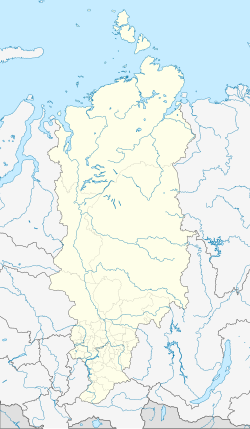
Igarka ( Russian Игарка ) is a Russian port city and formerly an important center of the timber industry opposite a river island of the Yenisei in the Krasnoyarsk region in central Siberia, 163 km north of the Arctic Circle . It was to be the eastern terminus of the Arctic Circle Railway , which was largely completed in the last years of Joseph Stalin's rule . The population has been declining for more than two decades, from 1989 it fell by two thirds to only 6183 today (as of October 14, 2010).
history
Igarka was founded in 1929 on the branch of the Yenisei, which has since been known as the Igarkian River ( Russian Игарская протока ) as a sawmill and sea port for timber exports, and in 1931 was granted city status. From 1936–1942 a scientific laboratory was also operated there, in whose 7 to 10 m deep tunnels in the permafrost and the constantly prevailing temperatures of −5 to −6 ° C, possible uses of the permafrost were researched.
Under Josef Stalin, the Council of Ministers of the USSR decided on January 29, 1949 to build a base for the Soviet Navy on the Yenisei in the Igarka district . From the city of Salekhard to the port of Igarka, a 1200 km long polar railway was to be built under the designations Project No. 501 on the Ob River and No. 503 on the Yenisei. In the north of the Krasnoyarsk region, construction project No. 503 was created. The headquarters were in the village of Yermakovo . After Stalin's death, construction was stopped in the summer of 1953 and planning for the naval base was abandoned. Only the telephone line between Salekhard and Igarka remained in operation until 1976. Today, a museum on the outskirts of the city commemorates the route, which was given the nickname Mjortwaja doroga (The Dead Route) because it was not completed .
In Igarka a museum on the topic of permafrost was opened on July 1, 1991 in the premises of the old scientific laboratory. In addition to objects archived and preserved in ice, there are also various layers of earth and larches up to 30,000 years old, which have been preserved in the ground.
economy
The high-sea port of Igarka, about 670 km from the mouth of the Yenisei, was put into operation in 1928 and was then used to load products from the local sawmill as well as products brought from Lessosibirsk by river boats onto ocean-going vessels. The port reached its heyday in the mid-1970s and early 1980s, when up to 1,236,000 cubic meters of wood were shipped, making it the second largest port for wood in the Soviet Union .
Igarka has an airport on the river island opposite the branch of the Yenisei ( IATA : IAA , ICAO : UOII , Russian Аэропорт "Игарка" ) with flight connections to Krasnoyarsk, Norilsk and Surgut , which can be reached directly in winter and by ferry in summer.
After the collapse of the Soviet Union and the decline of the sawmill, operations in the port also fell sharply. As a result of this, and as a result of the return of Ukrainians, Balts and other members of peoples who had become independent former Soviet republics, Igarka lost two thirds of the population, which culminated in a veritable exodus, especially at the end of the 1990s. In the meantime, there were plans to evacuate Igarka and relocate the remaining population to more southern areas of the Krasnoyarsk region, but these were abandoned due to the use of the Wankor oil field , which was discovered in 1988, 130 km west of Igarka, which was started in 2009 . Instead, oil companies are investing in the city's infrastructure, especially in the airport on the river island. Igarka has been the end point for cruises on the Yenisei since the cities of Dudinka and Norilsk, which are further downstream, were closed to foreigners in November 2001 .
Population development
| year | Residents |
|---|---|
| 1939 | 23,648 |
| 1959 | 14,311 |
| 1970 | 15,624 |
| 1979 | 16,335 |
| 1989 | 18,820 |
| 1996 | 14,900 |
| 2002 | 8,627 |
| 2010 | 6,183 |
Note: census data
sons and daughters of the town
- Damir Yusupov (* 1977), pilot
Web links
- Igarka on mojgorod.ru (Russian)
- homepage of the city of Igarka (Russian)
Individual evidence
- ↑ a b Itogi Vserossijskoj perepisi naselenija 2010 goda. Tom 1. Čislennostʹ i razmeščenie naselenija (Results of the All-Russian Census 2010. Volume 1. Number and distribution of the population). Tables 5 , pp. 12-209; 11 , pp. 312–979 (download from the website of the Federal Service for State Statistics of the Russian Federation)
- ↑ Archive link ( Memento of the original dated June 11, 2013 in the Internet Archive ) Info: The archive link was inserted automatically and has not yet been checked. Please check the original and archive link according to the instructions and then remove this notice. Rosneft Today. Vankor's Millions 2012


