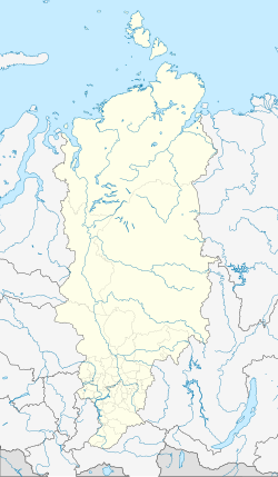
Balakhta
| Urban-type settlement
Balachta
Балахта
|
||||||||||||||||||||||||||||||||||||
|
||||||||||||||||||||||||||||||||||||
|
||||||||||||||||||||||||||||||||||||
Balachta ( Russian Балахта́ ) is an urban-type settlement in the Krasnoyarsk region in Russia with 7,410 inhabitants (as of October 14, 2010).
geography
The place is about 100 km as the crow flies southwest of the regional administrative center Krasnoyarsk on the right bank of the Ob tributary Chulym .
Balachta is the administrative center of the Rajons Balachtinski and seat of the municipality (gorodskoje posselenije) Possjolok Balachta, (17 km northeast) (8 km south-west) are among the also the villages Marjassowo (13 km southwest), Ogonki and Talowaja.
history
The place was founded by Cossacks in 1740 and was initially called Balakhtinskoe. In 1783 it was the seat of a Volost in Ujesd Krasnoyarsk (from 1822 Okrug of the Yeniseisk governorate ). On April 4, 1924, Balachta became the administrative seat of a Rajons named after him. It has had urban-type settlement status since 1961.
Population development
| year | Residents |
|---|---|
| 1939 | 4364 |
| 1959 | 4248 |
| 1970 | 7151 |
| 1979 | 7427 |
| 1989 | 7793 |
| 2002 | 7843 |
| 2010 | 7410 |
Note: census data
traffic
About 6 km east of Balachta the federal highway leads R257 (formerly M54) over, the Krasnoyarsk through Abakan and Kyzyl with the border with Mongolia connects. There the regional road 04K-042 (formerly R412) branches off, crosses Balakhta and leads via Ushur (120 km away, on the Achinsk - Abakan railway line ) to Sharypovo .
A small airport southwest of the settlement has been out of service since the early 1990s.
Web links
Individual evidence
- ↑ a b Itogi Vserossijskoj perepisi naselenija 2010 goda. Tom 1. Čislennostʹ i razmeščenie naselenija (Results of the All-Russian Census 2010. Volume 1. Number and distribution of the population). Tables 5 , pp. 12-209; 11 , pp. 312–979 (download from the website of the Federal Service for State Statistics of the Russian Federation)

