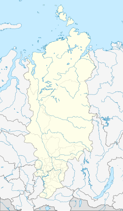
Tjuchtet (place)
| Village
Tjuchtet
Тюхтет
|
||||||||||||||||||||||||||||||||
|
||||||||||||||||||||||||||||||||
|
||||||||||||||||||||||||||||||||
Tjuchtet ( Russian Тюхте́т ) is a village (selo) in the Krasnoyarsk region in Russia with 4791 inhabitants (as of October 14, 2010).
geography
The place is about 230 km as the crow flies west-northwest of the regional administrative center Krasnoyarsk in the Chulym plain . It is located on the river Tjuchtet (also Jelanny Tjuchtet) of the same name , which flows into the Tschet about 2 km to the west .
Tjuchtet is the administrative center of Tjuchtetski Rajons and the seat of the rural community (selskoje posselenije) Tjuchtetski selsowet, which also includes the villages of Oskarowka (14 km southwest), Pokrowka (5 km west), Pusanowo (12 km south) and Romanowka (15 km south-west) .
history
The Russian settlement of the area, previously inhabited mainly by Chulymers and Siberian Tatars , did not begin until relatively late, in the 1820s. The proportion of Poles exiled after the January uprising was relatively large, and after a later surge of resettlement at the beginning of the 20th century, also Ukrainians , Belarusians and Latvians ( Latgals ). This is how Tjuchtet came about in 1924 as a resettlement place. On May 25, 1925, it became the administrative seat of a Rajon named after him.
Population development
| year | Residents |
|---|---|
| 1939 | 2802 |
| 1959 | 4113 |
| 1970 | 5267 |
| 1979 | 5182 |
| 1989 | 5937 |
| 2002 | 5219 |
| 2010 | 4791 |
Note: census data
traffic
The regional road 04K-004 leads to Tjuchtet, which branches off the federal trunk road R255 Baikal Novosibirsk - Krasnoyarsk - Irkutsk in the city of Bogotol, 40 km south . The closest train station to the Trans-Siberian Railway is also located there . From Tjuchtet the Tschet first runs down the largely unpaved 04N-893 to the village of Tschindat, about 100 km away, not far from the Tschulym .
A few kilometers north of Tjuchtet was a small airport ( ICAO code UNQH ) that has been out of service since the 1990s.
Web links
Individual evidence
- ↑ a b Itogi Vserossijskoj perepisi naselenija 2010 goda. Tom 1. Čislennostʹ i razmeščenie naselenija (Results of the All-Russian Census 2010. Volume 1. Number and distribution of the population). Tables 5 , pp. 12-209; 11 , pp. 312–979 (download from the website of the Federal Service for State Statistics of the Russian Federation)

