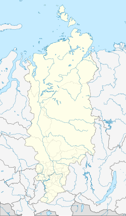
Solnechny (Krasnoyarsk)
| Urban-type settlement
Solnechny
Solnechny
|
||||||||||||||||||||||||||||||||||||||||||
|
||||||||||||||||||||||||||||||||||||||||||
|
||||||||||||||||||||||||||||||||||||||||||
| List of large settlements in Russia | ||||||||||||||||||||||||||||||||||||||||||
Solnetschny ( Russian Со́лнечный ) is an urban-type settlement in the Krasnoyarsk region ( Russia ) with 10,384 inhabitants (as of October 14, 2010).
geography
The settlement is located in the northeastern foothills of the Kuznetsk Alatau , a good 200 km southwest of the regional capital Krasnoyarsk .
Solnetschny is one of Russia's closed settlements (SATO) and as such is administratively directly subordinate to the regional administration. It borders directly from the southwest to the small town of Ushur , from whose center it is only about four kilometers away.
history
The prefabricated housing estate was built in 1965 as a housing estate for members of the Soviet Army after the 62nd Missile Division of Tomsk of the Soviet Union's Strategic Missile Forces had been relocated to this area in 1962 . It was initially named Ushur-4 after the nearby city .
Intercontinental ballistic missiles of the type R-36M ( NATO code SS-18 “Satan” ) were and are stationed in the vicinity of the settlement .
On July 14, 1992 the previously secret settlement officially became a "closed administrative-territorial entity (SATO)", in 1995 it received its current name (Russian for sunny [settlement] ) and the administrative status of an urban-type settlement directly subordinate to the region.
Population development
| year | Residents |
|---|---|
| 2002 | 10,809 |
| 2010 | 10,384 |
Note: census data
Economy and Infrastructure
The economy of the settlement is geared towards its character as the location of the Strategic Missile Forces (RWSN) of the Russian Armed Forces . Here are mainly supply facilities for military personnel and their families.
The nearest train station is in neighboring Ushur on the Achinsk - Abakan line . The regional road R 412 also runs through Ushur , which connects the places via Scharypowo with the trunk road M54 near Nasarowo .
Individual evidence
- ↑ a b Itogi Vserossijskoj perepisi naselenija 2010 goda. Tom 1. Čislennostʹ i razmeščenie naselenija (Results of the All-Russian Census 2010. Volume 1. Number and distribution of the population). Tables 5 , pp. 12-209; 11 , pp. 312–979 (download from the website of the Federal Service for State Statistics of the Russian Federation)
- ↑ Solnetschny ( Memento of the original from June 20, 2009 in the Internet Archive ) Info: The archive link was inserted automatically and has not yet been checked. Please check the original and archive link according to the instructions and then remove this notice. on the official website of the Krasnoyarsk Territory (Russian)
- ↑ Andrej Švajčenko (ed.): Omskaja strategičeskaja 1959-2004 . 2., ext. Edition. Omsk 2004 ( The Omsk Strategic [Army] 1959–2004 ; Russian).


