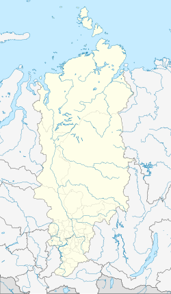
Artyomovsk
| city
Artyomovsk
Артёмовск
|
||||||||||||||||||||||||||||||||||||
|
||||||||||||||||||||||||||||||||||||
|
||||||||||||||||||||||||||||||||||||
| List of cities in Russia | ||||||||||||||||||||||||||||||||||||
Artjomowsk ( Russian Артёмовск ) is a small town in the Krasnoyarsk region ( Russia ) with 2179 inhabitants (as of October 14, 2010).
geography
The city is located on the southwest flank of the Eastern Sayan , about 180 km (as the crow flies) south of the regional capital Krasnoyarsk , on the Jeb River in the Yenisei river system .
The city of Artyomovsk is located in Kuragino Raion , about 70 kilometers northeast of the administrative center of Kuragino , which does not have city rights, but today exceeds Artyomovsk six times as much in terms of population.
history
The village of Olchowka (from Russian olcha for alder ) was built around 1700 in the area of today's city . In 1835 the place was mentioned as a settlement Olchowski near a gold mine . With the expansion of gold mining during the Soviet era , the town grew and was given town charter in 1939 under its current name (after the revolutionary Fyodor Sergejew , known as Artyom ). Shortly after the city charter was granted, the importance of this area began to decline in the 1940s with the shift in the focus of gold mining to other regions of the country, and the population fell sharply. With the factual cessation of gold production in the 1990s, the place gradually becomes a ghost town .
Population development
| year | Residents |
|---|---|
| 1939 | 23,513 |
| 1959 | 13,073 |
| 1970 | 10,485 |
| 1979 | 9,988 |
| 1989 | 4,521 |
| 2002 | 2,929 |
| 2010 | 2,179 |
Note: census data
economy
Gold mining with the by-products copper and silver , formerly in the hands of Yenisseisoloto , came to a standstill in the 1990s.
Eight kilometers away, the South Siberian Railway Abakan - Taischet, completed in 1965, runs past the village ( Koschurnikowo station near the settlement of the same name).
Individual evidence
- ↑ a b Itogi Vserossijskoj perepisi naselenija 2010 goda. Tom 1. Čislennostʹ i razmeščenie naselenija (Results of the All-Russian Census 2010. Volume 1. Number and distribution of the population). Tables 5 , pp. 12-209; 11 , pp. 312–979 (download from the website of the Federal Service for State Statistics of the Russian Federation)
Web links
- Artyomovsk on mojgorod.ru (Russian)

