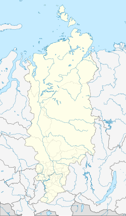
Ujar
| city
Ujar
Уяр
|
||||||||||||||||||||||||||||||||||||||
|
||||||||||||||||||||||||||||||||||||||
|
||||||||||||||||||||||||||||||||||||||
| List of cities in Russia | ||||||||||||||||||||||||||||||||||||||
Ujar ( Russian Уя́р ) is a small town in the Siberian region of Krasnoyarsk ( Russia ) with 12,665 inhabitants (as of October 14, 2010).
geography
The city is located about 130 km east of the regional capital Krasnoyarsk on the Ujarka river in the Yenisei river system .
The city of Ujar is the administrative center of the Rajon of the same name .
history
The place was created during the construction of the Siberian tract , after a resettler from the then Simbirsk governorate had built a hut here in 1760 . Ujar later became a post office .
In 1897 the East Siberian section of the Trans-Siberian Railway was passed through the place, which went into operation over its entire length in 1899 (Krasnoyarsk - Irkutsk ). The train station, initially called Ujarskaya after the river , was named as early as 1897 after the then larger village of Olgino , a few kilometers north, and was renamed again in 1906, after a train engineer, in Klyukwennaya .
From the 1920s the place developed on the basis of raw materials extracted in the area into a regional center of the building materials industry with a brick factory, a factory for refractory materials and a factory for mica products . In 1944 the city charter was granted under its current name.
The station was only named Ujar in 1973 after it had been expanded into a hub in the 1960s.
Population development
| year | Residents |
|---|---|
| 1874 | 1,100 |
| 1939 | 15,347 |
| 1959 | 21,646 |
| 1970 | 20,581 |
| 1979 | 18,028 |
| 1989 | 17,040 |
| 2002 | 13,807 |
| 2010 | 12,665 |
Note: from 1939 census data
Culture and sights
In the village of Olgino a wooden church from the beginning of the 20th century has been preserved, in Ujar itself various station buildings, including the water tower , from the same period.
Economy and Infrastructure
The most important branch of industry is the construction industry , u. a. with a factory for precast concrete products . In addition, the city is the center of an agricultural area with various companies in the food industry.
In Ujar there is a larger station of the Trans-Siberian Railway (km 4229 from Moscow ), from which a 56-kilometer cross-connection to the parallel South Siberian Railway Abakan - Tayshet ( Sajanskaya station ) branches off.
The M53 Novosibirsk- Krasnoyarsk-Irkutsk- Listvyanka road bypasses the city to the north.
Individual evidence
- ↑ a b Itogi Vserossijskoj perepisi naselenija 2010 goda. Tom 1. Čislennostʹ i razmeščenie naselenija (Results of the All-Russian Census 2010. Volume 1. Number and distribution of the population). Tables 5 , pp. 12-209; 11 , pp. 312–979 (download from the website of the Federal Service for State Statistics of the Russian Federation)
Web links
- Ujar on mojgorod.ru (Russian)


