Beryosovka (Krasnoyarsk)
| Urban-type settlement
Beryosovka
Berzovka
|
||||||||||||||||||||||||||||||||||||
|
||||||||||||||||||||||||||||||||||||
|
||||||||||||||||||||||||||||||||||||
| List of large settlements in Russia | ||||||||||||||||||||||||||||||||||||
Berjosowka ( Russian Берёзовка ) is an urban-type settlement in the Krasnoyarsk region ( Russia ) with 20,887 inhabitants (as of October 14, 2010).
geography
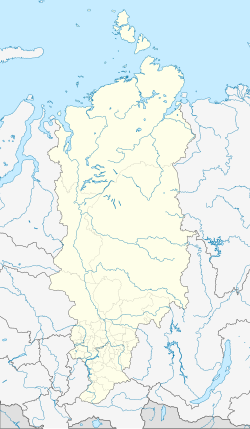
The settlement is located at the foot of the northern foothills of the Sayan Mountains , a good 15 kilometers east of the center of the regional capital Krasnoyarsk on the right bank of the Yenisei , at the confluence of the Beryosovka brook. The place merges practically seamlessly into the industrial areas on the south-eastern edge of the city.
Berjosowka is the administrative center of the Berjosowka Rajon of the same name .
history
The history of the place begins with the foundation of the Mariä-Tempelgang- Male Monastery ( Введенский монастырь / Vwedenski monastyr ) with a “poor house” for sick or wounded Cossacks in 1639, only a few years after the founding of Krasnoyarsk. In 1678 a village is mentioned.
In 1768 the monastery was closed, but the village continued to develop. In 1821 a stone church was built. From 1840 there was a ferry connection over the Yenisei in the course of the Siberian tract .
With the rapid growth of the city of Krasnoyarsk after 1945, Berjosowka also developed into a larger supply and residential suburb of the city. In 1966 the place received the status of an urban-type settlement, but still belonged to the Jemeljanowo Raion , which included practically the entire area around the city of Krasnoyarsk. In 1983 the areas to the right of the Yenisei were spun off as an independent Rajon and Berjosowka became its administrative center.
Population development
| year | Residents |
|---|---|
| 1939 | 993 |
| 1959 | 3,174 |
| 1970 | 15,526 |
| 1979 | 17,465 |
| 1989 | 20,766 |
| 2002 | 21,346 |
| 2010 | 20,887 |
Note: census data
Culture and sights
Immediately to the east of the place is the Berjosowski Bor pine forest area , which is used for local recreation .
Economy and Infrastructure
In Berjosowka there are companies in the building materials industry (extraction of gravel and sand), agriculture ( intensive rearing of poultry and cattle) and the food industry (large bakery) as well as wood processing and light industry.
The Trans-Siberian Railway (Transsib) passes southwest of the settlement and turns away from its course from the Yenisei Bridge parallel to the river, and leads south up the valley of the Berjosowka river. On the route there is a suburban train connection from Krasnoyarsk to Beryosovka ( Sady stop , route kilometer 4121); city buses also run. From the nearby Trans-Siberian railway stations Basaicha and Sykowo, the branch line branches off at the edge of Berjosowka to the northeastern " closed city " Zhelesnogorsk and the northern freight bypass around Krasnoyarsk.
The M53 Novosibirsk - Irkutsk road , part of the transcontinental road link , runs through Berjosowka . A newer bypass road runs east and north on the banks of the Yenisei past the settlement.
There is a landing stage at the Yenisei.
Individual evidence
- ↑ a b Itogi Vserossijskoj perepisi naselenija 2010 goda. Tom 1. Čislennostʹ i razmeščenie naselenija (Results of the All-Russian Census 2010. Volume 1. Number and distribution of the population). Tables 5 , pp. 12-209; 11 , pp. 312–979 (download from the website of the Federal Service for State Statistics of the Russian Federation)
Web links
- Settlement Administration website (Russian)
- Beryosovka on the website of the Geographical Institute of the RAN (Russian)


