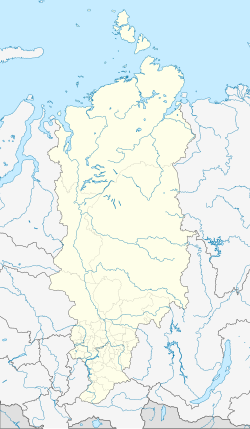
Nizhnyaya Poima
| Urban-type settlement
Nizhnyaya Poima
Нижняя Пойма
|
||||||||||||||||||||||||||||||||||||||
|
||||||||||||||||||||||||||||||||||||||
|
||||||||||||||||||||||||||||||||||||||
Nizhnyaya Poima ( Russian: Ни́жняя По́йма ) is an urban-type settlement in the Krasnoyarsk region in Russia with 9,000 inhabitants (as of October 14, 2010).
geography
The place is about 270 km as the crow flies east of the regional administrative center of Krasnoyarsk not far from the border with Irkutsk Oblast on the river Reshoty, which flows a good 15 km north of the right into the Birjussa tributary Poima .
Nizhnyaya Poima belongs to Nizhneingaschski Rajon , is located a good 40 km east of its administrative seat Nizhny Ingash and is the seat of the municipality (gorodskoje posselenije) Possjolok Nizhnyaya Poima, which also includes the settlements Klyuchi (11 km southeast) and Kurdojaki (9 km south-southeast) .
history
A village called Reshetinskaya not far from today's settlement was first mentioned in 1827. The place only gained some importance with the passage of the Trans-Siberian Railway at the end of the 19th century and the establishment of the local railway station Reshoty, as the place was now called.
At the end of the 1930s, Reshoty became one of the main locations of the Krasnoyarsk corrective labor camp (KrasLag) in the Gulag system . Up to 31,000 inmates in the camp were simultaneously primarily engaged in wood extraction and processing; For this purpose, a railway line was built from the station in a northerly direction with a large number of adjacent forest railways . A new settlement called Nizhnyaya Poima, literally “Lower floodplain ” in relation to its location, was built north of the station . In July 1949 the camp administration was moved from Kansk to Reshoty, as the place was officially called. On March 28, 1951, the place was given the status of an urban-type settlement, now as Nizhnyaya Poima after the now most important district.
In the 1950s, the settlement had the population of a medium-sized town , but as a result of the closure of most storage facilities in the early 1960s and the reduced importance of the timber industry in the area, it declined sharply until the 1970s. Since then, the population decline has continued at a lower level.
Population development
| year | Residents |
|---|---|
| 1959 | 32,021 |
| 1970 | 17,075 |
| 1979 | 11,456 |
| 1989 | 9,844 |
| 2002 | 9,711 |
| 2010 | 9,000 |
Note: census data
traffic
In Nizhnyaya Poima, the Reshoty station named after the river is located at 4452 km (from Moscow) of the Trans-Siberian Railway. There, a 259 km long branch line, completed in 1977, branches off in a northerly direction to the Karabula station near the Tajoschny settlement ; its continuation to the village of Jarki near Bogutschany an der Angara has been under construction since 2009 (status 2018).
To the south, Nizhnyaya Poima is bypassed by the federal highway R255 Sibir Novosibirsk - Irkutsk as part of the transcontinental road link. Until the completion of the bypass in 2014, the route ran through the settlement.
Web links
Individual evidence
- ↑ a b Itogi Vserossijskoj perepisi naselenija 2010 goda. Tom 1. Čislennostʹ i razmeščenie naselenija (Results of the All-Russian Census 2010. Volume 1. Number and distribution of the population). Tables 5 , pp. 12-209; 11 , pp. 312–979 (download from the website of the Federal Service for State Statistics of the Russian Federation)
- ^ Krasnoyarsk ITL on the GULAG website of Memorial Deutschland e. V.


