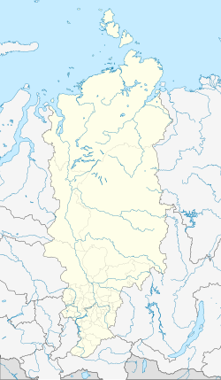
Idrinskoye
| Village
Idrinskoye
Irinskoe
|
||||||||||||||||||||||||||||||||
|
||||||||||||||||||||||||||||||||
|
||||||||||||||||||||||||||||||||
Idrinskoje ( Russian И́дринское ) is a village (selo) in the Krasnoyarsk region in Russia with 5135 inhabitants (as of October 14, 2010).
geography
The place is about 190 km as the crow flies south of the regional administrative center Krasnoyarsk on the edge of the northwestern foothills of the Western Sayan . It is located on the left bank of the right Yenisei tributary, Syda , almost 20 km above its mouth in an elongated bay of the Krasnoyarsk reservoir . In the village the name-giving small left tributary Idra flows into the Syda.
Idrinskoje is the administrative center Rajons Idrinski and seat of the rural community selsowet (selskoje posselenije) Idrinski, also (4 km northeast) and Vostochny (3 km east) belong to the settlements Sibir.
history
The village was founded in 1736. Since April 4, 1924 it has been the administrative seat of a Rajon named after him, with interruptions from 1932 to 1935, when the Rajon was dissolved and its territory became the Abakanski, from 1933 Krasnoturanski rajon with its seat today (after relocation due to the flooding of the Krasnoyarsk reservoir) 40 km to the west of Krasnoturansk was attached.
Population development
| year | Residents |
|---|---|
| 1897 | 1704 |
| 1939 | 4069 |
| 1959 | 4911 |
| 1970 | 5890 |
| 1979 | 5517 |
| 1989 | 6513 |
| 2002 | 5585 |
| 2010 | 5135 |
Note: census data
traffic
The regional road 04K-014 leads to Idrinskoje, which branches off 20 km southwest of the 04K-028. This begins about 75 km south-southwest near Minusinsk on the federal trunk road R257 Yenisei (formerly M54) from Krasnoyarsk via the Khakas capital Abakan and the Tuvin capital Kyzyl to the Mongolian border and follows the eastern side of the Krasnoyarsk reservoir to the village of Bellyk , from where there is a connection to a car ferry across the reservoir at the northwestern neighboring district of Novosjolowo . There the R257 is reached again. The nearest train station is in Minusinsk on the Novokuznetsk - Abakan - Taischet highway in South Siberia .
There was a small airport about 8 km west of the village, but it has been out of service since the early 1990s.
Web links
Individual evidence
- ↑ a b Itogi Vserossijskoj perepisi naselenija 2010 goda. Tom 1. Čislennostʹ i razmeščenie naselenija (Results of the All-Russian Census 2010. Volume 1. Number and distribution of the population). Tables 5 , pp. 12-209; 11 , pp. 312–979 (download from the website of the Federal Service for State Statistics of the Russian Federation)

