Middes
| Middes | ||
|---|---|---|
| State : |
|
|
| Canton : |
|
|
| District : | Glane | |
| Municipality : | Torny | |
| Postal code : | 1749 | |
| former BFS no. : | XXXX | |
| Coordinates : | 562 675 / 179 615 | |
| Height : | 705 m above sea level M. | |
| Residents: | 331 (2002) | |
| map | ||
|
|
||
Middes ( Friborg Patois ) is a village and formerly an independent political municipality in the Glane district of the canton of Friborg in Switzerland . On January 1, 2004, Middes merged with Torny-le-Grand to form the new municipality of Torny .
geography
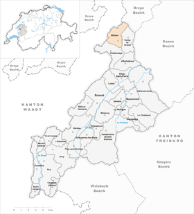
Middes is 705 m above sea level. M. , eight kilometers north-northeast of the district capital Romont (linear distance ). The village extends on a wide ridge in a panoramic position on the eastern edge of the central Broyetal , on the Molasse plateau of the Freiburg Central Plateau . The former municipality area was around 5.1 km². The area extended from the Bois de la Cigogne forest ( 660 m above sea level ) over the slope sloping towards the Broyetal and the ridge of Middes (on the Maumont 732 m above sea level ) to the height of La Brevire .
population
With 331 inhabitants (2002), Middes was one of the small communities in the canton of Friborg before the merger. Middes include the hamlets of Torny-le-Petit ( 655 m above sea level ) on a hill above the Broyetal and Le Rialet ( 672 m above sea level ) in the headwaters of the Bioleyre as well as some individual farms.
economy
Until the second half of the 20th century, Middes was predominantly an agricultural village. Even today, dairy farming , animal husbandry and, to a lesser extent, arable farming play an important role in the income structure of the population. A few other jobs are available in local small businesses (including in a construction company) and in the service sector. In the last few decades the village has also developed into a residential community thanks to its attractive location. Many employed people are therefore commuters who mainly work in the Freiburg and Payerne regions.
traffic
The village is located off the main thoroughfares on a connecting road from Payerne to Châtonnaye . Middes has a connection to the public transport network through the Postbus course , which runs from Romont to Avry .
history
The place was first mentioned in a document in 930 under the name Mildes . The names Mides (1212), Middes (1218) and also Migdes appeared later in the 13th century. Since the Middle Ages Middes belonged to the Montagny dominion, which was under the sovereignty of the Counts of Savoy . With this it came after the Burgundian Wars in 1477 to Freiburg, which converted the rule into a bailiwick.
After the collapse of the Ancien Régime (1798) Middes belonged to the Payerne district during the Helvetic Republic until 1803. The village then moved to the Montagny district and in 1830 to the Dompierre district before being incorporated into the Glâne district in 1848.
Middes, Torny-le-Grand and Châtonnaye were to be merged as part of the municipal mergers that the canton of Friborg has promoted since 2000 . As the residents of Châtonnaye opposed the merger, only the merger of Torny-le-Grand and Middes to form the new municipality of Torny came into force on January 1, 2004 .
Attractions
The former castle of Middes, built in the 16th century, now serves as a farmhouse. It has a polygonal stair tower, cross-frame windows and a portal dated 1676. A stately mansion is located near this castle, which was built in 1749 for the Vogt von Bulle. It is surrounded by an English garden.
Web links
- Evelyne Maradan: Middes. In: Historical Lexicon of Switzerland .
- Aerial views of the village


