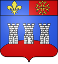
Montcuq
| Montcuq | ||
|---|---|---|

|
|
|
| local community | Montcuq-en-Quercy-Blanc | |
| region | Occitania | |
| Department | Lot | |
| Arrondissement | Cahors | |
| Coordinates | 44 ° 20 ′ N , 1 ° 13 ′ E | |
| Post Code | 46800 | |
| Former INSEE code | 46201 | |
| Incorporation | January 1, 2016 | |
| status | Commune déléguée | |
 View over Montcuq |
||
Montcuq is a village and a commune déléguée in the French commune of Montcuq-en-Quercy-Blanc with 1,200 inhabitants (as of January 1, 2017) in the Lot department in the Occitanie region . The long-distance hiking trail GR 65 leads through Montcuq , which largely follows the historical course of the French Way of St. James, Via Podiensis .
geography
Montcuq is located in the Quercy-Blanc area , the area where the Garonne and Tarn rivers converge , which forms a limestone plateau intersected by many river valleys. The place is located on a green hill above the river Barguelonnette and is crowned by the square tower of the former fortress. While the old town center is on the hill, the newer part with the industrial area stretches along the river.
The next town is Cahors , which can be reached in a north-easterly direction via the D653 after about 28 kilometers of road. The closest major French cities are Toulouse (84 km) in the south, Bordeaux (153 km) in the north-west and Montpellier (228 km) in the south-east.
history
The place is of Gallo-Roman origin. In the 12th century it was the capital of a castellany given by Raymond VII , Count of Toulouse . After the Treaty of Meaux of 1229 the castle and chateau of Montcuq were demolished on the orders of the French king. All that was left was the tower that is still visible today. In the Hundred Years' War and the Wars of Religion Montcuq was destroyed several times.
The municipality of Montcuq merged with Belmontet , Lebreil , Sainte-Croix and Valprionde on January 1, 2016 to form the Commune nouvelle Montcuq-en-Quercy-Blanc and has since had the status of a Commune déléguée there .
Way of St. James ( Via Podiensis )
The long-distance hiking trail GR 65 leads through Montcuq , which largely follows the historical course of the French Way of St. James, Via Podiensis . In the village there is a pilgrim hostel (French: Gîte d'étape ), hotels and private rooms (French: Chambre d'hôtes ), as well as a campsite and a tourist information office. The path continues through the foothills of the Causse du Blanc plateau , which is now intersected by many small streams, to the next larger town, Lauzerte . These brooks flow to the Tarn, which soon flows into the Garonne. The landscape is characterized by rolling hills on which fruit and vegetables are grown. Further accommodations on the way to Lauzerte are in Lubrugade, from where a variant leads back to the GR 65 , and in Montlauzun. The D953 leads to Lauzerte as a road connection .
Attractions
- Church Eglise de Rouillac from the 12th century Romanesque wall paintings in the choir
- Remains of the fortification with the Tour de Montcuq , a 30 meter high tower with almost two meter thick walls from the 12th century
- Charry Castle from the 15th and 17th centuries
Town twinning
- Cinigiano , in the province of Grosseto in Italy
literature
- Bettina Forst: French Way of St. James. From Le Puy-en-Velay to Roncesvalles. All stages - with variants and height profiles. Bergverlag Rother, Munich (recte: Ottobrunn) 2007, ISBN 978-3-7633-4350-8 ( Rother hiking guide ).
- Bert Teklenborg: Cycling along the Camino de Santiago. From the Rhine to the western end of Europe. (Cycling guide, route planner). 3rd revised edition. Publishing House Tyrolia, Innsbruck 2007, ISBN 978-3-7022-2626-8 .
Web links
- Pictures from Montcuq ( Memento from January 31, 2013 in the web archive archive.today )
- Office de Tourisme (French, English)
← Previous location: Lascabanes 12 km | Montcuq | Next town: Lauzerte 14.5 km →
