Sénergues
| Sénergues | ||
|---|---|---|
|
|
||
| region | Occitania | |
| Department | Aveyron | |
| Arrondissement | Rodez | |
| Canton | Lot et Dourdou | |
| Community association | Conques-Marcillac | |
| Coordinates | 44 ° 36 ′ N , 2 ° 29 ′ E | |
| height | 188-664 m | |
| surface | 44.90 km 2 | |
| Residents | 421 (January 1, 2017) | |
| Population density | 9 inhabitants / km 2 | |
| Post Code | 12320 | |
| INSEE code | 12268 | |
| Website | Community website | |
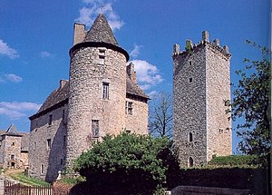
 Château Sénergues |
||
Sénergues is a French commune with 421 inhabitants (as of January 1, 2017) in the Occitanie region in the Aveyron department . The place is on the long-distance hiking trail GR 65 , which largely follows the historical course of the French Way of St. James " Via Podiensis ".
Geography and traffic
Sénergues is located in the Massif Central, south of the Lot Valley in the Entraygues-sur-Truyère - Vieillevie section . The closest major French cities are Lyon (225 km / 351 km by road) in the northeast, Toulouse (139 km / 190 km by road) in the southwest, Bordeaux (244 km / 360 km by road) in the west and Montpellier (159 km / 209 km by road) in the south East.
The nearest airport is Rodez-Marcillac , which is served by Air France and Ryanair , among others . It is about 45 kilometers away by road via the D904 or D901. The nearest train stations are Gare de Rodez and Gare SNCF Viviez / Decazeville with daily connections to Paris and Toulouse .
Way of St. James ( Via Podiensis )
There is only very limited accommodation in Sénergues. There are some pilgrim hostels (French: Gîte d'étape ). The next larger town on the Camino de Santiago is Conques . The path leads there in undulating relief over dirt roads and small roads through mixed forests and meadows. The D42 leads there as a road connection
Population development
| year | 1962 | 1968 | 1975 | 1982 | 1990 | 1999 | 2007 | 2016 |
| Residents | 910 | 898 | 815 | 732 | 608 | 545 | 494 | 421 |
| Sources: Cassini and INSEE | ||||||||
Attractions
- The church of St. Martin belonged to a monastery that was first mentioned in 819.
- The castle built in the late fourteenth century. Around 1580, Abraham Guirard, Lord of Sénergues, tried to persuade his subjects to convert to Protestantism. This aroused the resentment of the nearby Conques Abbey, on which Sénergues was largely dependent.
- The Tour de Montarnal : The ruins of the tower from the 13th century dominate the townscape with the old houses.
literature
- Bettina Forst: French Way of St. James. From Le Puy-en-Velay to Roncesvalles. All stages - with variants and height profiles. Bergverlag Rother, Munich (recte: Ottobrunn) 2007, ISBN 978-3-7633-4350-8 ( Rother hiking guide ).
- Bert Teklenborg: Cycling along the Camino de Santiago. From the Rhine to the western end of Europe. (Cycling guide, route planner). 3rd revised edition. Publishing House Tyrolia, Innsbruck 2007, ISBN 978-3-7022-2626-8 .
Web links
- Pictures from Sénergues ( Memento from January 31, 2013 in the web archive archive.today )
- Along the Via Podiensis
Individual evidence
- ↑ Congregational information on annuaire-mairie.fr (French). Retrieved on January 21, 2010
