Aumont-Aubrac
| Aumont-Aubrac | ||
|---|---|---|

|
|
|
| local community | Peyre en Aubrac | |
| region | Occitania | |
| Department | Lozère | |
| Arrondissement | Mende | |
| Coordinates | 44 ° 43 ′ N , 3 ° 17 ′ E | |
| Post Code | 48130 | |
| Former INSEE code | 48009 | |
| Incorporation | January 1, 2017 | |
| status | Commune déléguée | |
 Aumont-Aubrac |
||
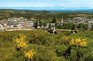
Aumont-Aubrac is a former French commune with 1,034 inhabitants (as of January 1, 2017) in the Lozère department in the Occitanie region . The inhabitants call themselves Aumonais. In the local Occitan language the place is called Aoumou. It is located on the GR 65 long-distance hiking trail , which largely follows the historical course of the French Way of St. James, Via Podiensis .
It was with effect from 1 January 2017 the former municipalities Fau-de-Peyre , Javols , La Chaze-de-Peyre , Sainte-Colombe-de-Peyre and Saint-Sauveur-de-Peyre in a commune nouvelle named Peyre en Aubrac merged. Since then it has had the status of a Commune déléguée there .
Geography and traffic
Aumont-Aubrac is located in the Massif Central on the edge of the Aubrac in the direction of Margeride . The nearest French cities are Lyon (168 km) in the northeast, Toulouse (192 km) in the southwest Bordeaux (306 km) in the west and Montpellier (132 km) in the southeast.
The nearest commercial airport is Rodez-Marcillac , which is served by Air France and Ryanair , among others . It is about 96 kilometers away on the D987 . Aumont-Aubrac can be reached by regional train , or by bus from Clermont-Ferrand or Millau train stations . Aumont-Aubrac is on the A75 motorway , where it is crossed by the D987 .
history
The place is at the intersection of two historical Roman roads and was therefore important as a trading center. Today Aumont-Aubrac, the gateway to the Aubrac, makes a rather sleepy impression. Around the St-Etienne Abbey, which was established at the beginning of the 12th century, a modest settlement was formed in the Middle Ages. The Counts of Peyre had a town house built here. At times, Aumont-Aubrac was the capital of the county of Gévaudan .
Way of St. James ( Via Podiensis )
In Aumont-Aubrac there is a hotel, restaurants and several pilgrimage hostels (French: Gîte d'étape ) in addition to the tourist information office . The place also has a rail connection. The Way of St. James continues via the hamlets of La Chaze-de-Peyre and Rieutort-d'Aubrac to the next larger town, Nasbinals on the Aubrac . The direct road connection there is the D987 .
Attractions
- The Saint-Etienne church was part of the former Benedictine monastery founded in 1061. Despite many changes in the twelfth and thirteenth centuries, the Romanesque choir and several Gothic side chapels have been preserved.
- Fortified houses from the 17th and 18th centuries, which show arcades with glass niches on the ground floor, in which either a swastika or the trigram JHS (Latin Jesus hominum Salvator , German Jesus, savior of the people) can be seen.
literature
- Bettina Forst: French Way of St. James. From Le Puy-en-Velay to Roncesvalles. All stages - with variants and height profiles. Bergverlag Rother, Munich (recte: Ottobrunn) 2007, ISBN 978-3-7633-4350-8 ( Rother hiking guide ).
- Bert Teklenborg: Cycling along the Camino de Santiago. From the Rhine to the western end of Europe. (Cycling guide, route planner). 3rd revised edition. Publishing House Tyrolia, Innsbruck 2007, ISBN 978-3-7022-2626-8 .
Web links
- Pictures along the Via Podiensis ( Memento from January 31, 2013 in the web archive archive.today )
- Office de Tourisme (French)
- Along the Via Podiensis
- Information about the area (French)
- Aubrac (French)
Individual evidence
- ↑ Arrêté Pref-BRCL 2016259-0002. (pdf) Création de la Commune nouvelle de PEYRE EN AUBRAC ... In: RECUEIL DES ACTES ADMINISTRATIFS DES SERVICES DE L'ETAT EN LOZERE. PREFET DE LA LOZERE, September 16, 2016, p. 144 , accessed on April 18, 2018 (French).
← Previous location: Saint-Alban-sur-Limagnole 19 km | Aumont-Aubrac | Next town: La Chaze-de-Peyre 4.4 km →
