
Hersdorf
| coat of arms | Germany map | |
|---|---|---|

|
Coordinates: 50 ° 10 ′ N , 6 ° 30 ′ E |
|
| Basic data | ||
| State : | Rhineland-Palatinate | |
| County : | Eifel district Bitburg-Prüm | |
| Association municipality : | Prüm | |
| Height : | 500 m above sea level NHN | |
| Area : | 12.86 km 2 | |
| Residents: | 401 (Dec. 31, 2019) | |
| Population density : | 31 inhabitants per km 2 | |
| Postal code : | 54597 | |
| Area code : | 06553 | |
| License plate : | BIT, PRÜ | |
| Community key : | 07 2 32 332 | |
| Community structure: | 5 districts | |
| Association administration address: | Tiergartenstrasse 54 54595 Prüm |
|
| Website : | ||
| Local Mayor : | Peter Thelen | |
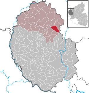
| Location of the local community Hersdorf in the Eifelkreis Bitburg-Prüm | ||
  |
||


Hersdorf is a municipality in the Eifelkreis Bitburg-Prüm in Rhineland-Palatinate . It belongs to the community of Prüm .
geography
The place is in the Eifel between Prüm and Gerolstein . The western part of the municipality is located in the North Eifel Nature Park . Hersdorf is divided into the districts of Niederhersdorf, Oberhersdorf, Jakobsknopp and Weißenseifen; the community also includes the residential areas Am Rödelberg and Anzelterhof.
history
The place was first mentioned in the Prümer Urbar as Herlendorpht in 893 .
Until the end of the 18th century, Hersdorf belonged to two different territories . Niederhersdorf belonged to the Electorate of Trier and was subject to the Prüm Office as a separate Zennerei , while Oberhersdorf belonged to the Fleringen lordship , which belonged to the Trier Abbey of St. Irminen and was administered by the Duke of Arenberg as Vogt.
In 1794 French revolutionary troops occupied the left bank of the Rhine . Under the French administration , the two localities were assigned to the Canton of Prüm in the Saardepartement from 1798 .
Due to the resolutions at the Congress of Vienna in 1815, substantial parts of the Rhineland were assigned to the Kingdom of Prussia . Under the Prussian administration the two communities from 1816 belonged to the mayor Wallersheim in county Prüm the administrative district of Trier , which by the end of 1822 WWII part of the Rhine province was.
Today's community of Hersdorf was created on March 20, 1971 through the merger of the two communities Niederhersdorf (then 315 inhabitants) and Oberhersdorf (76).
Statistics on population development
The development of the population of Hersdorf, the values from 1871 to 1987 are based on censuses:
|
|
Municipal council
The council in Hersdorf consists of eight council members, who in the local elections on May 26, 2019 in a majority vote were elected, and the honorary mayor as chairman.
Culture and sights
The Hersdorfer Schlösschen is a former aristocratic and manorial estate and was built for the noble family "von Aer". The property was built in 1509. It has a portal with a two-flight flight of stairs from 1660. The approximately 2 m high outer walls, which are not visible in the picture and which surround the building, bear witness to its importance and defensiveness. The building is privately owned.
Web links
- Homepage of the local community Hersdorf
- Local community Hersdorf on the website of the community association Prüm
- To search for cultural goods of the local community Hersdorf in the database of cultural goods in the Trier region .
Individual evidence
- ↑ State Statistical Office of Rhineland-Palatinate - population status 2019, districts, communities, association communities ( help on this ).
- ↑ State Statistical Office Rhineland-Palatinate (ed.): Official directory of the municipalities and parts of the municipality. Status: January 2019 [ Version 2020 is available. ] . S. 105 (PDF; 3 MB).
- ↑ Official municipality directory 2006 ( Memento from December 22, 2017 in the Internet Archive ) (= State Statistical Office Rhineland-Palatinate [Hrsg.]: Statistical volumes . Volume 393 ). Bad Ems March 2006, p. 179 (PDF; 2.6 MB). Info: An up-to-date directory ( 2016 ) is available, but in the section "Territorial changes - Territorial administrative reform" it does not give any population figures.
- ↑ State Statistical Office Rhineland-Palatinate: My village, my city. Retrieved January 28, 2020 .
- ^ The Regional Returning Officer Rhineland-Palatinate: Local elections 2019, city and municipal council elections.
- ↑ Entry on Hersdorfer Schlösschen in the database of cultural assets in the Trier region ; accessed on September 20, 2015.

Auw at Prüm | Lead alf | Brandscheid | Buchet | Büdesheim | Dingdorf | Fire divider | Fleringen | Giesdorf | Gondeboard | Großlangenfeld | Habscheid | Heckhuscheid | Heisdorf | Hersdorf | Kleinlangenfeld | Lasel | Masthorn | Matzerath | Mützenich | Neuendorf | Niederlauch | Nimshuscheid | Nimsreuland | Upper flap oath | Upper garlic | Olzheim | Orlenbach | Pittenbach | Pronsfeld | Prüm | Rommersheim | Roth near Prüm | Schönecken | Schwirzheim | Seiwerath | Celery | Wallersheim | Watzerath | Wawern | Weinsheim | Winringen | Winterscheid | Winterspelt