Frankfurt-Niederursel
|
Niederursel 25th district of Frankfurt am Main |
|
|---|---|
| Coordinates | 50 ° 10 ′ 1 ″ N , 8 ° 37 ′ 12 ″ E |
| surface | 7.422 km² |
| Residents | 16,460 (Dec. 31, 2019) |
| Population density | 2218 inhabitants / km² |
| Post Code | 60439 |
| prefix | 069 |
| Website | www.frankfurt.de |
| structure | |
| District | 8 - north-west |
| Townships |
|
| Transport links | |
| Subway | U2 U3 U8 U9 |
| bus | 29 71 72 73 251 n2 n3 |
| Source: Statistics currently 03/2020. Residents with main residence in Frankfurt am Main. Retrieved April 8, 2020 . | |
Niederursel has been a district of Frankfurt am Main since April 1, 1910 and is located in the northwest of the Main metropolis.
The population is 16,460.
location
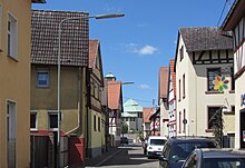
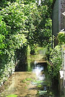
Niederursel is located on the lower reaches of the Urselbach , a right tributary of the Nidda in the northwest of Frankfurt. In the north and west it borders on the districts of Steinbach (Taunus) and Oberursel , in the northeast on the Frankfurt district of Kalbach-Riedberg , in the east on the districts of Eschersheim and Heddernheim and in the south on Frankfurt-Praunheim . Niederursel is crossed in the still used arable land in the north by the Frankfurt – Kassel section of the federal motorway 5 .
history
Niederursel was first mentioned in a document as a mill and estate in 1132. In 1437 Niederursel was divided by the royal bailiff Henne von Niederursel and sold to the city of Frankfurt and the knights of Kronberg . At that time the village had 21 inhabitants, often only the free citizens were counted. The neighboring desert of Mittelursel went under in the Thirty Years War . Half of the Mittelursel field was added to Niederursel.
In 1712, the then lords of the place, the imperial city of Frankfurt and the county of Solms-Rödelheim , agreed on the main street (today Alt-Niederursel) as the dividing line of their domain. In the south, the Counts of Solms-Rödelheim were responsible for law and order (Niederursel was part of the Rödelheim office in this regard ), in the north the City Council of Frankfurt. In 1806 the Solms share of Niederursel fell to the Grand Duchy of Hesse . In the peace treaty of September 3, 1866 , this was ceded to Prussia . With the annexation of the Free City of Frankfurt by Prussia, Niederursel's share of Frankfurt also fell to Prussia. Both parts belong to the Prussian urban district of Frankfurt am Main . It was not until March 1, 1899 that the two parts of Niederursel were merged again into one municipality. On April 1, 1910 Niederursel was incorporated into Frankfurt.
The rapid population growth from 2,200 inhabitants in 1960 to over 16,000 inhabitants in 1975 is mainly due to the newly built north-west town, which largely belongs to Niederursel .
Jewish community
In Heddernheim existed longer a Jewish community when the Heddernheimer Jew Joseph Weiler on payment of 5 on February 1, 1695 Reichstalern to the two gentlemen was given the right to live in Niederursel. He ran a brandy distillery. After the real division in 1714, the settlement of Jews was permitted in the Solms half of the village, but not in the Frankfurt half. In 1720 the old Jewish cemetery was opened on Oberurseler Straße. In 1876 the new Jewish cemetery was opened a few hundred meters away.
In 1740 the Jewish community consisted of 10 men, in 1777 there were 17 families. The number of Jews grew rapidly in the period that followed. In 1811 130 Jews lived in the Solmsche half, which was 1/3 of the population. In 1848 a synagogue was built on the Alt-Niederursel 3 property. In the period that followed, the number of Jews fell again. In 1857, 84 Jews were still living in Niederursel. In 1865 the community was so small that it was dissolved. The synagogue was given to the evangelical community, which built the school for small children there in 1910. In 1898 13 Jews were still counted. Four stumbling blocks remind of the life of the Jews in Niederursel and the Holocaust during the Nazi era .
Sights and cultural monuments
→ Main article: List of cultural monuments in Frankfurt-Niederursel .
The Niederursel sights include
- the former "Frankfurt City Hall" from 1716, a baroque building with ornamental framework and lintel beams, as well as an inscription and
- the former "Solms-Rödelheimsche Rathaus" in the immediate vicinity (Niederursel was divided into two parts for 600 years) from 1718, which was also built in the Baroque style with rich ornamental frameworks.
- In addition, the so-called "obedience" with the still existing chain of pillory at the foot of the former St. George's Chapel (on the foundation walls of which is today's Gustav Adolf Church) should be mentioned. Here the criminals were chained to the mockery of the residents during the day and brought back into the “dark hole” behind the door at night.
- The Gustav Adolf Church was built in 1927 by the architect Martin Elsaesser (an employee of Ernst May ), has an octagonal floor plan and was therefore downright revolutionary in terms of construction technology and planning at the time it was built. The church was poured from concrete including the roof . The most important parts of the old St. George's Chapel ( crucifix and wood-carved tapes from 1613) as well as a Romanesque lintel and a three-pass window were integrated into the building. The tombstones in the outer wall (from 1669) have also been preserved and can still be seen.
schools
- Albert Griesinger School; now mosaic school ( special school )
- Erich Kästner School ( primary school )
- Ernst Reuter schools ( upper secondary school and integrated comprehensive school )
- Heinrich Kromer School (primary school)
- European School Frankfurt, Praunheimer Weg 126: Kindergarten, elementary school and high school with completion of the European Abitur in four language sections (French, German, English and Italian)
economy
Due to its location on the Urselbach, Niederursel was mainly a location for mills in the pre-industrial era. Grain, paper, tobacco mills and other hydropower-based operations had developed here. In the 1970s, a branch of the Frankfurt Zoo was planned on Niederurseler Hang , but economic interests preferred building the site by the Goethe University , which today has numerous scientific institutes here on the Riedberg campus . A modern residential development is also being built in the Frankfurt-Riedberg housing estate. Due to the Niederursel bypass , some traditional businesses and shops had to give up. The Praunheimer Werkstätten also has its administration in the old part of Niederursel. Adjacent is the traditional restaurant "Zum Lahmen Esel" .
graveyard
Burials in Niederursel originally took place next to the church. In 1812 a 39 square rod field from the Katharinen- und Weißfrauenstift next to the church was acquired for 150 guilders and the cemetery was expanded with it.
In 1850 a 1 Gra acre plot of land was acquired by the Count zu Solms in exchange and the new cemetery was established there. After a dispute between the two halves of the village, it was decided to build the cemetery wall from red stones from the Hohe Mark . The cemetery was inaugurated in 1851. After the Second World War , the cemetery was expanded considerably to the west and the new cemetery chapel was consecrated in 1956 . Since the north-west town did not have its own cemetery, the dead there were also buried in Niederursel. In the early 1970s there was a new expansion, this time to the east. Today the cemetery covers an area of 4.5 hectares and contains 1,500 graves.
People who had or have their place of residence here
- Paul Klimsch (1868–1917), impressionist painter and member of the Berlin Secession
- Ludwig von Friedeburg (1924–2010), sociologist and educational politician
- Dieter Zetsche (* 1953), CEO of Daimler AG
traffic
Niederursel is on Rosa-Luxemburg-Strasse (L3004), which leads from the Miquelallee junction to Oberursel . Other main streets in the district are Niederurseler Landstrasse, Praunheimer Weg, Hammarskjöldring and Gerhart-Hauptmann-Ring. The A5 motorway runs along the western edge of Niederursel, but it has no exit in this area. With the construction of the bypass road from Frankfurt's north-west town to Oberursel in the 1990s, transit traffic through the old district was cut off, which led to a pronounced calming of traffic.
To the public transport Niederursel is through the lines U3, U8 and U9 of the Frankfurter subway connected. The Niederursel station is located in the old town center of the district.
literature
- Manfred Gerner: Niederursel, Mittelursel: chronical records of a village , 1976
Web links
- "Niederursel, City of Frankfurt am Main". Historical local dictionary for Hessen. In: Landesgeschichtliches Informationssystem Hessen (LAGIS).
- Literature on Frankfurt-Niederursel in the Hessian Bibliography
- My district - my home on YouTube
Individual evidence
- ^ A b "Niederursel, City of Frankfurt am Main". Historical local dictionary for Hessen. (As of June 22, 2015). In: Landesgeschichtliches Informationssystem Hessen (LAGIS).
- ^ Frankfurt.de: Chronicle of Niederursel accessed on Feb. 20, 2020
- ↑ Manfred Gerner: Niederursel, Mittelursel, pp. 107–110
- ↑ Manfred Gerner: Niederursel, Mittelursel, pp. 110–112
- ^ City of Frankfurt am Main: The cemetery guide, March 2012, section on the Niederursel cemetery


