
Frankfurt-Niederrad
 17th district of Frankfurt am Main |
|
|---|---|
  |
|
| Coordinates | 50 ° 5 '18 " N , 8 ° 38' 37" E |
| surface | 6.124 km² |
| Residents | 26,488 (Dec. 31, 2019) |
| Population density | 4325 inhabitants / km² |
| Post Code | 60528 |
| prefix | 069 |
| Website | www.frankfurt.de |
| structure | |
| District | 5 - south |
| Townships |
|
| Transport links | |
| Highway |
|
| Federal road |
|
| Train | S7 S8 S9 |
| tram | 12 15 19 20 21 |
| bus | 51 61 78 79 80 84 90 n7 n81 |
| Source: Statistics currently 03/2020. Residents with main residence in Frankfurt am Main. Retrieved April 8, 2020 . | |
Niederrad has been a district of Frankfurt am Main since July 1, 1900 .
The population is 26,488.
location
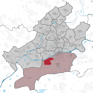
Niederrad is located south of the Main , about 2.7 km from the Frankfurter Hauptwache , and borders the Gutleutviertel to the north, Sachsenhausen to the east and Schwanheim to the west . In the south it is surrounded by part of the Frankfurt city forest.
General
The district is mainly designated as a residential area. It includes the Bruchfeldstrasse housing estate , which was built in the 1920s under urban planner Ernst May , as well as the Adolf-Miersch-Siedlung and the Mainfeld-Siedlung. The purchasing power is 22,067 euros per inhabitant (as of 2009) . Niederrad is the location of the western part of the Frankfurt University Hospital .
politics
- Niederrad local councils: 3 (in Frankfurt local council no.5 )
- Niederräder city council: 3
history

The district, which was incorporated into Frankfurt in 1900, was first mentioned in 1151 as Rode (clearing) in the then Dreieich Wildbann . At that time the place already consisted of 15 houses. The mention of the Sandhof , a royal moated castle, was first made in 1193 in a document that testified that the knight Konrad von Hagen had acquired 200 acres of land. The forest between Frankfurt and Niederrad, which was later to be referred to as part of the Frankfurt City Forest , was acquired by the Free Imperial City of Frankfurt in 1372. As it was located directly on a loop of the Main, the rural population in Niederrad developed a secondary activity for washing and dyeing especially since the arable land was very limited. For a long time, the people of Frankfurt referred to it as the “washer village”, as soon more than 100 companies were cleaning and then bleaching the laundry in a soft water brook (called Großer Waschbach ).

In 1850 Niederrad had 2000 inhabitants. 15 years later the racecourse opened and again after 15 years a railway bridge to Frankfurt over the Main was built in 1880 , the Main-Neckar Bridge . The construction of a needle weir and a sluice (1883) as well as the commissioning of the continent's first mechanical sewage treatment plant (1887) followed together with Seckbach and Oberrad in the city of Frankfurt before the final incorporation . At that time on July 1, 1900, Niederrad had 8,800 inhabitants. In 1881 the Niederrad cemetery was opened.
The businessman Eugen René Lacroix built his now international delicatessen company in Niederrad in 1925 with 350 employees , where he made the turtle soup that made him famous. A contemporary witness mentioned that “the whole yard was full of turtles” and “Lacroix eyed every one” . The Niederräder plant ceased to exist in 1994; after its demolition, apartments were built there.
After the Second World War Niederrad had a population of 18,000 (1950) and grew continuously in the following years. Eleven years later there were 25,000 inhabitants, and with the construction of the “Bürostadt im Grünen”, now called Bürostadt Niederrad , which began in 1963 , the district also became known in the business world.
traffic

Local public transport
Niederrad is connected to the Rhein-Main S-Bahn network as well as to the city's tram and bus network.
The Frankfurt-Niederrad station is a stop on the S-Bahn lines S7, S8 and S9 as well as the regional trains RE2 ( Koblenz main station ) and RE70 ( Mannheim main station ). It was built in 1977 as a high station for S-Bahn operations and replaced the station further north. The train station is located on Lyoner Strasse on the eastern border with the Niederrad office district. Line S7 runs from Riedstadt-Goddelau via Niederrad to Frankfurt Central Station . Lines S8 and S9 run from Wiesbaden Hauptbahnhof either via Mainz Hauptbahnhof (S8) or Mainz-Kastel (S9), Rüsselsheim , Frankfurt Airport , Frankfurt Stadium , Niederrad, Frankfurt Hauptbahnhof , Frankfurt-Hauptwache and Offenbach Ost to Hanau Hauptbahnhof . At Niederrad train station there are direct transfer options to tram lines 12 and 19 and to bus lines 78 and 79. From September 1996 to May 2006, Frankfurt-Niederrad was also a scheduled stop for individual long-distance trains operated by Deutsche Bahn.
The tram lines 12, 15, 19 (only runs at certain times), 20 (only runs during events in the Commerzbank-Arena) and 21 have their origin in the network of the Frankfurter Waldbahn . Line 12 connects Niederrad with Schwanheim, Sachsenhausen, Hauptbahnhof, city center, Nordend, Bornheim, Ostend and Fechenheim. Line 15 ends in Niederrad at Haardtwaldplatz and runs from there via Sachsenhausen, Südbahnhof and Oberrad to the Offenbach city limits. Line 19 is a pure school line with only two journeys a day between Schwanheim, Niederrad, Sachsenhausen and Südbahnhof. Line 21 runs from the stadium (at times only to / from Oberforsthaus) via Niederrad, Sachsenhausen, Hauptbahnhof and Gallus to Nied; Line 20 is used as an amplifier line between the stadium and the main station.
Bus routes 51 (Niederrad, Schwanheim, Höchst, Industriepark Höchst), 61 (airport, stadium, Niederrad, Sachsenhausen, Südbahnhof), 78 (Schwanheim, Bürostadt, Niederrad, Sachsenhausen, Südbahnhof) and 80 (Stadion Osttribüne, Oberforsthaus, Sachsenhausen, Südbahnhof) ) and the ring bus route 79 (Niederrad Bahnhof, Bürostadt, Haardtwaldplatz, Niederrad Bahnhof) complete the range of local public transport in Niederrad. Since 2019, the 84er bus has been circling the entire district including the Mainfeldsiedlung and ultimately Niederräderlandstrasse.
Street
Niederrad is located near the Frankfurter Kreuz , directly on the federal autobahn 5 and - after decades of planning - has been accessible from the north since July 8, 2013. From the federal highway 3 Niederrad can be reached via the exit Frankfurt-Süd . The federal highway 43 leads through Niederrad from Wiesbaden to Hanau and the federal highway 44 to Ludwigshafen am Rhein.
Bike trails
Several cycle paths run along the banks of the Main :
- The Hessian long -distance cycle route R3 ( Rhein-Main-Kinzig-Radweg ) leads under the motto In the footsteps of the late rider . along the Rhine , Main and Kinzig via Fulda to Tann in the Rhön . On the section to Eltville - Hochheim am Main, the R3 leads over the Rheingau Riesling Route .
- The Main Cycle Path leads from the sources of the White and Red Main to Mainz where it flows into the Rhine .
- The D-Route 5 (Saar-Mosel-Main) from Saarbrücken via Trier, Koblenz, Mainz, Frankfurt am Main, Würzburg and Bayreuth to the Czech border (1,021 km).
Worth seeing


- The baroque building of the Frauenhof was erected as a factory building from 1761 to 1781 . The property with the archway over Kelsterbacher Strasse was originally on the edge of the village. From 1841 it was temporarily owned by the Katharinen- und Weißfrauenstift. In 1937, large parts of the property were demolished, only the archway with the two side wings remained. In 1944 the archway was badly damaged by a bomb hit and only temporarily repaired.
- The Bruchfeldstrasse (“Zickzackhausen”) housing estate, which was built in 1927, is part of the major project New Frankfurt , which was created under the Frankfurt city planner and architect Ernst May . It owes its nickname "Zigzackhausen" to its special angled facade arrangement.
- Two urban green spaces or parks are located in the Niederräder district: the Elli-Lucht-Park and the Niederrad light and air bath , which was set up around 1900 and a former river swimming pool , located on the headland formed by the old Niederrad lock on the southern bank of the Main. The Carl-von-Weinberg-Park with forest playground, which is often seen as part of Niederrad, is already in the Schwanheim district.
Regular events
- Wäldchestag is Whit Tuesday . The folk festival for this begins on Pentecost Saturday.
Web links
- My district - my home on YouTube
- Virtual tour through the historic sewage treatment plant
- 360 ° panoramic view from the stadium pool
Individual evidence
- ^ Frankfurt am Main: Niederrad sewage treatment plant. In: www.frankfurt.de. Retrieved February 27, 2020 .
- ↑ No more detours - A5 junction Niederrad released
Old town | Bahnhofsviertel | Bergen-Enkheim | Berkersheim | Bockenheim | Bonames | Bornheim | Thorn bush | Eckenheim | Eschersheim | Fechenheim | Airport | Frankfurter Berg | Gallus | Ginnheim | Griesheim | Gutleutviertel | Harheim | Hausen | Heddernheim | Highest | Downtown | Kalbach-Riedberg | Nied | Nieder-Erlenbach | Nieder-Eschbach | Niederrad | Niederursel | Northrend-East | Northrend-West | Upper wheel | Ostend | Praunheim | Preungesheim | Riederwald | Rödelheim | Sachsenhausen-North | Sachsenhausen-South | Schwanheim | Seckbach | Sindlingen | Sossenheim | Unterliederbach | Westend-North | Westend-South | Zeilsheim
Inner city I (01) | Inner city II (02) | Inner city III (03) | Bornheim / Ostend (04) | South (05) | West (06) | Middle-West (07) | North-West (08) | Center-North (09) | North-East (10) | East (11) | Kalbach / Riedberg (12) | Nieder-Erlenbach (13) | Harheim (14) | Nieder-Eschbach (15) | Bergen-Enkheim (16)