Okrouhlo
| Okrouhlo | ||||
|---|---|---|---|---|
|
||||
| Basic data | ||||
| State : |
|
|||
| Region : | Středočeský kraj | |||
| District : | Praha-západ | |||
| Area : | 831 ha | |||
| Geographic location : | 49 ° 55 ' N , 14 ° 27' E | |||
| Height: | 333 m nm | |||
| Residents : | 704 (Jan. 1, 2019) | |||
| Postal code : | 254 01 | |||
| License plate : | S. | |||
| structure | ||||
| Status: | local community | |||
| Districts: | 2 | |||
| administration | ||||
| Mayor : | Ludvík Pařízek (as of 2018) | |||
| Address: | Okrouhlo 44 254 01 Jílové u Prahy |
|||
| Municipality number: | 539511 | |||
| Website : | www.okrouhlo.cz | |||
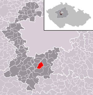
| Location of Okrouhlo in the Praha-západ district | ||||

|
||||
Okrouhlo (German Okrauhlo ) is a municipality in Okres Praha-západ , Czech Republic . It is 333 m above sea level. M. 21 kilometers south of the city center of Prague . The area of the municipality is 8.31 km².
history
The first written mention of the place comes from the year 1310.
Local division
The municipality Okrouhlo consists of the districts Okrouhlo and Zahořany. The municipality is divided into the Okrouhlo cadastral district.
Web links
Commons : Okrouhlo - collection of images, videos and audio files
- Homepage of the municipality (Czech)

