Kytin
| Kytin | ||||
|---|---|---|---|---|
|
||||
| Basic data | ||||
| State : |
|
|||
| Region : | Středočeský kraj | |||
| District : | Praha-západ | |||
| Area : | 1088.4213 ha | |||
| Geographic location : | 49 ° 51 ' N , 14 ° 13' E | |||
| Height: | 435 m nm | |||
| Residents : | 540 (Jan. 1, 2019) | |||
| Postal code : | 252 10 | |||
| License plate : | S. | |||
| traffic | ||||
| Street: | Mníšek pod Brdy - Kytín | |||
| Next international airport : | Prague airport | |||
| structure | ||||
| Status: | local community | |||
| Districts: | 1 | |||
| administration | ||||
| Mayor : | Miloslav Holý (as of 2013) | |||
| Address: | Kytín 65 252 10 Mníšek pod Brdy |
|||
| Municipality number: | 571261 | |||
| Website : | www.kytin.eu | |||
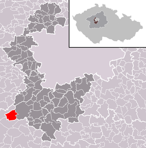
| Location of Kytín in the Praha-západ district | ||||

|
||||
Kytín (German Kitin ) is a municipality in the Czech Republic . It is located four kilometers southwest of Mníšek pod Brdy and belongs to the Okres Praha-západ .
geography
Kytín is located in the headwaters of the Bojovský potok ( Mnichek brook ) at the foot of the Hřebeny in the northeastern foothills of the Brdská vrchovina . The U Lávek (563 m) and the U Červeného kříže (548 m) rise to the north, the Skalka (553 m) to the northeast, the Pleš (490 m) and the Malá svatá hora (482 m) south of the Zelenský vrch (450 m), in the southwest the Točná (505 m), to the west of the Jistevník (606 m) and in the northwest of the Vrážky (577 m). Two and a half kilometers east of the village runs the R 4 expressway between Zbraslav and Dobříš , with the Dobříš – Praha-Modřany railway behind it . West of Kytín on Jistevník is the former Klondajk military facility .
Neighboring towns are Svinaře , Na Rovinách, Halouny, Zadní Třebaň and Řevnice in the north, Stříbrná Lhota and Mníšek pod Brdy in the Northeast, Kamenné, Rymaně, Horní Rymaně, Včelnik and Zahořany the east, Malá Svatá Hora, Senešnice and Nová Ves pod Pleší in the southeast , Chouzavá and Voznice in the south, Trnová, Knížecí Studánky, Malý Chlumec and Velký Chlumec in the south-west, Osov , Osovec, Vižina and Podbrdy in the west and Skalka, Drahlovice, Skuhrov , Hatě, Rochota and Hodyně in the north-west.
history
Between the 10th and 12th centuries there were the villages of Kdýčina and Korutany in the municipality. The first written mention of Kytín took place on June 23, 1321, when the chief land recorder of Bohemia Štěpán von Tetín received the village as an Emphyteuse . King John of Luxembourg raised Kytín to a town. In 1334 the Moravian Margrave Charles bought the estate back from Štěpán's sons and gave it to the Bohemian Crown . In 1348 King Charles IV added the Kytín estate to the royal fortress of Monachus . In 1357 Kytín was placed under the administration of the Karlstein royal castle . King Wenceslaus IV pledged Kytín to the Lithuanian prince Keistut before 1372 . In 1409 the Žebrák burgrave Johann von Leßkow ( Jan z Lestkova ) received the goods Mníšek and Kytín for 900 groschen as a pledge, which was converted into a feudal relationship in the same year. During the Hussite Wars in 1420 the army captured Jan Žižkas Mníšek. In 1427 the Karlstein burgrave Zdeslav Tluksa of Bušenice Mníšek took. A little later, the owner of the Kytín feud was his son Jan Tluksa von Vrábí. In 1431 he made an unsuccessful attack on the fortress Viklefska near Podbrdy, as a result of which the villages of Kdýčiny and Korutany were burned down. From 1437 the Předbor Řepnický estate belonged to Řepnice, followed by his sons Jindřich and Václav. The latter sold the Kytín estate with the villages of Lhotka and Korutany in 1490 for 800 shock groschen to Litwin von Klingenstein ( Litvín z Klinštejna ) on Hořovice . In 1503, King Vladislav Jagiello released the Kytín estate from the feudal relationship with Mníšek. After Litwin's death in 1520, his daughter Vracka, who was married to Nikolaus von Říčan, inherited the Kytín estate. She sold Kytín in 1541 to Wratislaw von Mitrowitz on Mníšek. King Ferdinand I confirmed the old privileges of Kytín in 1543. In the same year, the top climber Václav Liznov from Nový Knín was awarded a mine "Důl fundgrub za kytínskú stezkú" ( treasure trove behind the Kytíner Steig ), the entry in the Kniner Bergbuch is the oldest evidence of gold mining near Kytín. Wratislaw's sons Johann and Sebastian von Mitrowitz sold the Kytín estate to Johann the Elder in 1588. A. Wratislaw von Mitrowitz on Skřipel . In 1595 his son of the same name, Johann d. J. took over the property, followed by his brother Hertvík around 1611. In 1614 Zdeněk von Mitrowitz on Mníšek also acquired the Kytín estate. After the outbreak of the class uprising in 1618, he had both goods transferred to his wife Ludmilla von Gersdorff out of concern for his property . After their death in 1623 they fell back to Zdeněk von Mitrowitz. The parish of Kytín became extinct around 1623, its parish was closed to Mníšek. In 1639, Kytín, Kdýčiny and Korutany were burned down by the troops of the Swedish field marshal Banér and lay desolate afterwards. Kdýčiny and Korutany were never settled again. In 1642, Zdenek's sons Wratislaw Friedrich and Wenzel Eusebius von Mitrowitz inherited the ruined rule of Mníšek with Kytín, they sold it on September 30, 1655 to the Prague citizen and tanner Servatius Engel von Engelfluss, who became wealthy during the war through orders to supply the Wallenstein Army and was ennobled for his services in defending Charles Bridge against the Swedes. Engel von Engelfluss had the city of Mníšek rebuilt and waived the taxes for its citizens for 17 years; the former market of Kytín was also repopulated, but it sank to a small village settlement. Servatius Engel von Engelfluss united the rule of Mnisk with the feudal estates Chrastitz and Čisowitz , and on August 1, 1661 raised them to the family entailment . In 1670 he was raised to the rank of baron. On March 2nd, 1674 he left 600 guilders in his will for the repair and expansion of the church in Kytín. The next owner was his son Servatius Ignaz Engel von Engelfluss, who together with his wife Ludmilla Franziska Wratislaw von Mitrowitz realized the father's legacy. After Servatius Ignaz Engel von Engelfluss died on February 26, 1704 without heirs, his nephew Ignaz Karl inherited the rule. Until 1714 Kytín belonged to the Podbrdsko District, and after it was merged with the Vltavsko District, it became a new Berauner District. In 1742 a peasant uprising broke out in Kytín, the Kytín judge Jan Mesek was shot on June 11, 1742 as the leader of the rebellion by French troops. Ignaz Karl Engel von Engelfluss died in 1743 without descendants, the Fideikommissherrschaft Mnicek fell in 1755 after a lengthy inheritance dispute of his older sister Maria Victoria, widowed Freiin Unwerth, who passed it on to her son Ignaz Joseph Freiherr von Unwerth. He was raised to the rank of count in 1764. From 1769, his widow Benedicta Countess Čejková von Olbramovice, born Countess von Bünau, administered the rule. In 1780 her son Johann Nepomuk Graf Unwerth took over the property; He was followed from 1792 by his younger brother Joseph and from 1822 by his brother Ignaz with his death the dynasty of Count Unwerth died out on April 29, 1829 in the male line. Because of a legal dispute over the inheritance, the rulership was then under national administration for nine years, with Johann Freiherr von Henniger appointed as administrator. In 1838, Ignaz Unwerth's granddaughter, Countess Maria Anna Pachta von Rájov, née von Steinbach, and her husband Karl were given control of the rule . Marie de Silva-Tarouca was satisfied with an estate. In 1846 the village of Kittin or Kytjn in the Berauner district consisted of 51 houses with 501 inhabitants. In the village there was the public chapel of the Birth of the Virgin, in which services were held at all Marian feasts, and an official hunter's house. The parish was Mnisek . In 1847 the daughters Emanuela and Ludmilla Pachta von Rájov inherited the rule. Until the middle of the 19th century Kittin remained subject to the Fideikommissherrschaft Mnick.
After the abolition of patrimonial Kytín / Kittin formed from 1850 a municipality in the judicial district of Zbraslav . Through the marriage of Emanuela Pachta with Johann von Schirnding , the estate passed into the possession of the von Schirnding family. In 1856 a village school was inaugurated in Kytín. In the same year a gold treasure with over 1200 coins was found north-east of the village in the Korytanech forest , where the village of Korutany used to stand . After the cholera epidemic of 1862, a new cemetery was created on the outskirts. In 1864 Lhotka was incorporated. From 1868 the municipality belonged to the Smichow district . The district road to Mníšek was built in 1868. In 1882 a volunteer fire brigade was established in Kytín. On the edge of the Točná zoo, a new keeper and forest house was built in 1892. On January 1, 1896, the community was assigned to the district of Příbram and the judicial district of Dobříš . On October 5, 1905, a large fire in Kytín destroyed 17 chalets and a farm. The following year, another fire burned four chalets. Karl von Schirnding sold the property in 1909 to Theodor Kast von Ebelsberg. The district Lhotka was renamed in 1924 in Stříbrná Lhota . In the same year the road to Chouzavá was built, its intended continuation to Voznice was never realized. In 1925 another road to Branka was built, it was planned to continue once through the Hřebeny. In 1927 the village was connected to the electricity network. From 1931 Llewellyn Kast von Ebelsberg took over the large estate from his father. In 1932 there were 515 people living in Kytín with Stříbrná Lhota. Stříbrná Lhota broke away from Kytín on September 16, 1936 and formed its own community. In 1943 the Gestapo occupied Kytín and threatened to liquidate the village. Several residents were arrested for supporting partisans and later executed. From 1949 Kytín belonged to the newly formed Okres Dobříš, after its abolition, the municipality was again part of the Okres Příbram in 1960. The school was closed on July 1, 1970. Since July 1st 1974 Kytín belongs to the Okres Praha-západ . In 1976 it was incorporated into Mníšek pod Brdy. Between 1981 and 1985, the largest anti-aircraft missile station in Czechoslovakia, Klondajk , was built in the middle of the woods on the mountain plateau at Jistevník . Kytín broke away from Mníšek pod Brdy on November 24, 1990 and formed its own community. Since July 1, 1996, Kytín has been connected to the Prague Integrated Transport Association, and since May 28, 2000 also to the Dobříš Transport Association. In 2001 the closure of the Klondajk FlaRak station was announced. Today Kytín is a resort.
City structure
No districts are designated for the Kytín. Kytín consists of the basic settlement units Chouzavá II ( Chousowa II ) and Kytín ( Kitin ). The Na Rovinách settlement also belongs to Kytín.
Legend of the founding of the church
Ms. Korutanská is said to have stopped at a fountain on a trip from her Korutany fortress to Studenec fortress. There she washed the face of a blind child who could see again afterwards. To commemorate this miracle, she had a chapel built at the fountain, which was later expanded to become a church.
Attractions
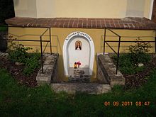
- Church of the Assumption of Mary on the village square, it was probably built in the 13th or beginning of the 14th century and has been a parish church since 1321. At the end of the 17th century the church was redesigned in baroque style. The Gothic core has been preserved. The church tower was added in 1866. The church was repaired in 1964 and 1992. Inside there is a baroque main altar; the altar painting of Mary with baby Jesus is the work of Karel Javůrek, who also painted the portraits of St. John of Nepomuk and St. Adalbert created for the side altars. The rococo organ on the wooden choir was made around 1814 in the workshop of the Tachov organ builder Gartner; it was restored in 2000. On the foundation wall of the apse there is a fountain whose water is said to have healing properties for eye diseases.
- Chapel of the Visitation of the Virgin Mary on the Malá Svatá hora southwest of Mníšek, built 1809–1811 by the Prague citizen Edmund Chvalský with the support of Johann Count Unwerth on the pilgrimage route to Svatá Hora .
- Forest house southwest of the village, it is the setting of the children's book Školák Kája Mařík by Felíx Háj (Marie Wagnerová-Černá).
- Memorial stone for those killed in World War I from Kytín and Stříbrná Lhota, unveiled in 1921
Personalities
- Pavel Landovský (1936–2014), the actor lives in a chalet in Kytín
Web links
- History of Kytín (Czech)
Individual evidence
- ↑ http://www.uir.cz/obec/571261/Kytin
- ↑ Český statistický úřad - The population of the Czech municipalities as of January 1, 2019 (PDF; 7.4 MiB)
- ^ Johann Gottfried Sommer The Kingdom of Bohemia, Vol. 16 Berauner Kreis, 1849, p. 54
- ↑ http://www.brdy.org/content/view/106/101/
- ↑ http://www.uir.cz/zsj-obec/571261/Obec-Kytin
- ↑ http://www.kytin.eu/cz/redakce/zivot-v-obci/o-kytine/zajimavosti-obce/c2597 ( page no longer available , search in web archives ) Info: The link was automatically marked as defective. Please check the link according to the instructions and then remove this notice.


