Měchenice
| Měchenice | ||||
|---|---|---|---|---|
|
||||
| Basic data | ||||
| State : |
|
|||
| Region : | Středočeský kraj | |||
| District : | Praha-západ | |||
| Area : | 133.3659 ha | |||
| Geographic location : | 49 ° 54 ' N , 14 ° 24' E | |||
| Height: | 205 m nm | |||
| Residents : | 858 (Jan. 1, 2019) | |||
| Postal code : | 252 06 | |||
| License plate : | S. | |||
| traffic | ||||
| Street: | Zbraslav - Chotilsko | |||
| Railway connection: | Dobříš – Praha-Modřany | |||
| Next international airport : | Prague airport | |||
| structure | ||||
| Status: | local community | |||
| Districts: | 1 | |||
| administration | ||||
| Mayor : | František Zoul (as of 2018) | |||
| Address: | Hlavní 4 252 06 Měchenice |
|||
| Municipality number: | 539490 | |||
| Website : | www.mechenice.cz | |||
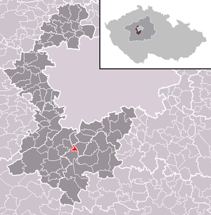
| Location of Měchenice in the Praha-západ district | ||||

|
||||
Měchenice (German Miechenitz ) is a municipality in the Czech Republic . It is located 20 kilometers south of the city center of Prague and belongs to the Okres Praha-západ .
geography
Měchenice is located on the left bank of the Vltava at the confluence of the Bojovský potok ( Mnicker Bach ). To the north rises the hill Chlumík (348 m). The place lies in the northeastern foothills of the Brdská vrchovina .
Neighboring towns are Vrané nad Vltavou and Skochovice in the north, Březová-Oleško in the east, Davle in the south-east, Račany and Sloup in the south, Bojov and Čtvrť Svatopluka Čecha in the south-west, Klínec in the west and Trnová in the north-west.
history
Měchenice was one of the 31 villages of the Insula monastery ; it was first mentioned in a document when the monastery was founded in 999. Gold mining began in the Bojovský potok valley in the second half of the 13th century. Later Měchenice was attached to the Hradištko manor . In 1845 Mněchenitz or Mechnitz consisted of 16 houses with 99 inhabitants. There was an inn in the village. The parish was St. Kilian ( Svatý Kilián ). Until the middle of the 19th century Mněchenitz remained subordinate to the Good Hradischko belonging to the Strahov monastery in the Berauner district .
After the abolition of patrimonial Měchenice formed from 1850 a district of the market town Davle in the judicial district Königsaal . From 1869 the village belonged to the Smichow district . In 1927 Měchenice was assigned to Okres Praha-venkov, in 1942 to Okres Praha-venkov-jih and in 1949 to Okres Praha-jih. In 1935 the construction of the Vltava dam in Vrané began . After the valley was flooded, the football club's sports field was rebuilt at its current location in 1940. On January 1, 1961, the separation from Davle and the formation of the municipality Měchenice, which was assigned at the same time to the Okres Praha-západ. Since the second half of the 20th century, numerous holiday homes, a car campsite and a tennis court have been built in Měchenice. There are about 130 weekend houses in Měchenice, most of which belong to Prague residents. Měchenice has had a coat of arms since 1998.
Community structure
No districts are shown for the municipality of Měchenice.
Attractions
- Vltava valley with a rocky steep slope on the right bank
Web links
Individual evidence
- ↑ http://www.uir.cz/obec/539490/Mechenice
- ↑ Český statistický úřad - The population of the Czech municipalities as of January 1, 2019 (PDF; 7.4 MiB)
- ↑ Johann Gottfried Sommer The Kingdom of Bohemia, vol. 16 Berauner Kreis, 1849, p. 58


