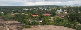
Puerto Carreño
| Puerto Carreño | ||
|---|---|---|
|
Coordinates: 6 ° 11 ′ N , 67 ° 29 ′ W Puerto Carreño on the map of Colombia
|
||
|
Location of the municipality of Puerto Carreño on the map of Vichada
|
||
| Basic data | ||
| Country | Colombia | |
| Department | Vichada | |
| City foundation | 1922 | |
| Residents | 16,763 (2019) | |
| City insignia | ||
| Detailed data | ||
| surface | 12,409 km 2 | |
| Population density | 1 inhabitant / km 2 | |
| height | 51 m | |
| Waters | Orinoco , Río Meta | |
| Post Code | 990001-990017 | |
| City Presidency | Marcos Pérez Jímenez (2016-2019) | |
| Website | ||
| View of Puerto Carreño | ||
| Church in Puerto Carreño | ||
Puerto Carreño is the capital and a municipality ( municipality ) in the Vichada department in Colombia .
Puerto Carreño is named after Pedro María Carreño , Minister of Government under President Carlos Eugenio Restrepo .
geography
Puerto Carreño is located at an altitude of about 51 meters at the confluence of the Orinoco and Meta rivers and on the border with Puerto Páez in Venezuela . The municipality is bordered by the state of Apure in the north and the state of Amazonas in Venezuela in the east, Cumaribo in the south and La Primavera in the west .
population
The municipality of Puerto Carreño has 16,763 inhabitants, of which 14,231 live in the urban part (cabecera municipal) of the municipality.
history
The area was inhabited by the Achagua indigenous people even before the arrival of the Spaniards . The first non-indigenous settlement was the Jesuit Mission San Joaquín de Atanari , which the missionary Alonso de Neira built in 1666, but had to give up again in 1669 due to a shortage of supplies. In the centuries that followed, there were further missionary efforts and trade contacts. In 1922 the General Buenaventura Bustos founded Puerto Carreño on the site of the El Picacho settlement , which in 1930 became the capital of the Vichada Commissariat. Puerto Carreño has had parish status since 1974. Since 1991 Vichada has the status of a department with Puerto Carreño as the capital.
economy
The main industries are cattle production , fishing , agriculture and mining .
Infrastructure
Puerto Carreño has an airport, Aeropuerto Germán Olano ( IATA code : PCR ), and can be reached from Villavicencio by air. Puerto Carreño can be reached by river from Villavicencio and Puerto Gaitán via the Río Meta and from Puerto Gaitán by land. The road conditions can, however, be very bad in the rainy season, so that the travel time can be between a day and a week.
religion
The Apostolic Vicariate of Puerto Carreño is located in Puerto Carreño .
Personalities
- Juan Carlos Ávila (* 1973), politician
Web links
- Alcaldía de Puerto Carreño - Vichada. Alcaldía de Puerto Carreño - Vichada, accessed on May 3, 2019 (Spanish, website of the municipality of Puerto Carreño).
Individual evidence
- ^ Información del municipio. Alcaldía de Puerto Carreño - Vichada, accessed on May 3, 2019 (Spanish, information on the geography of the municipality).
- ↑ ESTIMACIONES DE POBLACIÓN 1985 - 2005 Y PROYECCIONES DE POBLACIÓN 2005 - 2020 TOTAL DEPARTAMENTAL POR ÁREA. (Excel; 1.72 MB) DANE, May 11, 2011, accessed on May 3, 2019 (Spanish, extrapolation of the population of Colombia).
- ↑ Pasado, presente y futuro. Alcaldía de Puerto Carreño - Vichada, accessed on May 3, 2019 (Spanish, information on the history of the municipality).
- ↑ Economía. Alcaldía de Puerto Carreño - Vichada, accessed on May 3, 2019 (Spanish, information on the municipality's economy).
- ↑ Vías de comunicación. Alcaldía de Puerto Carreño - Vichada, accessed on May 3, 2019 (Spanish, information on the infrastructure of the municipality).


