Bucaramanga
| Bucaramanga | ||
|---|---|---|
|
Coordinates: 7 ° 6 ′ N , 73 ° 6 ′ W Bucaramanga on the map of Colombia
|
||
|
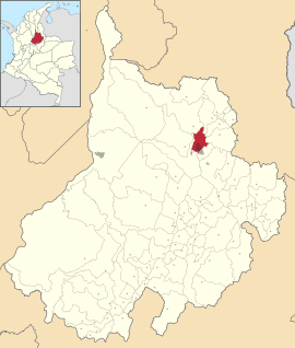
Location of the municipality of Bucaramanga on the map of Santander
|
||
| Basic data | ||
| Country | Colombia | |
| Department | Santander | |
| Residents | 528,610 (2019) | |
| - in the metropolitan area | 1,160,243 | |
| City insignia | ||
| Detailed data | ||
| surface | 165 km 2 | |
| Population density | 3466 inhabitants / km 2 | |
| height | 959 m | |
| City structure | 17 Comunas | |
| Post Code | 680001-08 / 68011 | |
| prefix | 0057 7 | |
| Time zone | UTC -5 | |
| City Presidency | Juan Carlos Cárdenas Rey (2020-2023) | |
| City patron | San Laureano | |
| Website | ||
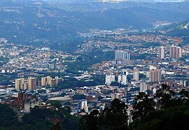
| View of Bucaramanga | ||
| Panorama Bucaramanga | ||
Bucaramanga is the capital and a municipality (municipio) in the department of Santander in Colombia . It is located approx. 410 km northeast of Bogotá and has the Santander Industrial University, one of the most renowned universities in the region.
Bucaramanga, together with Floridablanca , Girón and Piedecuesta, forms the metropolitan region of Bucaramanga .
Bucaramanga is called La ciudad bonita de Colombia ("The beautiful city of Colombia") and has a large number of public parks and many green areas. Bucaramanga is the fifth largest metropolitan region in terms of population (after Bogotá , Cali , Medellín and Barranquilla ) and the tenth largest municipality in Colombia as well as the seat of an archbishopric .
geography
Geographical location
The city is located on a plateau of the Eastern Cordillera of the Colombian Andes , the Meseta de Bucaramanga , which is bounded in the east by a mountain range and in the west by the ravine of the Río de Oro .
The city has major problems with erosion on the edges of the plateau, especially in its western part.
The municipality is located in the north of Santander in the Provincia de Soto and borders in the north on Rionegro , in the east on Matanza , Charta and Tona , in the south on Floridablanca and in the west on Girón .
City structure
The city is divided into 17 districts ( comunas ), which in turn are divided into 1341 blocks ( manzanas ) and around 200 quarters ( barrios ). The rural area of the municipality of Bucaramanga consists of three corregimientos , which in turn are divided into 25 veredas (rural administrative sub-units).
- Norte
- Nororiente
- San Francisco
- Occidente
- García Rovira
- Concordia
- Ciudadela Real de Minas
- Suroccidente
- Pedregosa
- Provenza
- Sur
- Cabecera del Llano
- Oriente
- Morrorico
- Centro
- Lagos del Cacique
- Mutis
The economic center of the city, Cabecera del Llano , has several shopping centers, shops, bars and even - rare for Colombia - a small pedestrian zone. In the course of the last few years, a district of the neighboring municipality of Floridablanca with the Cañaveral and La Florida shopping centers directly south of Bucaramanga has established itself as a further center.
Metropolitan area
With the formation of metropolitan regions, the Colombian government is trying to control the planning and agreements of cities that are close to one another. A core city and several neighboring cities that are dependent on this core city form a planning region. Bucaramanga became a metropolitan region in 1981 with the cities of Girón and Floridablanca . In 1985 Piedecuesta was added.
climate
The mean annual temperature is 23 degrees Celsius and the mean annual precipitation is 1041 millimeters.
| Bucaramanga | ||||||||||||||||||||||||||||||||||||||||||||||||
|---|---|---|---|---|---|---|---|---|---|---|---|---|---|---|---|---|---|---|---|---|---|---|---|---|---|---|---|---|---|---|---|---|---|---|---|---|---|---|---|---|---|---|---|---|---|---|---|---|
| Climate diagram | ||||||||||||||||||||||||||||||||||||||||||||||||
| ||||||||||||||||||||||||||||||||||||||||||||||||
|
Monthly average temperatures and rainfall for Bucaramanga
Source: WMO ; wetterkontor.de
|
|||||||||||||||||||||||||||||||||||||||||||||||||||||||||||||||||||||||||||||||||||||||||||||||||||||||||||||||||||||||||||||||||||||||||||||||||||||||||||||||||||||
population
The municipality of Bucaramanga has 528,610 inhabitants, of which 522,353 live in the urban part (cabecera municipal) of the municipality (as of 2019). 1,160,243 people live in the metropolitan region.
Economy and Infrastructure
Industry and Commerce
Bucaramanga has a modern exhibition center, CENFER, on which regional and national trade fairs and exhibitions take place several times a year. The economic strength lives mainly from small and medium-sized businesses.
traffic
From here main roads lead to the northeast to Cúcuta , to the north to Santa Marta and to the south to Tunja and on to Bogotá . The city also has its own airport ( Aeropuerto Internacional Palonegro ), which is located in the territory of the municipality of Lebrija . The train station in Bucaramanga is today a slum made of wooden castles, also because of the laying down of the Colombian railway. In addition, Bucaramanga has a public bus system called Metrolínea based on the model of TransMilenio Bogotás, which acts alongside numerous private bus companies.
Sports
The city's best-known football club is Atlético Bucaramanga , which plays its home games at the Estadio Alfonso López . The greatest success was reaching the runner-up in 1996/97. After seven seasons in the second division , the club became champions in 2015 and thus made it to the first division.
Born in Bucaramanga
- Jacobo Arenas (1924–1990), politician and guerrilla
- Martha Bayona (* 1995), track cyclist
- Catalina Denis (* 1985), actress and model
- Daniel Elahi Galán (* 1996), tennis player
- Joaquín Garcia Benitez (1883–1958), Archbishop
- José Figueroa Gómez (* 1946), bishop
- Luis Carlos Galán (1943–1989), journalist and politician
- Alfonso Valdivieso Samiento (* 1949), lawyer and politician
- Omar Gomez Rey (* 1957), painter
- Beatriz González (* 1938), painter
- Jorge Enrique Jiménez Carvajal (* 1942), Archbishop
- Julian Leal (* 1990), racing car driver
- Gustavo Martínez Frías (1935–2009), Archbishop
- Luis Gabriel Rey (* 1980), football player
- Pedro Manuel Salamanca Mantilla (* 1961), auxiliary bishop
- Horacio Serpa (* 1943), politician
- Fabio Suescún Mutis (* 1942), military bishop
Web links
- Página Oficial del Municipio de Bucaramanga. Alcaldía del Municipio de Bucaramanga - Santander, accessed on April 16, 2019 (Spanish, website of the municipality).
- www.vanguardia.com. Vanguardia Liberal, accessed April 16, 2019 (Spanish, regional newspaper).
Individual evidence
- ↑ San Laureano cec.org.co, accessed May 2, 2019 (Spanish)
- ↑ Datos Generales versionantigua.bucaramanga.gov.co, accessed on March 28, 2019 (Spanish)
- ↑ Information on the metropolitan region of Bucaramanga on their website
- ↑ ESTIMACIONES DE POBLACIÓN 1985 - 2005 Y PROYECCIONES DE POBLACIÓN 2005 - 2020 TOTAL DEPARTAMENTAL POR ÁREA. (Excel; 1.72 MB) DANE, May 11, 2011, accessed on April 16, 2019 (Spanish, extrapolation of the population of Colombia).
- ↑ Cenfer SA website cenfer.com, accessed on March 28, 2019 (Spanish)
- ^ Atlético Bucaramanga y su campaña de equipo grande. Vanguardia.com, November 27, 2015, accessed November 27, 2015 .


