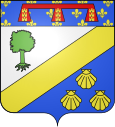
Sains-en-Gohelle
| Sains-en-Gohelle | ||
|---|---|---|

|
|
|
| region | Hauts-de-France | |
| Department | Pas-de-Calais | |
| Arrondissement | Lens | |
| Canton | Bully-les-Mines | |
| Community association | Lens-Liévin | |
| Coordinates | 50 ° 27 ' N , 2 ° 41' E | |
| height | 39-90 m | |
| surface | 5.73 km 2 | |
| Residents | 6,145 (January 1, 2017) | |
| Population density | 1,072 inhabitants / km 2 | |
| Post Code | 62114 | |
| INSEE code | 62737 | |
| Website | http://www.sains-en-gohelle.fr/ | |
Sains-en-Gohelle is a French community and belongs to Canton Bully-les-Mines in the department of Pas-de-Calais in the region of Hauts-de-France . The municipality with 6145 inhabitants (as of January 1, 2017) belongs to the Communauté d'agglomération de Lens-Liévin .
geography
Sains-en-Gohelle is located in the Gohelle countryside between the hills of the former county of Artois. Neighboring communities are Nœux-les-Mines in the north and north-west, Mazingarbe in the north-east, Bully-les-Mines in the east, Aix-Noulette in the south-east, Bouvigny-Boyeffles in the south and Hersin-Coupigny in the west.
The Autoroute A26 and the former Route nationale 37 (today: D937) run through the municipality .
history
The place has been called being since 1190 (as an abbreviation of Villa (de) sanctis (place of saints)). The town was known early on as a mining community.
| Population development | ||||||||
|---|---|---|---|---|---|---|---|---|
| year | 1962 | 1968 | 1975 | 1982 | 1990 | 1999 | 2006 | 2011 |
| Residents | 5,248 | 5,340 | 5,186 | 5,584 | 6,031 | 6,084 | 6,049 | 6,420 |
Attractions
- The former church Saint-Marguerite in Art Deco style
- Saint-Vaast church from the twelfth century
- Sainte-Appoline Chapel and the Bacon Park
- scaled down replica of the Eiffel Tower
Personalities
- Jean-Claude Gautrand (1932–2019), photographer
- Daniel Krawczyk (* 1961), football player


